


Florida Facing Multiple Weather Threats: Air Quality Alerts, Severe Thunderstorms, and Marine Warnings
Florida residents are dealing with a combination of weather-related hazards this week as wildfire smoke, dangerous thunderstorms, and marine weather warnings create concerns across portions of the state.
Air Quality Alerts Continue in South Florida
Air quality alerts have been issued for parts of South Florida, particularly Miami-Dade and Broward counties, where lingering wildfire smoke from ongoing brush fires has reduced air quality and created health concerns for sensitive groups. Officials have warned that smoke particles may aggravate respiratory conditions, including asthma and other lung diseases. (wplg)
The smoke originates from large wildfires burning in western Miami-Dade County and nearby Everglades areas. Shifting wind patterns have periodically pushed smoke and haze into populated communities, leading to reduced visibility and unhealthy breathing conditions. (wplg)
Residents are encouraged to:
- Limit prolonged outdoor activities.
- Keep windows and doors closed.
- Run air conditioning systems on recirculation mode.
- Monitor local air quality reports.
- Wear protective masks if spending extended time outdoors in smoky conditions. (wplg)
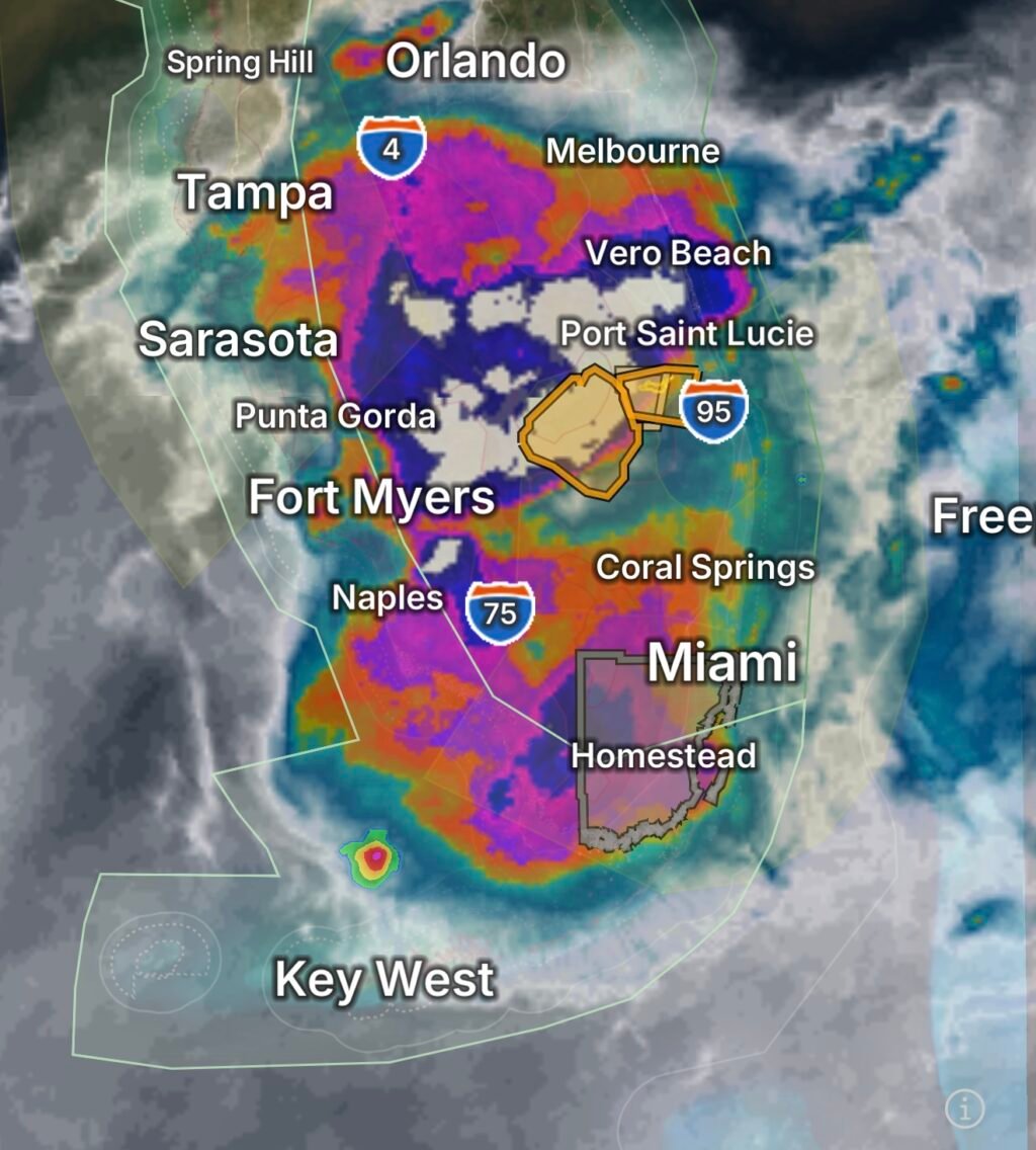
Severe Thunderstorm Threat Expands Across Florida
Florida’s hot and humid atmosphere continues to fuel afternoon and evening thunderstorm development. Forecasters have highlighted the potential for isolated severe thunderstorms capable of producing:
- Frequent cloud-to-ground lightning
- Damaging wind gusts
- Heavy rainfall
- Localized flooding
- Small hail in stronger storms (CBS News)
South Florida remains particularly vulnerable as extreme heat combines with abundant moisture, creating an unstable environment favorable for rapid storm development. Some storms may intensify quickly and produce dangerous weather conditions during peak heating hours. (CBS News)
Motorists should remain alert for sudden downpours that can significantly reduce visibility and create hazardous driving conditions.
Special Marine Warnings Affect Coastal Waters
Boaters and beachgoers should closely monitor weather conditions as thunderstorms move across Florida’s coastal waters. Special Marine Warnings are frequently issued when strong thunderstorms develop over marine zones and produce hazardous conditions.
Potential marine hazards include:
- Wind gusts exceeding 34 knots
- Dangerous lightning strikes
- Waterspouts
- Rough seas
- Torrential rainfall reducing visibility to near zero
Thunderstorms can strengthen rapidly over the Gulf of Mexico and Atlantic coastal waters, posing significant risks to recreational boaters and fishermen. Mariners are urged to check marine forecasts before heading offshore and seek safe harbor immediately if storms approach. (National Hurricane Center)
Looking Ahead
The active weather pattern is expected to continue across Florida as summer heat, high humidity, and lingering wildfire smoke remain in place. Daily thunderstorm chances will persist, especially during the afternoon and evening hours, while air quality concerns may continue in areas impacted by wildfire smoke. (CBS News)
Residents should stay informed through local weather forecasts, monitor air quality reports, and remain weather-aware when planning outdoor activities or marine excursions.
Safety Reminders
✓ Stay hydrated during periods of extreme heat.
✓ Move indoors immediately when thunder is heard.
✓ Never drive through flooded roadways.
✓ Reduce outdoor activity during air quality alerts.
✓ Boaters should monitor weather radar and return to shore when storms develop nearby.
Florida’s combination of heat, smoke, thunderstorms, and marine hazards serves as a reminder that summer weather can change rapidly and requires constant awareness.