



















Rip Current Statement for Eastern Massachusetts Beaches: High Risk on September 19, 2026
High rip current risk affects eastern Massachusetts beaches Saturday, September 19. Learn where conditions are dangerous and how to stay safe.

Helping You Stay Ahead of Severe Weather.
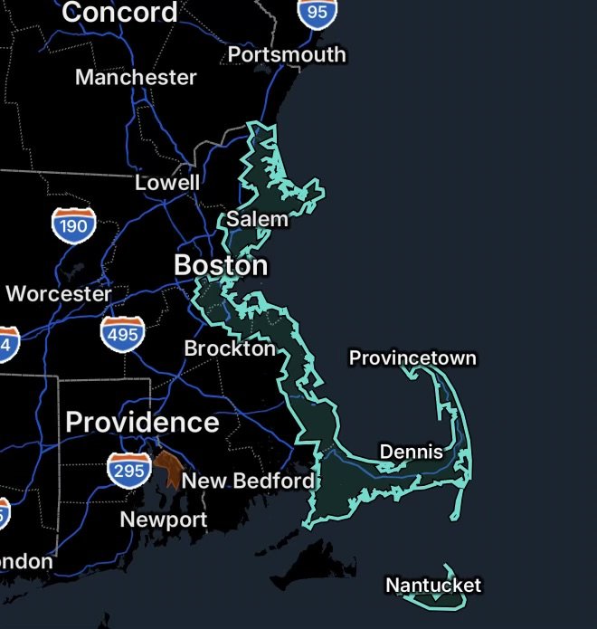
High rip current risk affects eastern Massachusetts beaches Saturday, September 19. Learn where conditions are dangerous and how to stay safe.
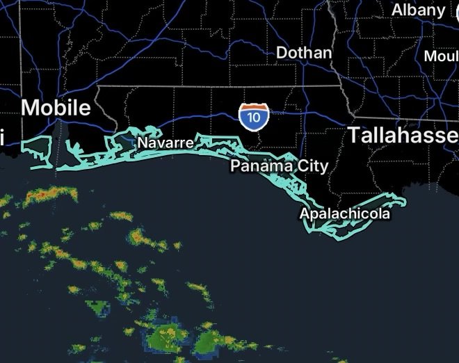
Rip Current Statements cover beaches across Northwest Florida and Coastal Alabama. Learn where conditions are hazardous and how to stay safe.
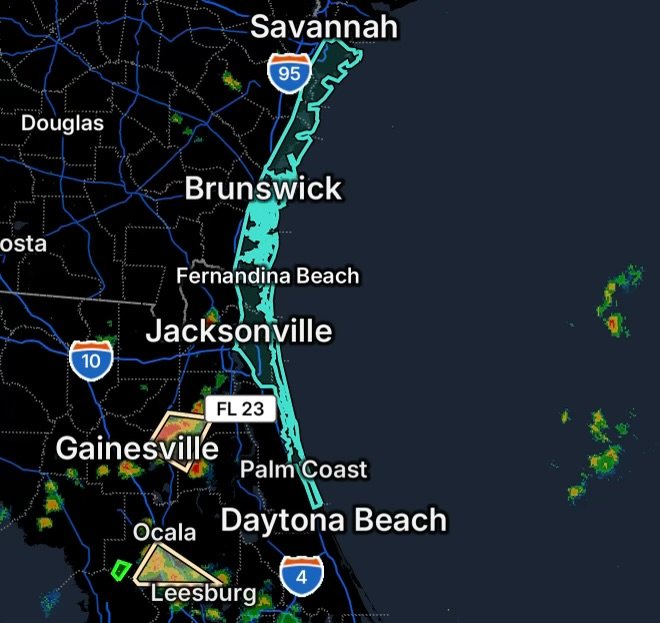
Special Weather Statements affect parts of Northeast Florida, while a Rip Current Statement highlights dangerous surf conditions along Georgia and Northeast Florida beaches.
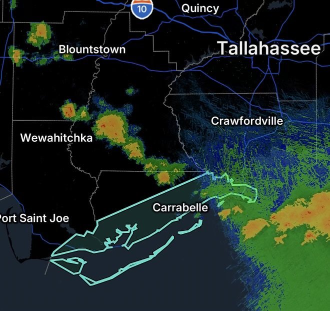
A Rip Current Statement highlights dangerous water conditions along Franklin County, Florida beaches. Learn rip current safety and escape tips.
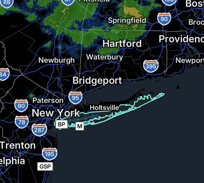
Rip Current Statement for Brooklyn, Queens, Nassau and Suffolk County beaches. Learn how to recognize rip currents and stay safe in dangerous surf.
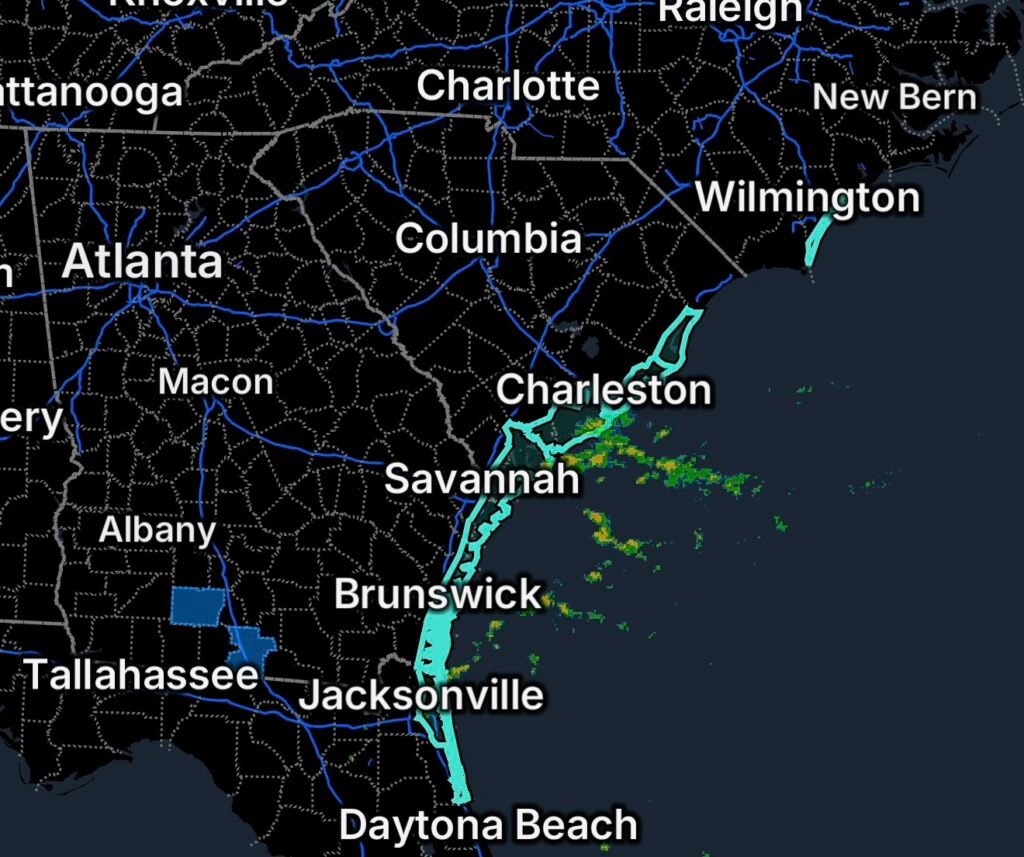
Rip Current Statements affect coastal areas from North Carolina through Florida. Learn where dangerous currents are expected and how to stay safe at the beach.
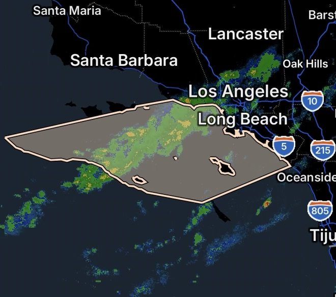
Tropical moisture brings a slight chance of thunderstorms to Southern California coastal waters, including waters near Catalina and Anacapa Islands.
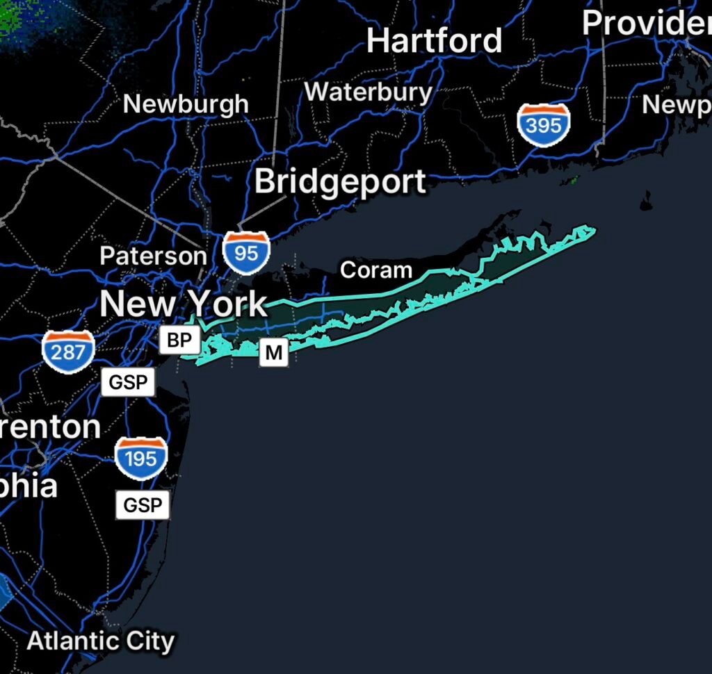
A Rip Current Statement affects Kings, Queens, Nassau and Suffolk beaches. Learn about surf conditions, risks and essential beach safety tips.
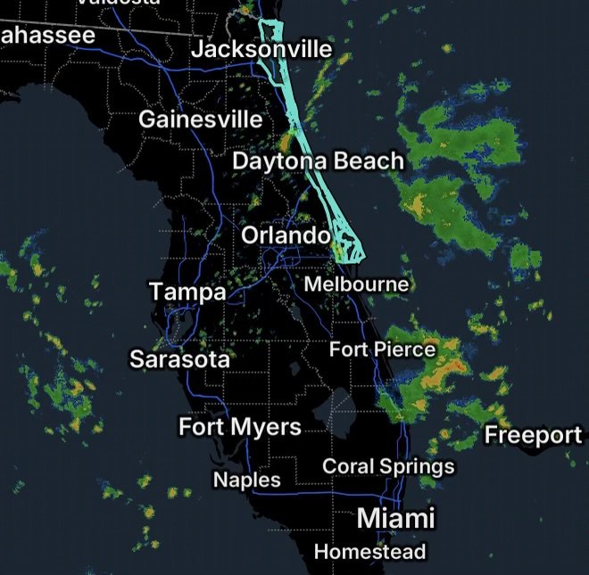
A High Rip Current Risk affects Volusia, Northern Brevard and Northeast Florida beaches. Learn how to recognize and survive dangerous rip currents.
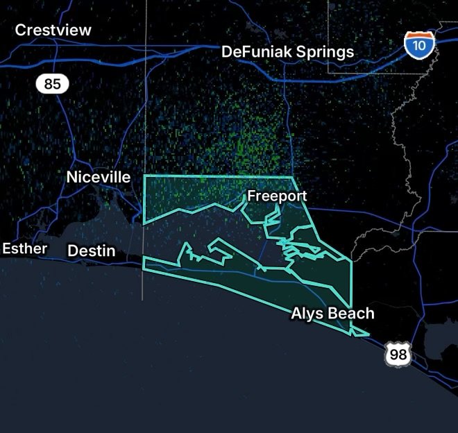
A high rip current risk is in effect for Walton County beaches through this evening. Learn the dangers and how swimmers can stay safe.
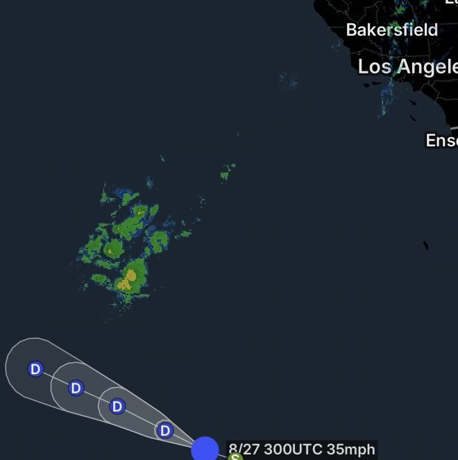
Post-Tropical Iselle is sending swells toward California, increasing surf and rip-current risks. Here’s what beachgoers need to know.
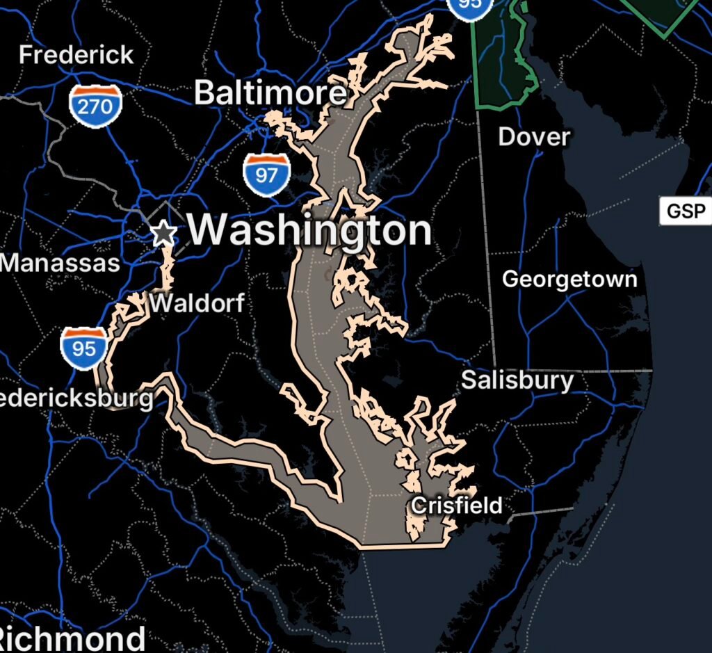
Marine weather concerns the Chesapeake Bay and Tidal Potomac Aug. 26, with stronger winds, higher waves and hazardous conditions for small craft.
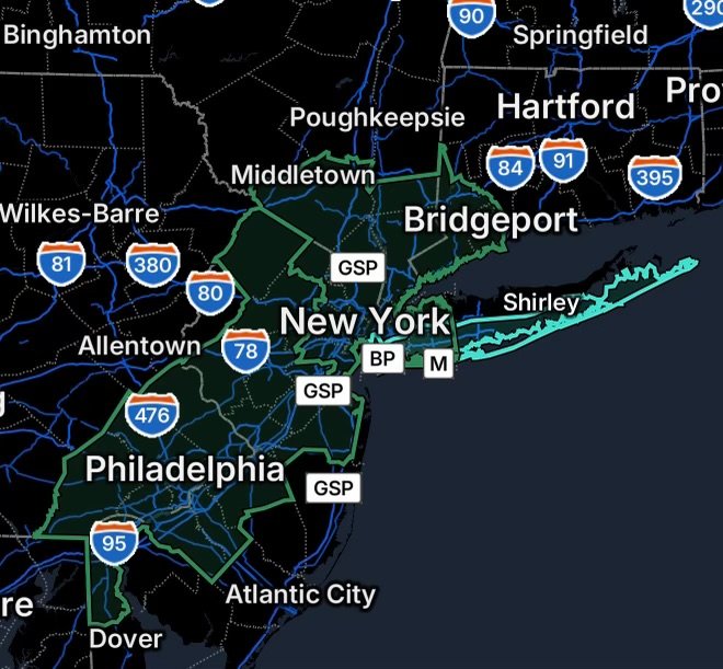
Flood Watch covers parts of NY, NJ, PA, DE and CT, while rip currents threaten beaches around NYC and Long Island on August 26, 2026.
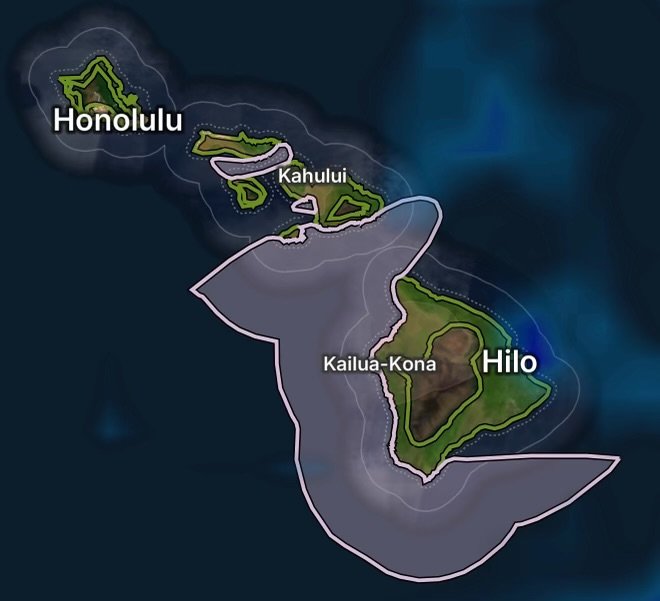
Small Craft Advisory affects waters around Maui and the Big Island, while a Coastal Flood Statement highlights potential coastal impacts in Hawaii.
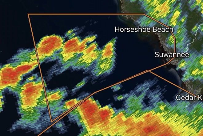
A Special Marine Warning has been issued for the Gulf Coast, including coastal waters from Suwannee River to Keaton Beach out 20 NM and waters…
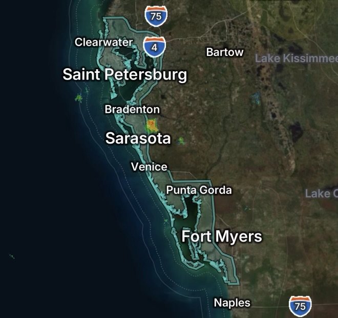
A high rip current risk remains in effect through Friday evening for Pinellas, Coastal Hillsborough, Coastal Manatee, Coastal Sarasota, Coastal Charlotte, and Coastal Lee counties….
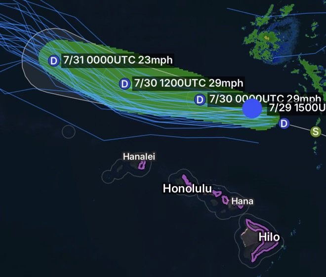
Post-Tropical Cyclone Fausto is 285 miles north of Hilo, Hawaii, bringing dangerous surf and a High Surf Advisory to east-facing shores on July 29, 2026.
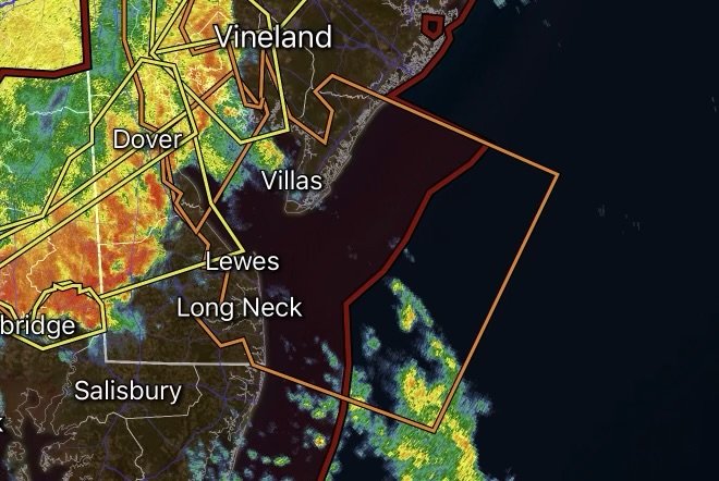
Special Marine Warning issued for coastal waters from Cape May, NJ to Cape Henlopen and Fenwick Island, DE. Dangerous storms threaten mariners.
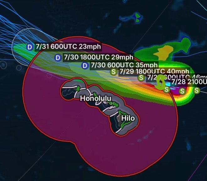
Tropical Storm Fausto weakens northeast of Hilo, but dangerous surf, tropical storm conditions, and marine hazards continue across Hawaii on July 28, 2026.
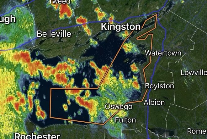
Special Marine Warning issued for Lake Ontario and the St. Lawrence River as strong thunderstorms bring dangerous winds, lightning, and hazardous boating conditions.
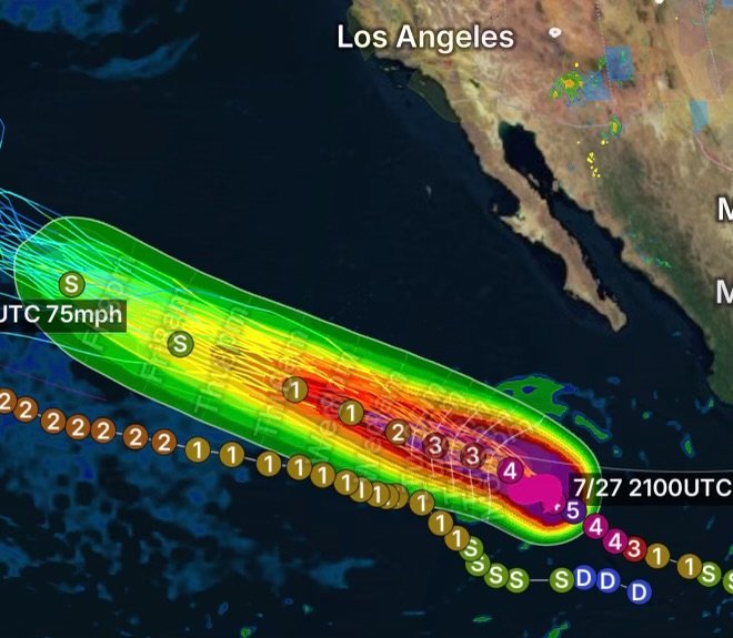
Category 4 Hurricane Genevieve is generating dangerous surf and rip currents along California beaches. Learn what residents should know before heading to the coast.
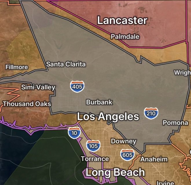
Extreme Heat Warning impacts Antelope Valley with dangerous temperatures. Air quality alerts, heat advisories, coastal flooding, and surf hazards affect Southern California.
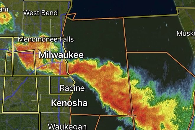
Special Marine Warning issued for Lake Michigan from North Point Light to Wind Point and Port Washington to North Point. Dangerous thunderstorms, strong winds, and…
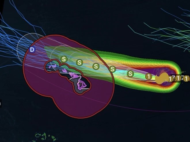
Hurricane Fausto is 740 miles east of Hilo as Hawaii faces tropical storm warnings, storm warnings, high surf, and dangerous marine conditions.
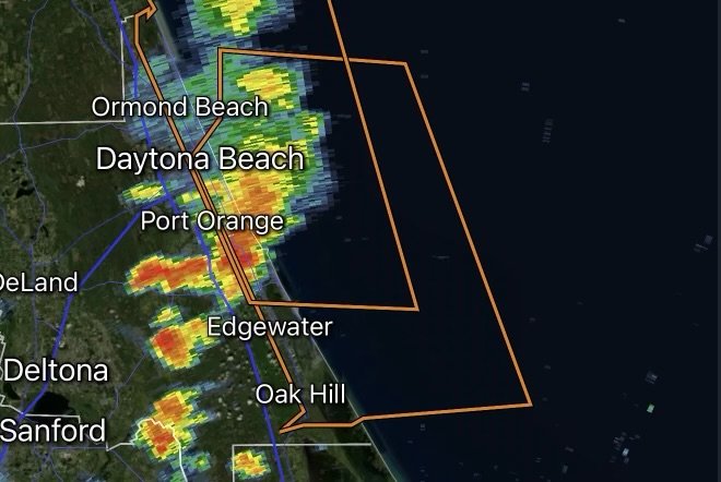
Special Marine Warning issued for Flagler Beach to the Volusia-Brevard County Line. Strong thunderstorms bring dangerous winds, lightning, and rough seas.
