


Flood Watches and Heavy Rain Threat Continue Across Northern Oklahoma and Oklahoma City
Northern Oklahoma and the Oklahoma City metro remain under heightened weather concerns as rounds of thunderstorms bring the threat of flooding, flash flooding, and severe weather across the region. The National Weather Service in Norman has issued Flood Watches and multiple flood-related alerts as heavy rainfall continues to impact communities throughout central and northern Oklahoma. (National Weather Service)
Flood Watch in Effect
Forecasters warn that repeated rounds of thunderstorms could produce excessive rainfall through early Friday morning. Saturated soils from previous storms increase the risk of rapid runoff, leading to flash flooding in low-lying areas, creeks, streams, and urban locations. Northern and eastern portions of Oklahoma are expected to receive the highest rainfall totals, although flooding concerns extend into the Oklahoma City metropolitan area. (National Weather Service)
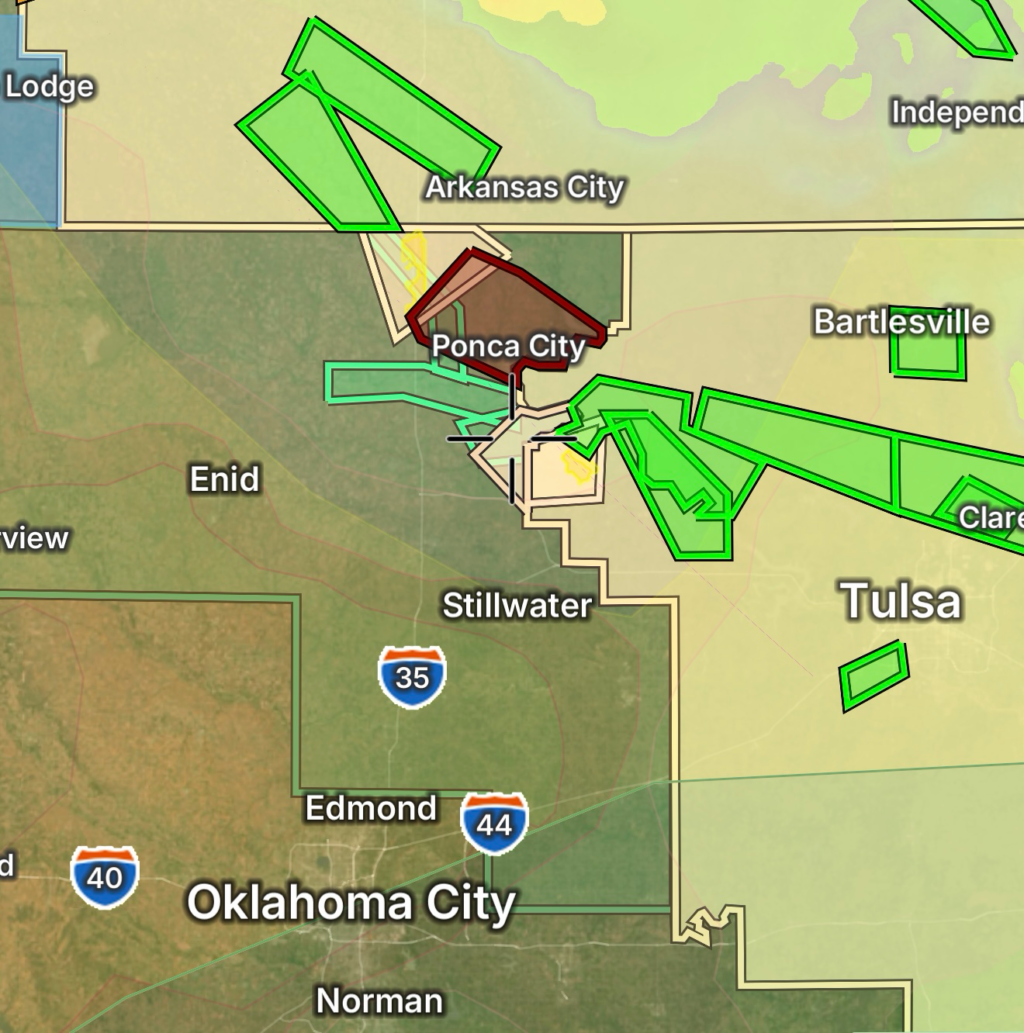
Oklahoma City Facing Flooding Concerns
Oklahoma City residents should remain alert for rapidly changing weather conditions. Heavy downpours may overwhelm drainage systems, causing water-covered roads and localized flooding. Additional rainfall is expected as multiple storm complexes move across the region. Forecast guidance indicates that flash flooding could develop quickly where storms repeatedly track over the same locations. (New York Post)
Severe Thunderstorm Threat Accompanies Heavy Rain
In addition to flooding concerns, strong to severe thunderstorms are expected across much of Oklahoma. The primary threats include:
- Damaging wind gusts
- Large hail
- Frequent lightning
- Isolated tornadoes
- Flash flooding from torrential rainfall
Meteorologists indicate that severe weather could continue into the overnight hours as atmospheric conditions remain favorable for storm development. (National Weather Service)
Northern Oklahoma Under Enhanced Flood Risk
Thunderstorms have already produced periods of heavy rainfall across northern Oklahoma, with some locations experiencing flooding issues. Weather officials report that additional rounds of rain may occur, increasing the potential for flooded roadways and dangerous travel conditions. Areas near rivers, streams, and flood-prone locations should closely monitor warnings and be prepared to move to higher ground if necessary. (Facebook)
Safety Tips During Flooding
- Never drive through flooded roadways.
- Turn around, don’t drown.
- Monitor local forecasts and emergency alerts.
- Have multiple ways to receive weather warnings.
- Move to higher ground if flooding develops.
- Avoid camping or parking near creeks and drainage channels.
Looking Ahead
The active weather pattern is expected to continue through the end of the week, with additional opportunities for heavy rainfall and severe thunderstorms. Residents across northern Oklahoma and the Oklahoma City area should remain weather-aware and stay updated on the latest watches, warnings, and advisories issued by the National Weather Service. (National Weather Service)
Radar Watch HQ will continue monitoring flooding concerns, severe thunderstorm development, and weather alerts across Oklahoma as conditions evolve.