


Severe Thunderstorm Watch Issued for Portions of West-Central Arkansas and Far East-Central Oklahoma
June 25, 2026
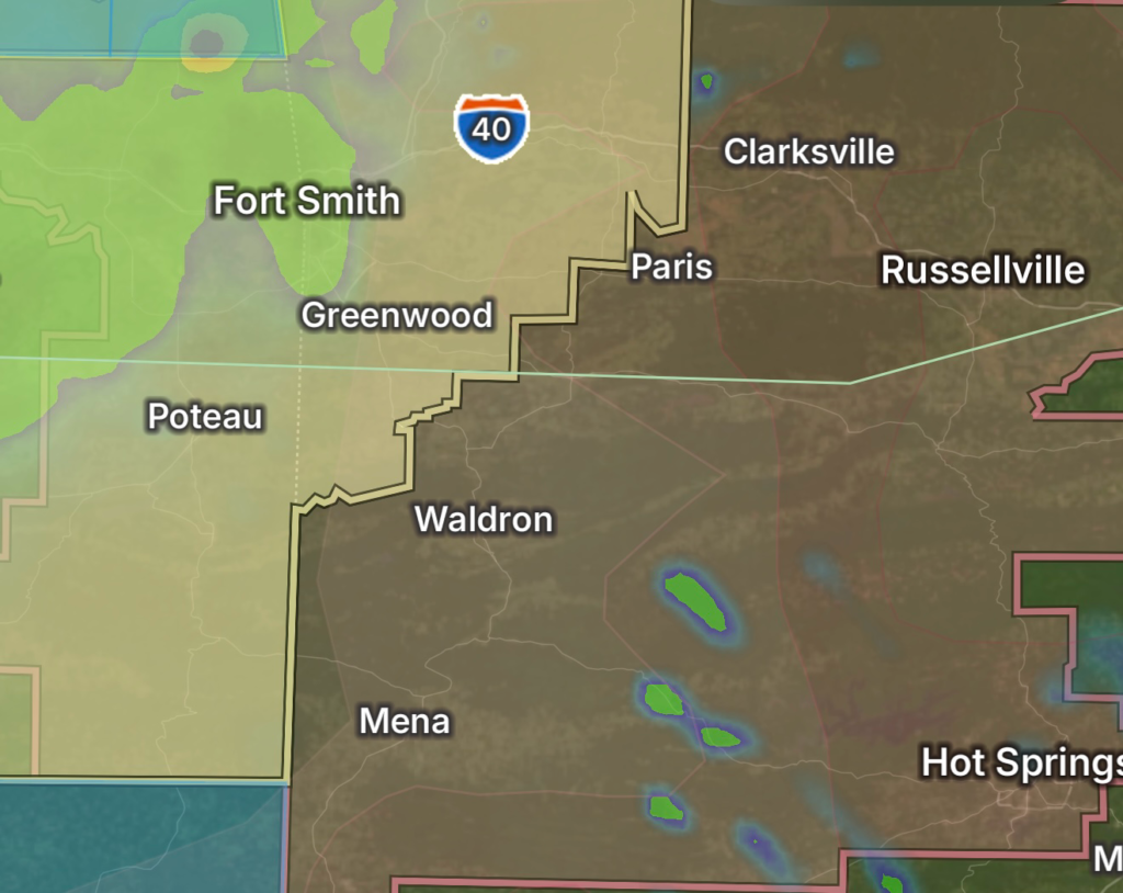
Residents across portions of west-central Arkansas and far east-central Oklahoma should remain alert this evening as a Severe Thunderstorm Watch remains in effect. Atmospheric conditions are favorable for the development of severe thunderstorms capable of producing damaging wind gusts, large hail, torrential rainfall, frequent lightning, and the potential for isolated tornadoes. (National Weather Service)
Storm Threat Overview
Meteorologists are tracking multiple rounds of thunderstorms moving across eastern Oklahoma into western Arkansas. These storms are expected to strengthen as they move east, with the greatest threats including:
- Wind gusts exceeding 60-70 mph
- Large hail capable of damaging vehicles and property
- Intense cloud-to-ground lightning
- Heavy rainfall leading to localized flash flooding
- A few tornadoes cannot be ruled out, especially with stronger supercell thunderstorms. (National Weather Service)
Areas Impacted
The Severe Thunderstorm Watch includes portions of:
- West-Central Arkansas
- Far East-Central Oklahoma
- Nearby communities should continue monitoring weather conditions as storms progress through the evening.
Additional Flood Watches and Flood Advisories remain in effect for parts of eastern Oklahoma due to saturated ground and the potential for multiple rounds of heavy rainfall. (National Weather Service)
Flash Flooding Also Possible
In addition to severe thunderstorms, heavy rainfall may produce rapid runoff and flash flooding, particularly in low-lying and flood-prone areas. Rainfall rates of 1.5 to 2.5 inches per hour are possible in the strongest storms, increasing the risk of flooded roadways and small streams overflowing. (NOAA Weather Prediction Center)
Safety Tips
If severe weather approaches:
- Move indoors immediately when thunder is heard.
- Stay away from windows during severe thunderstorms.
- Secure outdoor furniture and loose objects.
- Avoid driving through flooded roads. Turn Around, Don’t Drown.
- Keep multiple ways to receive weather warnings, especially overnight.
- Be prepared to move to an interior room on the lowest floor if a Tornado Warning is issued.
Stay Weather Aware
Conditions will continue to evolve throughout the evening as thunderstorms move across the region. Residents in west-central Arkansas and far east-central Oklahoma should closely monitor forecasts, watches, and any warnings that may be issued as storms intensify. Additional severe weather and localized flooding remain possible through tonight. (National Weather Service)