


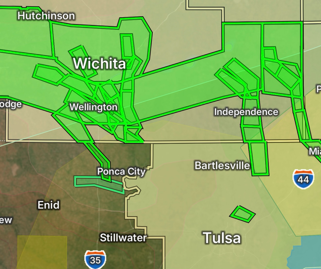
Wichita Area Under Flood Warnings and Hazardous Weather Outlook as Strong to Severe Thunderstorms Move Through Kansas
Residents across Wichita and surrounding communities are being urged to remain weather-aware as multiple weather alerts remain in effect across south-central Kansas. Flood Warnings and a Hazardous Weather Outlook have been issued as repeated rounds of thunderstorms bring the potential for heavy rainfall, flash flooding, damaging winds, large hail, and isolated tornadoes.
Flooding Concerns Continue
Heavy rainfall has already saturated many areas, increasing the risk of flash flooding. Forecasters warn that localized rainfall totals of 3 to 5 inches or more are possible where thunderstorms repeatedly move over the same locations.
Flooding may quickly develop in:
- Wichita
- Derby
- Andover
- Haysville
- Newton
- El Dorado
- Valley Center
- Bel Aire
- Goddard
- Park City
- Surrounding portions of Sedgwick, Butler, Harvey, and Reno counties
Low-water crossings, creeks, streams, and urban streets are especially vulnerable to rapidly rising water. Officials continue to stress the importance of never driving through flooded roadways.
Hazardous Weather Outlook
The National Weather Service has also issued a Hazardous Weather Outlook highlighting the potential for strong to severe thunderstorms across south-central Kansas.
Primary hazards include:
- Torrential rainfall
- Flash flooding
- Damaging wind gusts between 60–70 mph
- Large hail ranging from quarter-size to golf-ball size
- Isolated tornadoes, particularly near the Kansas-Oklahoma border
- Frequent cloud-to-ground lightning
Forecasters indicate the greatest severe weather threat is generally along and south of Highway 56, with storms expected during the evening and overnight hours.
Travel Could Become Dangerous
Drivers should prepare for rapidly changing road conditions as heavy rain significantly reduces visibility and floodwaters may cover roadways within minutes.
Remember:
- Never drive through flooded streets.
- Turn around if you encounter standing water.
- Allow extra travel time.
- Monitor local weather alerts throughout the day and night.
Stay Weather Ready
Weather conditions can change rapidly as thunderstorms strengthen. Residents should have multiple methods of receiving emergency alerts, including NOAA Weather Radio, wireless emergency alerts, trusted weather apps, and local emergency management notifications.
Continue monitoring official forecasts and be prepared to move to shelter immediately if Severe Thunderstorm Warnings or Tornado Warnings are issued.