


Tallahassee Weather Update: Special Weather Statements and Flood Warnings Issued Across the Region
Published: June 26, 2026
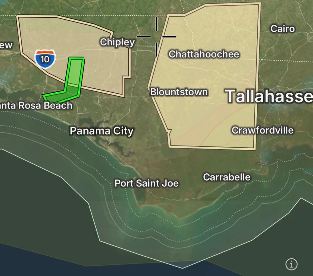
Residents across Tallahassee and surrounding portions of Florida’s Big Bend are experiencing an active weather pattern as rounds of thunderstorms continue to move through the region. The National Weather Service has issued multiple Special Weather Statements highlighting the potential for strong thunderstorms capable of producing gusty winds, frequent lightning, torrential rainfall, and localized flooding. (floridadisaster.org)
Current Weather Conditions
Warm, humid air combined with abundant Gulf moisture is fueling widespread afternoon and evening thunderstorms across the Tallahassee area. While not every storm will become severe, many are producing heavy rainfall that can quickly overwhelm drainage systems, especially in urban and low-lying locations. (floridadisaster.org)
Hazards Include
- Heavy rainfall leading to ponding of water on roadways
- Frequent cloud-to-ground lightning
- Wind gusts capable of downing small tree limbs
- Reduced visibility during intense downpours
- Localized flash flooding in poor drainage areas
Flood Warnings Affecting Surrounding Areas
Flood concerns extend beyond Tallahassee into portions of the Florida Panhandle and surrounding river basins. River Flood Warnings remain in effect for some waterways monitored by the National Weather Service Tallahassee office as recent rainfall continues to keep water levels elevated. Residents living near rivers, creeks, and flood-prone areas should closely monitor changing conditions. (National Weather Service)
Even where formal flood warnings have not been issued, slow-moving thunderstorms may produce rainfall rates capable of causing rapid street flooding and hazardous travel conditions.
Travel Impacts
Motorists should prepare for rapidly changing weather conditions, including:
- Water-covered roads
- Hydroplaning hazards
- Reduced visibility
- Delays during periods of heavy rainfall
Remember: Turn Around, Don’t Drown. Never attempt to drive through flooded roadways, as water depth and road damage may be impossible to determine.
Safety Tips
- Stay weather aware and monitor official forecasts throughout the day.
- Seek shelter immediately if thunder is heard.
- Avoid flooded streets, creeks, and drainage ditches.
- Secure outdoor objects before thunderstorms arrive.
- Keep mobile devices charged in case severe weather leads to isolated power outages.
Looking Ahead
The unsettled weather pattern is expected to continue as tropical moisture remains in place across North Florida. Additional rounds of showers and thunderstorms are possible over the coming days, meaning localized flooding may continue to develop where repeated heavy rainfall occurs. Residents should remain alert for updated Special Weather Statements, Flood Advisories, Flood Warnings, and Severe Thunderstorm Warnings issued by the National Weather Service. (floridadisaster.org)
Stay With Radar Watch HQ
Radar Watch HQ will continue providing the latest weather updates, flood alerts, severe thunderstorm information, and emergency preparedness coverage for Tallahassee and communities throughout North Florida as conditions evolve.