


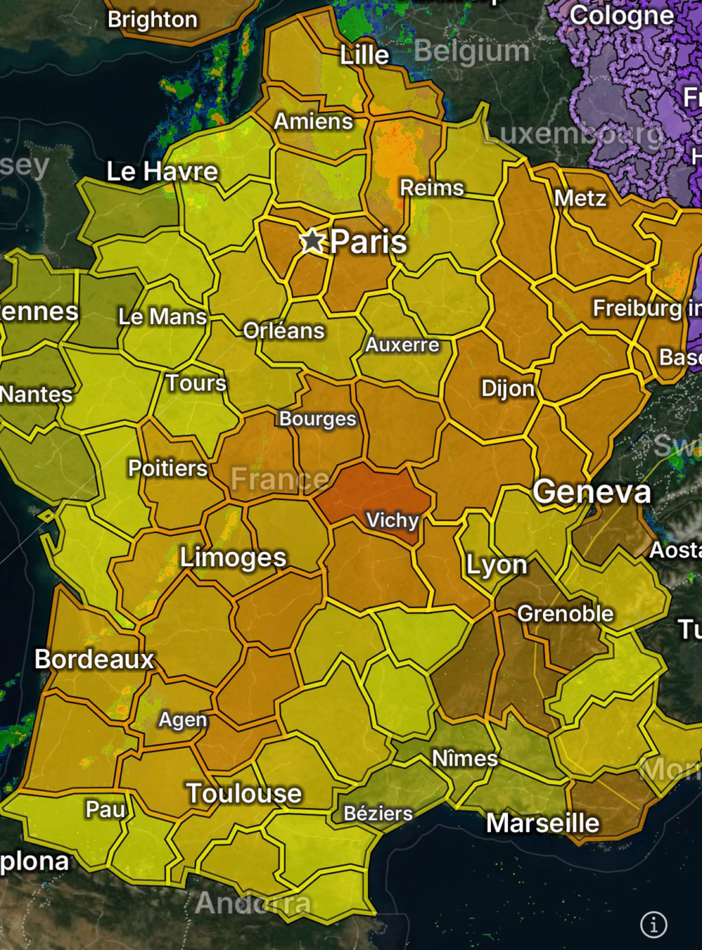
Severe Thunderstorms Warning and Extreme High Temperatures Expected Across France
France is currently experiencing a dangerous combination of severe thunderstorms and extreme heat, creating heightened risks for flash flooding, damaging winds, lightning strikes, and heat-related illness across multiple regions. Meteorological conditions are unstable as hot air masses from the south collide with incoming atmospheric disturbances, triggering volatile storm development.
Widespread Severe Thunderstorm Risk
Meteorologists warn that strong to severe thunderstorms may develop rapidly, particularly across central and eastern parts of France. These storms are capable of producing:
- Damaging wind gusts that may exceed safety thresholds
- Heavy rainfall leading to localized flash flooding
- Frequent lightning activity
- Isolated hail in stronger storm cells
The most intense storm activity is expected during late afternoon and evening hours when surface heating peaks. Sudden storm formation may reduce visibility and create hazardous travel conditions, especially on highways and rural roads.
Residents are advised to remain alert for rapidly changing weather conditions and to seek shelter indoors at the first sign of thunder.
Extreme High Temperatures Intensify Heat Stress
Alongside storm threats, France is also dealing with a significant heatwave, with temperatures climbing well above seasonal norms. In some areas, daytime highs are expected to reach dangerous levels, increasing the risk of heat exhaustion and heatstroke.
High-risk conditions include:
- Prolonged exposure to direct sunlight
- Limited nighttime cooling in urban areas
- Increased strain on power grids due to air conditioning demand
- Dehydration risks, especially for outdoor workers and vulnerable populations
Urban centers such as Paris and Lyon may experience amplified heat due to the “urban heat island” effect, where concrete and asphalt retain heat overnight.
Combined Weather Hazards: A Dangerous Mix
The combination of extreme heat and thunderstorms creates particularly unstable atmospheric conditions. Heat fuels storm energy, increasing the likelihood of:
- Sudden storm intensification
- Severe wind bursts (downbursts)
- Rapid storm cell development with little warning
This dual threat makes forecasting more complex and increases the importance of real-time weather monitoring.
Safety Recommendations
Authorities urge residents and visitors to take precautions during this period of severe weather:
During thunderstorms:
- Stay indoors and avoid unnecessary travel
- Unplug sensitive electronics during lightning activity
- Avoid sheltering under trees or near tall isolated structures
- Monitor local weather alerts frequently
During extreme heat:
- Drink water regularly, even if not thirsty
- Avoid strenuous outdoor activity during peak afternoon heat
- Wear light, breathable clothing
- Check on elderly neighbors and vulnerable individuals
Outlook
Weather conditions are expected to remain unstable until the high-pressure heat dome weakens and storm systems move through the region. Further updates will be necessary as models refine the timing and intensity of both heat and thunderstorm activity.
Residents across France should stay weather-aware, as conditions may change quickly and without warning during this active period.