Illinois Severe Weather 2026: Tornadoes, Damaging Winds, Flash Flooding, and a Busy Storm Season
Illinois continues to be one of the nation’s most active severe weather states in 2026, with repeated rounds of thunderstorms, tornadoes, damaging winds, large hail, and flash flooding impacting communities across the state. As summer weather patterns become more established, residents are being urged to remain weather-aware and prepared for rapidly changing conditions.
A Dangerous Pattern Across Illinois
Over the past several weeks, Illinois has experienced multiple severe weather outbreaks. Central, northern, and southern portions of the state have all faced threats ranging from tornado-producing supercells to widespread damaging wind events.
Recent severe weather reports documented several tornadoes, wind gusts approaching 80 mph, hail up to 3 inches in diameter, and localized flash flooding across central Illinois. Numerous communities reported downed trees, power outages, road closures, and structural damage from intense thunderstorms. (National Weather Service)
Forecasters continue to monitor an active weather pattern that supports repeated severe thunderstorm development throughout the Midwest. Illinois remains in a favorable corridor where warm, humid air from the Gulf of Mexico interacts with powerful storm systems moving across the Plains and Great Lakes. (FOX Weather)
Tornado Threat Remains Elevated
Illinois has already experienced an unusually active tornado season in 2026. Earlier this year, the state recorded numerous tornado-producing storms, including significant outbreaks during March and April. Northern and central Illinois have been particularly active, with several communities reporting tornado damage and large hail events. (National Weather Service)
Recent storms during the week of June 17 produced multiple tornado reports across central Illinois, including areas near Effingham, Springfield, Coles County, and surrounding communities. Emergency managers, storm spotters, and National Weather Service offices continue to conduct damage surveys in affected areas. (National Weather Service)
Damaging Winds and Large Hail
While tornadoes often receive the most attention, straight-line winds and large hail have caused widespread damage across Illinois this year.
A powerful derecho event on June 10 produced extensive wind damage across northern Illinois, leaving thousands without power and damaging infrastructure. Severe thunderstorms throughout June have also generated hailstones ranging from golf-ball size to baseball size in some locations. (National Weather Service)
These storms can cause:
- Roof and siding damage
- Broken windows
- Vehicle damage
- Fallen trees and power lines
- Extended power outages
Residents should take severe thunderstorm warnings seriously, as damaging winds can be just as dangerous as weaker tornadoes.
Flash Flooding Concerns Increase
Heavy rainfall has become a growing concern across Illinois as repeated rounds of thunderstorms move over already saturated ground.
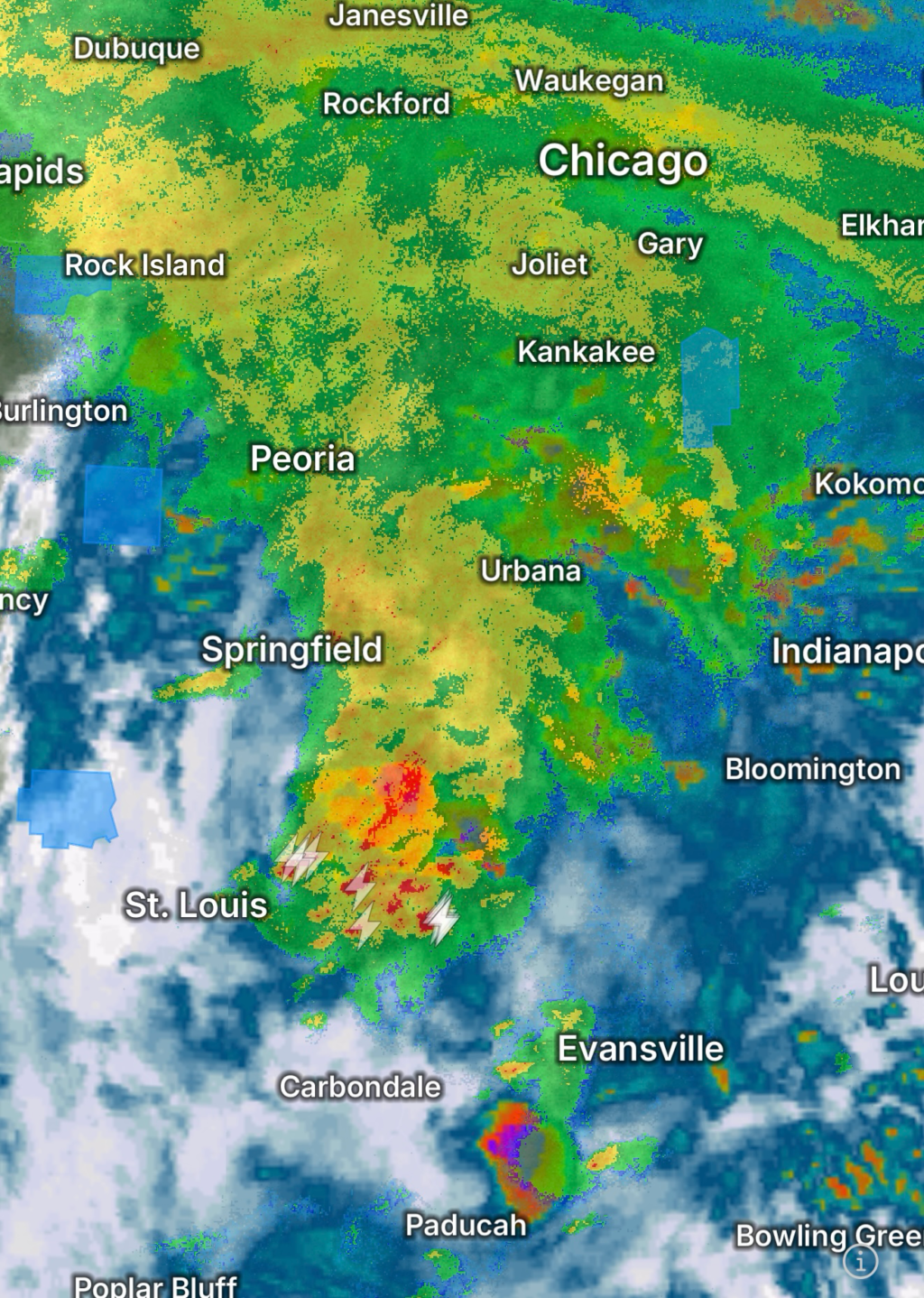
Urban flooding has been reported in portions of the Chicago metropolitan area, while rivers, streams, and low-lying roadways across central Illinois have experienced rising water levels. Forecasters have repeatedly highlighted flash flood risks during recent severe weather outbreaks. (NBC Chicago)
Flash flooding can occur with little warning and often becomes one of the deadliest weather hazards during the summer months.
Remember:
- Never drive through flooded roadways.
- Turn around, don’t drown.
- Move to higher ground if flooding develops.
- Monitor local alerts and weather warnings.
Why Illinois Is Seeing So Much Severe Weather
Illinois sits within a region commonly referred to as the Midwest severe weather corridor. During spring and summer, warm and humid air masses collide with cooler air systems moving from the west and north.
These atmospheric ingredients create an environment favorable for:
- Severe thunderstorms
- Tornadoes
- Large hail
- Damaging straight-line winds
- Flash flooding
Meteorologists have noted that 2026 has already produced an unusually active start to the severe weather season, with more watches, warnings, and storm reports than average across parts of Illinois. (National Weather Service)
Staying Prepared During Severe Weather
Illinois residents should take proactive steps to prepare for future severe weather events:
- Enable Wireless Emergency Alerts on mobile devices.
- Keep multiple methods of receiving weather warnings.
- Identify a safe shelter location in your home.
- Prepare emergency kits with food, water, flashlights, and batteries.
- Review tornado and severe thunderstorm safety plans with family members.
- Monitor local forecasts daily during active weather periods.
Looking Ahead
The severe weather season is far from over. As summer heat and humidity continue to build across the Midwest, Illinois may remain vulnerable to additional rounds of thunderstorms capable of producing tornadoes, damaging winds, hail, and flooding.
Residents are encouraged to stay informed, remain weather-aware, and act quickly whenever watches or warnings are issued. With atmospheric conditions continuing to support severe weather development, preparedness remains the best defense against nature’s most powerful storms.