Jacksonville, FL: Special Marine Warning & Special Weather Statement
The National Weather Service in Jacksonville, Florida has recently issued both a Special Marine Warning and a Special Weather Statement, highlighting short-fused but impactful hazardous weather conditions across the region, especially along coastal waters and nearby inland areas.
🌊 Special Marine Warning (Coastal Waters – Jacksonville Area)
A Special Marine Warning is issued when hazardous conditions develop rapidly over coastal or offshore waters, usually lasting a short period but posing immediate danger to boaters.
Recent warnings from the Jacksonville marine zone indicated:
- ⚠️ Severe thunderstorms moving across coastal waters near Jacksonville Beach, Atlantic Beach, and Mayport
- 🌬️ Wind gusts reaching or exceeding 34 knots (39+ mph)
- 🌊 Possible waterspouts developing within thunderstorms
- 🚤 Rapidly building seas and dangerous boating conditions
These storms were tracked moving east over the Atlantic waters, creating a risk for:
- Small craft overturning
- Sudden high waves
- Reduced visibility and lightning hazards
Boaters were strongly advised to seek safe harbor immediately and avoid offshore waters until conditions improve.
🌩️ Special Weather Statement (Jacksonville Metro & Surrounding Areas)
A Special Weather Statement is typically issued for less severe but still impactful weather, often used for strong thunderstorms, gusty winds, or brief hazardous conditions.
Recent activity in the Jacksonville area included:
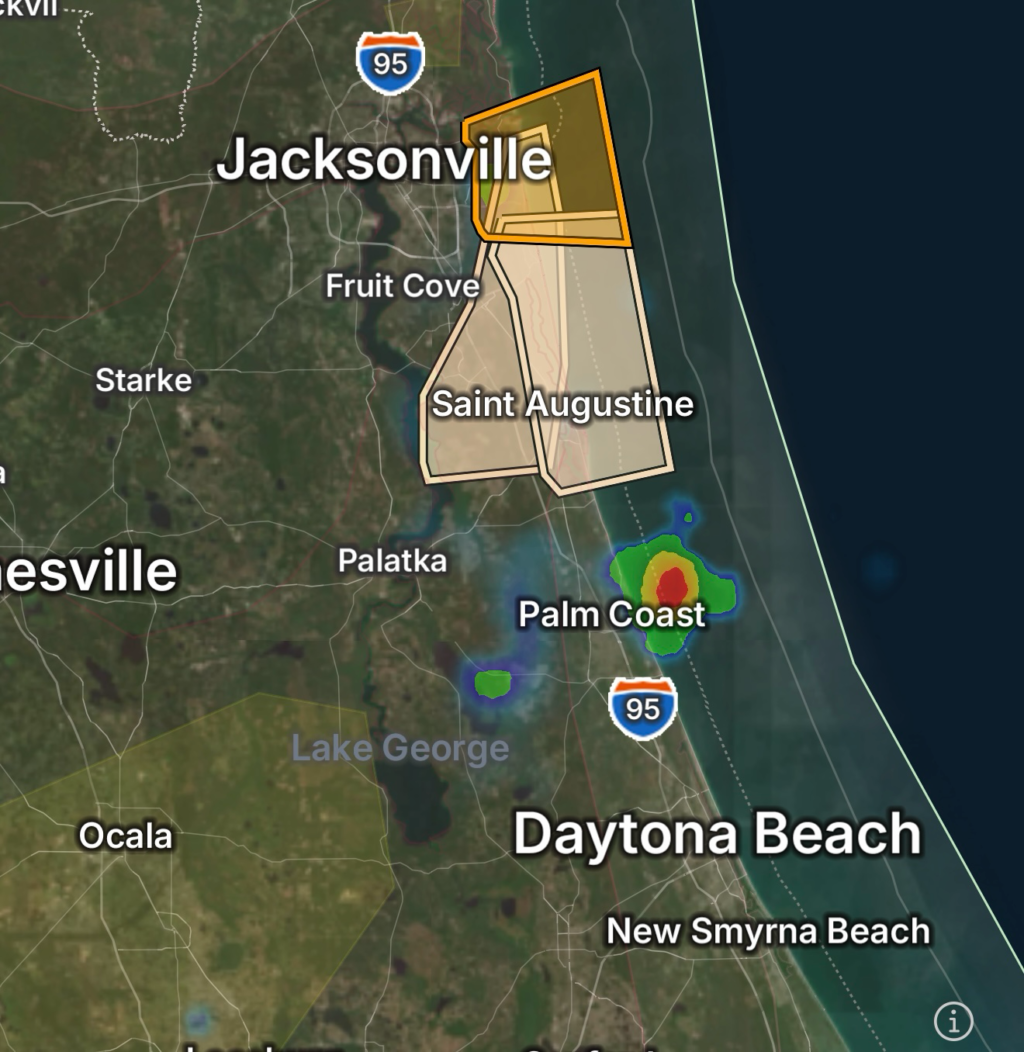
- 🌩️ Strong thunderstorms near St. Augustine, World Golf Village, and surrounding coastal St. Johns County
- 💨 Wind gusts around 40 mph
- 🌿 Potential impacts:
- Downed tree limbs
- Flying debris
- Minor power disruptions in isolated spots
Radar indicated storms moving around 15–20 mph, producing brief but noticeable impacts across eastern Florida communities.
📍 Affected Areas
Marine Zones:
- Jacksonville Beach
- Atlantic Beach
- Mayport
- Offshore waters (Fernandina Beach to St. Augustine)
Inland Areas:
- St. Augustine
- World Golf Village
- St. Johns County coastal communities
- Northern coastal Florida zones
⚠️ Safety Guidance
For Marine Interests:
- Immediately head to nearest safe harbor
- Secure all vessels and gear
- Avoid offshore travel until warnings expire
For Inland Residents:
- Stay indoors during thunderstorm activity
- Secure loose outdoor items
- Watch for falling branches and brief wind bursts
🧭 Bottom Line
Jacksonville’s weather pattern shows fast-moving thunderstorms impacting both land and coastal waters, with marine zones experiencing the highest risk due to potential waterspouts and dangerous wind gusts. While short-lived, these events can become hazardous very quickly, especially for boaters and beachgoers.