


Shreveport Weather Update: Storms and Flood Watches Raise Flooding Concerns Across Northwest Louisiana
Residents across Shreveport and the surrounding Ark-La-Tex region are facing an active stretch of weather as multiple rounds of thunderstorms continue to impact the area. Heavy rainfall, frequent lightning, gusty winds, and the threat of flash flooding have prompted weather officials to issue Flood Watches and closely monitor developing storm systems. (National Weather Service)
Flood Watch in Effect
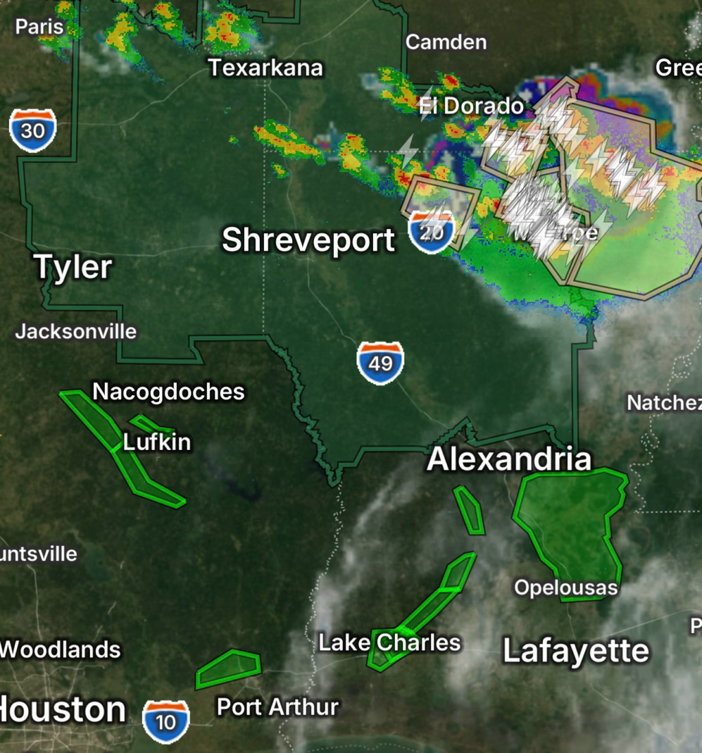
The National Weather Service office in Shreveport has issued Flood Watches across portions of North Louisiana and East Texas as repeated rounds of rainfall move through the region. Forecasters warn that training thunderstorms—storms that repeatedly move over the same location—could produce rainfall rates exceeding 1 to 3 inches per hour. Additional rainfall totals of 2 to 4 inches are possible in some areas, increasing the risk for flash flooding. (National Weather Service)
Flood-prone roadways, low-lying areas, urban streets, and poor-drainage locations are especially vulnerable to rapidly rising water levels.
Storm Threat Continues
Beyond flooding concerns, thunderstorms moving through the region may also produce:
- Frequent cloud-to-ground lightning
- Strong wind gusts
- Small hail
- Brief periods of torrential rainfall
- Localized flash flooding
Meteorologists continue to monitor atmospheric conditions that remain favorable for additional storm development through the evening and overnight hours. (National Weather Service)
Flooding Already Impacting Roads
Reports from around the Ark-La-Tex indicate flooded roadways have already become a concern as heavy rain continues to fall. Water-covered streets can develop quickly during intense rainfall events, creating dangerous travel conditions for motorists. (https://www.ksla.com)
Officials remind drivers that just a few inches of moving water can sweep a vehicle off the road.
Why Flooding Is Becoming a Bigger Concern
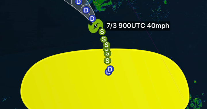
Recent tropical moisture associated with the remnants of Tropical Storm Arthur has contributed to elevated moisture levels across Louisiana and neighboring states. This tropical air mass allows thunderstorms to produce very efficient rainfall, increasing the likelihood of flash flooding when storms repeatedly move across the same areas. (The Guardian)
With saturated soils already present in some locations, it takes less rainfall to trigger flooding compared to drier periods.
Safety Tips During Flood Watches
When a Flood Watch is issued, conditions are favorable for flooding to develop. Residents should:
- Monitor weather alerts frequently
- Avoid driving through flooded roads
- Have multiple ways to receive warnings
- Charge mobile devices before storms arrive
- Move vehicles away from flood-prone locations
- Be prepared to seek higher ground if flooding develops
Remember: “Turn Around, Don’t Drown.” Most flood-related fatalities occur in vehicles. (Shreveport)
Looking Ahead
The unsettled weather pattern is expected to continue across Shreveport and much of Northwest Louisiana, with additional showers and thunderstorms possible over the coming days. While not every community will experience flooding, areas that receive repeated rounds of heavy rainfall could see rapidly changing conditions.
Residents should remain weather aware and stay updated on the latest forecasts, watches, and warnings as storms continue to move through the region. (National Weather Service)
Final Thoughts
Shreveport’s weather remains highly active, with storms capable of producing heavy rainfall and dangerous flash flooding. As Flood Watches remain in effect and additional rounds of rain are expected, preparedness and situational awareness will be critical for residents throughout the Ark-La-Tex region.
Stay tuned to Radar Watch HQ for the latest weather intelligence, flood updates, and severe weather coverage.