


Severe Weather Impacts Tallahassee and Florida Panhandle: Thunderstorm Warnings, Flood Threats, and Coastal Hazards Continue
Tallahassee and Florida Panhandle Facing Multiple Weather Hazards
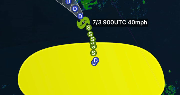
Residents across Tallahassee, the Florida Big Bend, and the Florida Panhandle are dealing with an active weather pattern as the National Weather Service (NWS) continues to issue Severe Thunderstorm Warnings, Special Weather Statements, Flood Warnings, and Coastal Hazard alerts throughout the region. Heavy rainfall, dangerous lightning, strong wind gusts, localized flooding, and hazardous beach conditions remain the primary concerns. (National Weather Service)
Severe Thunderstorm Warnings and Special Weather Statements
Strong thunderstorms have developed across portions of North Florida, producing frequent lightning, torrential rainfall, and damaging wind gusts. The National Weather Service Tallahassee office has issued multiple severe weather products to alert residents of rapidly changing conditions. Storms capable of producing strong winds and dangerous cloud-to-ground lightning may develop with little warning. (National Weather Service)
Meteorologists continue to monitor thunderstorms moving across the region, particularly during the afternoon and evening hours when atmospheric instability is highest. Some storms may reach severe limits and create hazardous travel conditions across major roadways and low-lying areas. (National Weather Service)
Flood Warnings and Heavy Rainfall Concerns
Flooding remains a significant concern across parts of the Florida Panhandle and surrounding areas. Recent rainfall has left soils saturated, increasing the risk of flash flooding from additional downpours. Forecasters warn that localized flooding can develop quickly, especially in urban locations, poor drainage areas, and near small streams and creeks. (GovDelivery)
Emergency officials urge motorists to avoid driving through flooded roadways. Even a small amount of moving water can become dangerous and lead to vehicle rescues. The threat of flash flooding remains elevated wherever thunderstorms repeatedly move over the same locations. (GovDelivery)
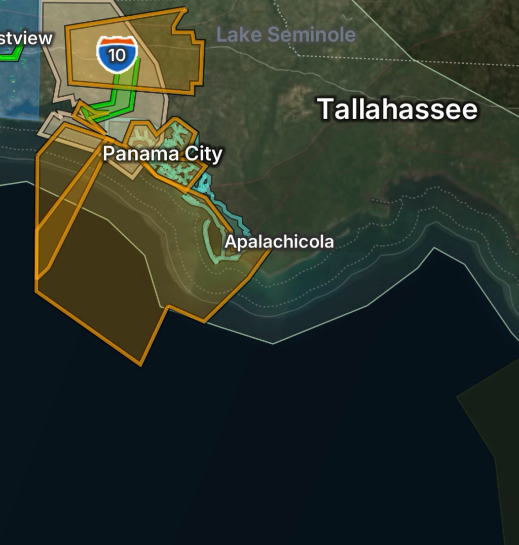
Coastal Hazards Along the Panhandle
Beachgoers along the Florida Panhandle should remain aware of coastal hazards, including dangerous rip currents and rough surf conditions. Moderate to high rip current risks continue along several Gulf Coast beaches, creating life-threatening swimming conditions. (Florida Disaster)
Strong onshore flow and persistent wave action can quickly pull swimmers away from shore. Visitors are encouraged to swim only near lifeguards and obey all posted beach warning flags.
What Residents Should Do
- Monitor NOAA Weather Radio and trusted local weather sources.
- Have multiple ways to receive weather warnings.
- Avoid flooded roads and never drive through standing water.
- Seek shelter immediately when thunder is heard.
- Stay off area beaches when hazardous surf or rip current conditions are present.
- Charge electronic devices in case of power outages caused by severe storms.
Outlook
Unsettled weather is expected to continue across portions of North Florida and the Florida Panhandle. Additional rounds of thunderstorms may produce heavy rain, localized flooding, lightning, and gusty winds. Coastal hazards will also remain a concern for beach communities along the Gulf Coast. Residents should stay weather-aware and be prepared to act quickly if additional warnings are issued. (Florida Disaster)