


Tornado Watch Issued Across Parts of Illinois: Severe Weather Threat Develops
June 17, 2026
The National Weather Service and Storm Prediction Center have issued a Tornado Watch for portions of Illinois as a powerful storm system moves across the Midwest. Forecasters warn that conditions are favorable for the development of severe thunderstorms capable of producing tornadoes, damaging winds, and large hail. (Jacksonville Journal-Courier)
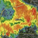
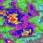
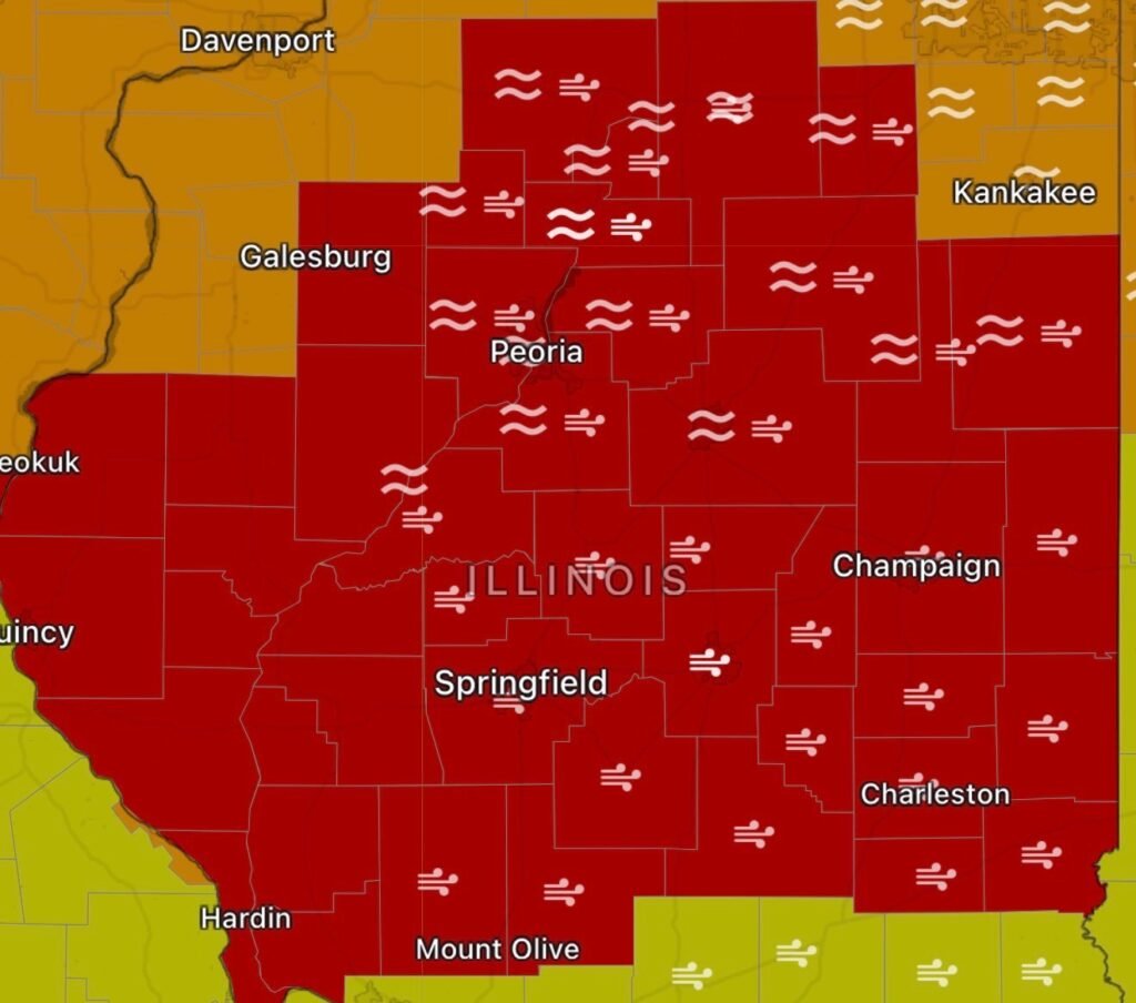
The watch includes areas of Central and Northern Illinois where atmospheric conditions are becoming increasingly favorable for rotating thunderstorms. Meteorologists indicate that a combination of warm, humid air and strong wind shear could support the development of supercells capable of producing tornadoes, some of which could become strong or long-tracked. (Jacksonville Journal-Courier)
What the Tornado Watch Means
A tornado watch does not mean a tornado is currently occurring. Instead, it means weather conditions are favorable for tornado development. Residents should remain alert, review safety plans, and be prepared to take shelter if a warning is issued. (Shaw Local)
Forecasters are also highlighting the potential for:
- Damaging wind gusts exceeding 75 mph
- Large hail up to 2.5 inches in diameter
- Flash flooding in areas experiencing repeated thunderstorms
- A few strong tornadoes, including the possibility of intense tornadoes in the highest-risk areas (Jacksonville Journal-Courier)
Areas Facing the Greatest Risk
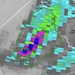
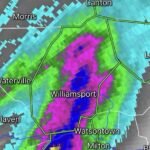
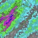
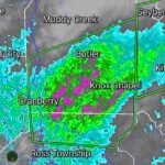
Central Illinois remains near the center of today’s severe weather threat, though impacts may extend into Northern Illinois as storms continue to organize. The Storm Prediction Center has placed portions of Illinois under an elevated severe weather risk, indicating the potential for significant severe weather outbreaks. (Jacksonville Journal-Courier)
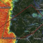
This latest threat comes just days after multiple tornadoes impacted parts of Illinois during a very active severe weather pattern that has affected much of the Midwest throughout June. (National Weather Service)
How to Prepare Now
If you live within the Tornado Watch area:
1. Monitor Weather Alerts
Keep multiple ways to receive warnings, including NOAA Weather Radio, local television stations, weather apps, and emergency alerts on your mobile device.
2. Identify Your Safe Place
Move to the lowest level of a sturdy building. Interior rooms, basements, and storm shelters provide the best protection.
3. Charge Devices
Ensure phones, power banks, and emergency communication devices are fully charged before storms arrive.
4. Secure Outdoor Items
Strong winds may develop ahead of storms. Bring in or secure outdoor furniture, trash cans, and loose objects.
5. Have an Emergency Kit Ready
Include:
- Flashlights
- Batteries
- Water
- Non-perishable food
- Medications
- Important documents
Radar Watch HQ Outlook
Illinois residents should remain weather-aware throughout the day and evening as multiple rounds of thunderstorms are expected to move across the state. While not every community will experience severe weather, conditions are favorable for dangerous storms capable of producing tornadoes, damaging winds, and large hail.
Stay tuned to Radar Watch HQ for continuing updates, watches, warnings, radar analysis, and severe weather coverage as this event unfolds.