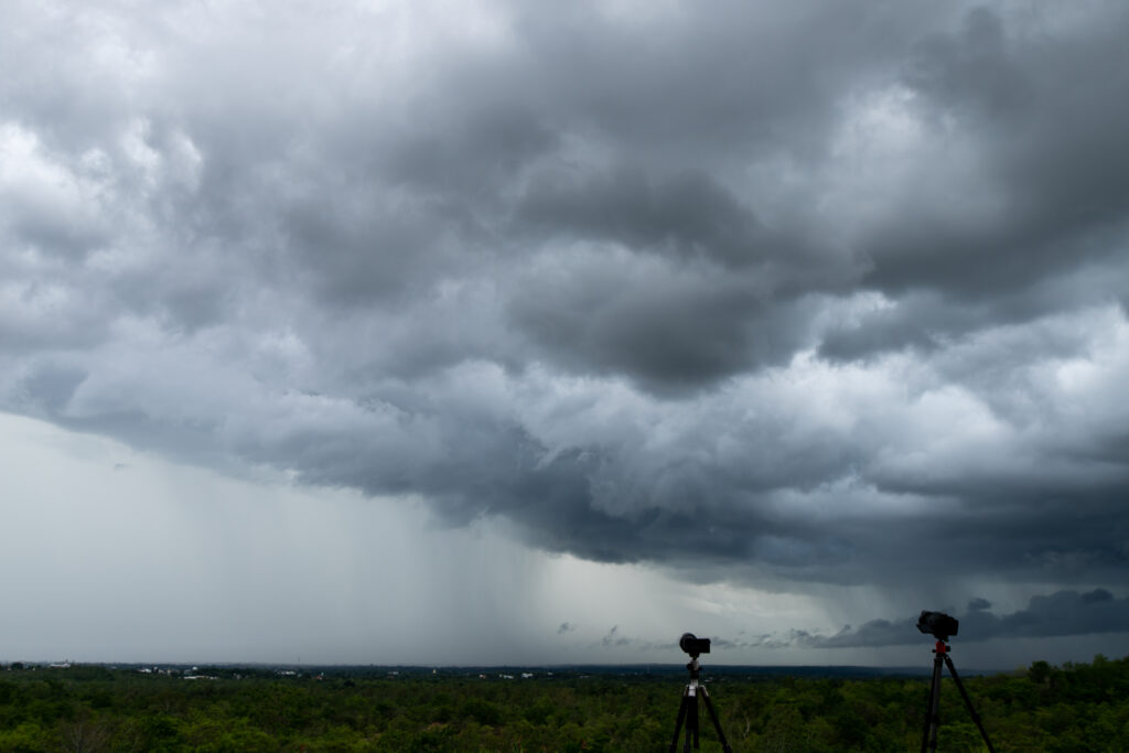
A dangerous severe weather outbreak is expected to develop across portions of the Central and Northern Plains, with forecasters warning of large hail, destructive wind gusts, and the potential for tornadoes. The threat is expected to expand eastward into parts of the Upper Midwest through midweek.
Areas Under the Greatest Threat
Northern Plains
- North Dakota
- South Dakota
- Northwestern Minnesota
Central Plains
- Nebraska
- Kansas
- Eastern Colorado
- Western Oklahoma
- Texas Panhandle
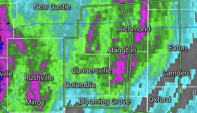
The highest-risk zone currently stretches from the Dakotas into northwestern Minnesota, where conditions are favorable for intense supercell thunderstorms.
Main Threats
🌪️ Tornadoes
Several storms may become capable of producing tornadoes, including a few that could become strong and long-lived if supercells remain isolated before merging into larger storm complexes.
🧊 Very Large Hail
Forecasters warn that hail larger than golf balls—and in some cases exceeding 2 inches in diameter—may accompany the strongest storms.
💨 Damaging Winds
Wind gusts between 60 and 80 mph could cause tree damage, power outages, and hazardous travel conditions.
🌧️ Flash Flooding
Repeated rounds of thunderstorms may produce localized flooding, especially in areas that have already received heavy rainfall.
Why the Threat Is Increasing
A powerful upper-level disturbance moving out of the Rockies is combining with rich Gulf moisture and extreme atmospheric instability across the Plains. This setup creates an environment favorable for explosive thunderstorm development during the afternoon and evening hours.
Timeline
Tuesday: Highest threat across the Dakotas, Nebraska, and northwestern Minnesota.
Wednesday: Severe storms shift east into Minnesota, Iowa, Wisconsin, and surrounding areas.
Thursday: The threat spreads farther into the Midwest, including parts of Illinois, Missouri, Indiana, and Wisconsin.
Weather Intelligence Center Analysis
The severe weather pattern developing across the Plains is one of the more significant setups of June so far. Residents in the threat area should ensure multiple ways to receive warnings, especially during the overnight hours when storms may continue after sunset. Tornado watches, severe thunderstorm watches, and flash flood alerts may become increasingly common as this outbreak unfolds.