


Training Storms: A Hidden Flood Threat
When severe weather strikes, most people focus on tornadoes, hail, or damaging winds. However, one of the most dangerous weather patterns often receives less attention: training storms. These thunderstorms can repeatedly move over the same location for hours, producing excessive rainfall and creating life-threatening flooding conditions.
Meteorologists frequently monitor training storms because they can rapidly overwhelm drainage systems, flood roadways, and cause rivers, creeks, and streams to rise well beyond their banks.
What Is a Training Storm?
A training storm occurs when multiple thunderstorms move over the same area one after another, much like train cars traveling along a railroad track. Instead of storms moving through and ending quickly, new storms continue to develop and follow the same path.
This repetitive pattern allows heavy rainfall to accumulate over a small geographic area in a short amount of time.
In some cases, areas can receive several inches of rain within just a few hours, dramatically increasing the risk of flash flooding.
Why Do Training Storms Form?
Several atmospheric ingredients contribute to the development of training storms:
- Abundant moisture in the atmosphere
- Slow-moving weather fronts
- Strong low-level moisture transport
- Favorable wind patterns that repeatedly steer storms over the same region
- High humidity levels and unstable air
When these conditions align, thunderstorms can continuously regenerate and move across identical locations, producing prolonged periods of heavy rainfall.
Impacts on Communities
Training storms can have widespread impacts on both urban and rural areas.
Flash Flooding
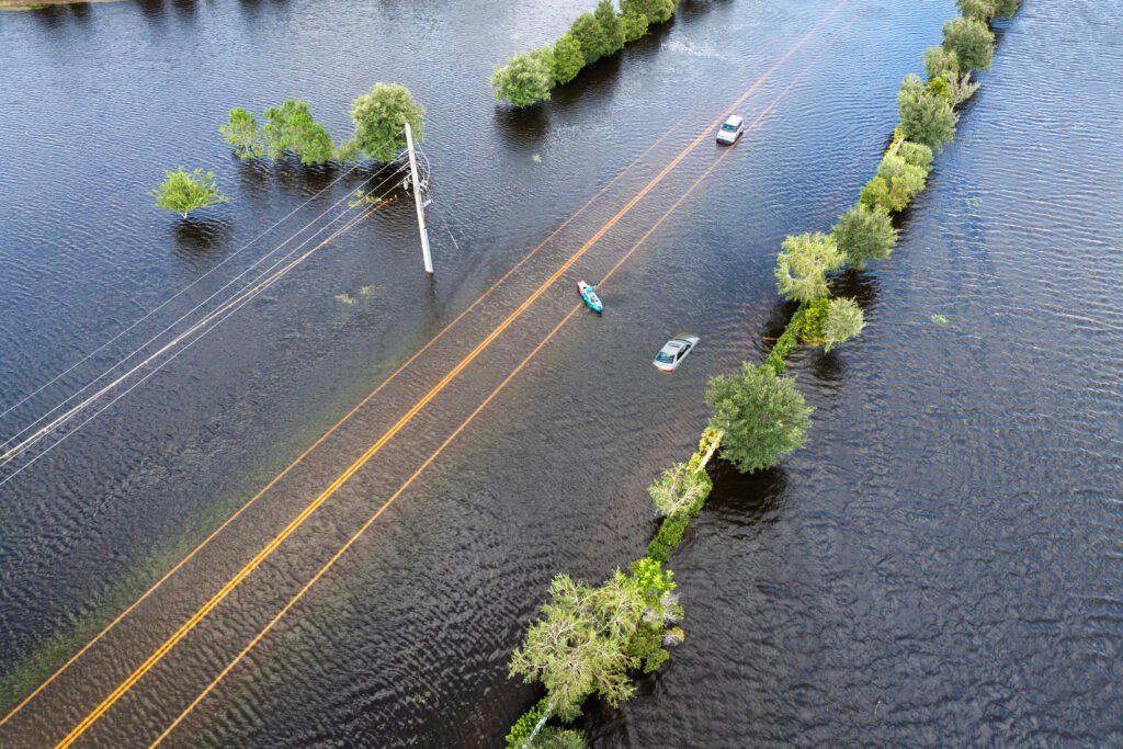
One of the greatest dangers is flash flooding. Water levels can rise rapidly, sometimes within minutes, catching motorists and residents off guard.
River and Stream Flooding
Creeks, streams, and rivers may continue rising long after rainfall has ended. Prolonged flooding can impact homes, businesses, agricultural land, and transportation routes.
Road Closures
Flooded roadways are common during training storm events. Even a small amount of moving water can sweep vehicles away, creating dangerous travel conditions.
Agricultural Impacts
Farmers may experience:
- Crop damage
- Soil erosion
- Delayed planting or harvesting
- Livestock challenges
- Infrastructure damage to fields and equipment
Infrastructure Concerns
Excessive rainfall can overwhelm storm drains, sewer systems, and water management infrastructure, leading to localized flooding throughout communities.
How Training Storms Differ from Ordinary Thunderstorms
A typical thunderstorm moves through an area and then exits. Training storms repeatedly affect the same location, causing rainfall totals to increase significantly.
For example:
- Ordinary thunderstorm: 0.5 to 1 inch of rain
- Training storm event: 3 to 10+ inches of rain over several hours
The difference can mean the transition from minor ponding of water to major flash flooding emergencies.
Safety Tips During Training Storm Events
If training storms are forecast in your area:
- Monitor weather alerts and warnings.
- Have multiple ways to receive emergency notifications.
- Never drive through flooded roadways.
- Move to higher ground if flooding develops.
- Keep emergency supplies readily available.
- Avoid walking through floodwaters.
- Follow instructions from local emergency management officials.
Remember the phrase: “Turn Around, Don’t Drown.”
Looking Ahead
As warmer temperatures increase atmospheric moisture, training storm events can produce increasingly intense rainfall rates. Communities across the United States remain vulnerable to these flooding events, particularly during the spring and summer severe weather seasons.
Understanding how training storms develop and recognizing the risks they pose can help residents make informed decisions when heavy rainfall threatens their area. Staying weather-aware and prepared can make all the difference when repeated thunderstorms begin tracking over the same location.