


Hazardous Weather Outlook in Effect Across the Mid-South
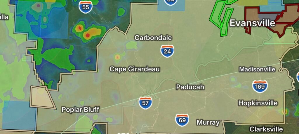
Residents across southern Illinois, southwest Indiana, western Kentucky, and southeast Missouri should prepare for an active period of hazardous weather as the National Weather Service has issued both a Hazardous Weather Outlook and a Flood Watch. Multiple rounds of thunderstorms are expected to develop through the region, bringing the potential for heavy rainfall, localized flash flooding, dangerous lightning, and isolated severe storms.
The Flood Watch remains in effect as repeated thunderstorms move across already saturated areas, increasing the likelihood of flooding in low-lying locations, creeks, streams, and urban areas. Rainfall rates may become intense enough to overwhelm drainage systems in a short period of time.
Main Weather Threats
Communities throughout the watch area should remain alert for rapidly changing weather conditions. The primary hazards include:
- Heavy rainfall capable of producing flash flooding
- Flooded roads and low-water crossings
- Frequent cloud-to-ground lightning
- Wind gusts capable of downing trees and power lines
- Isolated hail with stronger thunderstorms
- Reduced visibility during torrential rainfall
Forecasters warn that storms may repeatedly move over the same locations, significantly increasing rainfall totals and the risk for flash flooding.
Areas Included in the Flood Watch
The Flood Watch covers portions of:
- Southern Illinois
- Southwest Indiana
- Western Kentucky
- Southeast Missouri
Residents near rivers, creeks, drainage ditches, and flood-prone roadways should closely monitor forecasts throughout the event.
Flood Safety Tips
If flooding develops:
- Never drive across flooded roadways. Just a small amount of moving water can carry away a vehicle.
- Move to higher ground if flooding begins.
- Keep multiple ways to receive weather warnings, especially overnight.
- Charge mobile devices and prepare for possible power outages.
- Avoid camping or recreating near streams and rivers during heavy rainfall.
Stay Weather Aware
Conditions can change quickly as thunderstorms develop throughout the day and overnight. Additional Flood Warnings, Flash Flood Warnings, or Severe Thunderstorm Warnings may be issued with little notice as storms intensify.
Continue monitoring forecasts from the National Weather Service and local emergency management officials, and be prepared to take action if warnings are issued for your area.