


Missouri Weather Update: Storm Threats, Flooding Concerns, and Summer Heat Continue Across the Show-Me State
Missouri continues to experience an active stretch of weather as rounds of thunderstorms, heavy rainfall, and increasing summer heat impact communities across the state. From Kansas City and St. Louis to Springfield and the Ozarks, residents are being urged to stay weather aware as changing conditions create multiple weather hazards.
Severe Thunderstorms Remain a Concern
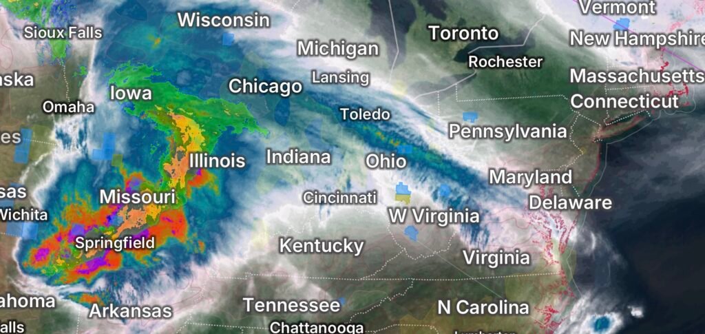
Recent weather patterns have brought repeated rounds of strong to severe thunderstorms across Missouri. Forecasters have highlighted the potential for damaging wind gusts, large hail, frequent lightning, and isolated tornadoes as storm systems move through the Midwest. Portions of eastern Missouri, including the St. Louis metropolitan area, have recently been included in tornado watch areas as unstable atmospheric conditions continue to support severe weather development. (Jacksonville Journal-Courier)
Storms moving across northern and central Missouri have also produced heavy rainfall capable of overwhelming drainage systems and causing rapid rises on creeks, streams, and low-lying roadways. (FOX Weather)
Flooding Concerns Continue
With multiple rounds of rainfall already affecting parts of the state, saturated soils remain a major concern. Additional thunderstorms could quickly lead to flash flooding, especially in areas that have received significant rainfall over the past several weeks.
Several rivers and waterways across Missouri have experienced elevated water levels, and flood warnings have been issued at times for portions of northwest Missouri. Residents living near rivers, creeks, and flood-prone locations should continue monitoring forecasts and local emergency alerts. (KQ2 News)
Officials continue to remind motorists never to drive through flooded roadways. Just a small amount of moving water can sweep vehicles off the road, creating life-threatening situations.
Heat and Humidity Building Across the Region
As summer officially settles in, temperatures are climbing across Missouri. High humidity levels are combining with warm temperatures to create uncomfortable and potentially dangerous heat index values.
The combination of tropical moisture and summer heat is fueling an unstable atmosphere that can contribute to stronger thunderstorms while also increasing the risk of heat-related illnesses. Residents spending time outdoors should remain hydrated, take frequent breaks, and limit strenuous activity during the hottest part of the day. (FOX Weather)
What Residents Should Watch For
Missourians should remain alert for:
- Severe Thunderstorm Watches and Warnings
- Tornado Watches and Warnings
- Flash Flood Watches and Warnings
- Flood Warnings for rivers and streams
- Dangerous lightning
- Large hail and damaging winds
- Increasing heat and humidity
Weather conditions can change rapidly during the summer months, especially when tropical moisture interacts with approaching cold fronts and storm systems. (FOX Weather)
Looking Ahead
The overall weather pattern remains active across Missouri as additional disturbances move through the central United States. Forecast models suggest continued opportunities for thunderstorms, periods of heavy rainfall, and fluctuating temperatures through the coming days. While not every community will experience severe weather, the potential remains for localized flooding, strong storms, and hazardous travel conditions. (FOX Weather)
Residents are encouraged to review emergency plans, ensure they have multiple ways to receive weather warnings, and stay informed as conditions evolve.
Final Thoughts
Missouri’s weather remains highly dynamic as summer begins. Between severe thunderstorms, flood risks, and increasing heat, communities across the state should remain prepared and vigilant. Staying informed and acting quickly when warnings are issued can help protect lives and property during this active weather period.