Severe Weather Alert: Illinois, Indiana, Michigan, and Ohio Facing Active Weather Pattern
Residents across parts of Illinois, Indiana, Michigan, and Ohio should remain weather-aware as multiple National Weather Service (NWS) alerts continue to be issued across the region. Recent storms have already produced damaging winds, tornadoes, large hail, flash flooding, and widespread power outages, and additional rounds of severe weather remain possible.
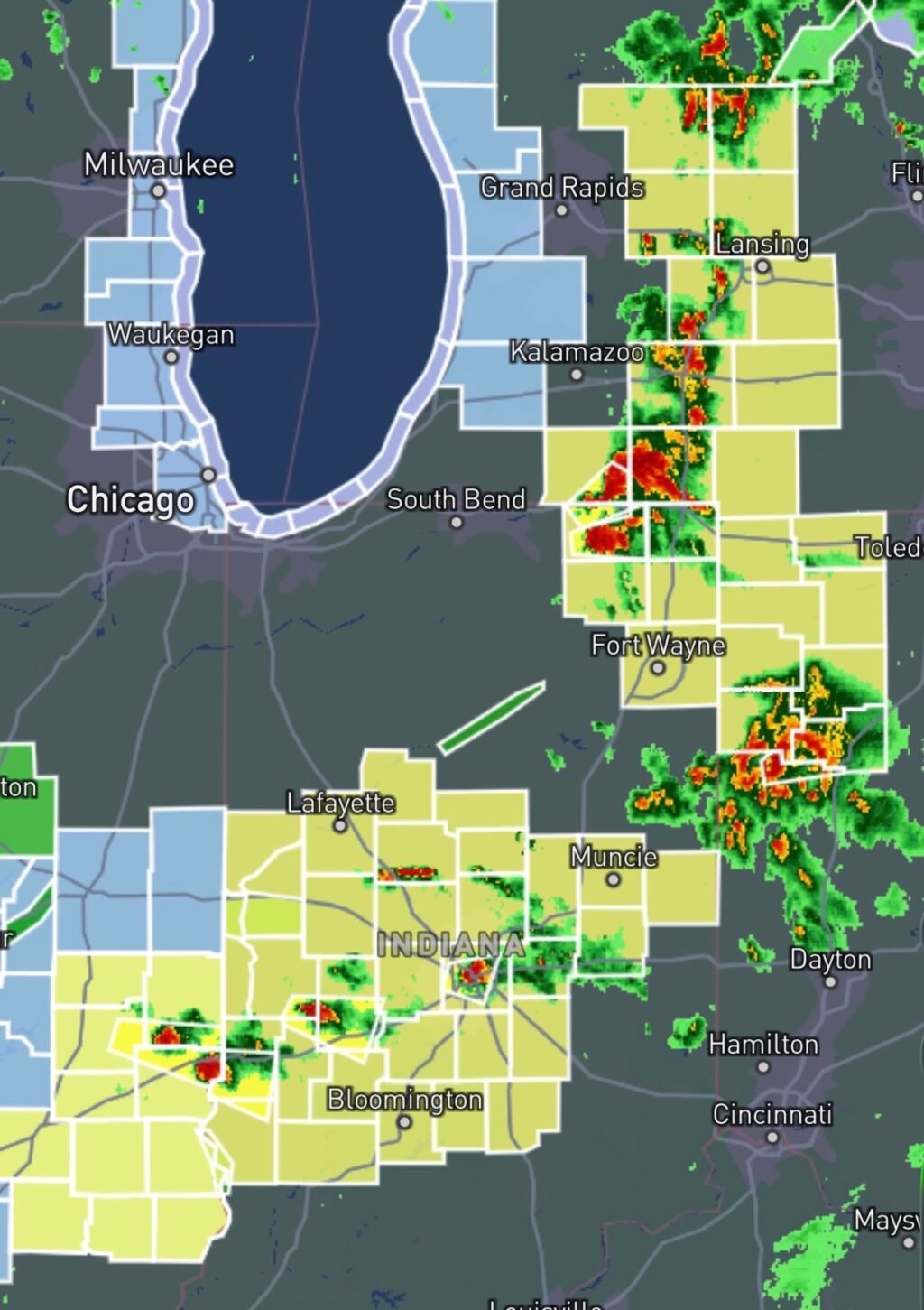
Recent severe weather outbreaks across northern Illinois and northwest Indiana produced multiple tornadoes and significant wind damage, while Michigan and Ohio have also experienced severe thunderstorms capable of damaging winds and localized flooding.
What Hazards Are Expected?
Meteorologists are monitoring conditions favorable for:
- Severe thunderstorms
- Damaging wind gusts exceeding 60-80 mph
- Large hail
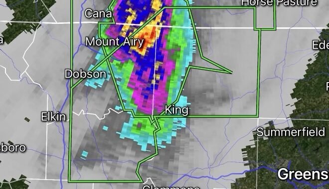
- Tornadoes
- Frequent lightning
- Heavy rainfall and flash flooding
- Localized power outages due to falling trees and power lines
Forecast discussions indicate the strongest threats may develop along advancing cold fronts interacting with warm, humid air across the Midwest and Great Lakes region.
Illinois and Indiana Face Elevated Risk
Parts of Illinois and Indiana have recently been highlighted for enhanced severe weather potential, including the possibility of strong tornadoes and widespread damaging winds. Forecasters note that atmospheric conditions remain favorable for rapidly developing thunderstorms capable of producing significant impacts.
Northern Illinois and northwest Indiana were particularly hard hit during the June 11 outbreak, which generated multiple tornadoes and extensive storm damage.
Michigan and Ohio Remain Under Threat
Across Michigan and Ohio, storms may continue to produce damaging winds, hail, and heavy downpours. Recent storm systems have caused power outages, tree damage, and localized flooding concerns across portions of both states.
With saturated soils in some locations, additional heavy rainfall could increase the risk of flash flooding, especially in low-lying and urban areas.
How to Prepare Before Storms Arrive
Have Multiple Ways to Receive Warnings
Do not rely on a single source of information. Use:
- NOAA Weather Radio
- Wireless Emergency Alerts on your phone
- Local television stations
- Trusted weather apps
- National Weather Service alerts
Identify Your Safe Place
If a Tornado Warning is issued:
- Move to the lowest level of your home.
- Stay in an interior room away from windows.
- Put as many walls between you and the outside as possible.
- Mobile home residents should relocate to a sturdier shelter ahead of time.
Prepare for Power Outages
Strong winds can quickly knock out electricity.
Keep ready:
- Flashlights
- Portable chargers
- Extra batteries
- Bottled water
- Non-perishable food
- Essential medications
Flood Safety
Never drive through flooded roadways.
Remember:
Turn Around, Don’t Drown.
Just a few inches of moving water can sweep a vehicle off the road.
Looking Ahead
The overall weather pattern remains active across the Midwest and Great Lakes. Additional watches and warnings may be issued with little notice as new storms develop. Residents in Illinois, Indiana, Michigan, and Ohio should continue monitoring forecasts closely and be prepared to take immediate action if warnings are issued.