Gale Warning and Small Craft Advisories Issued for Cape Hatteras, Ocracoke Waters, and Pamlico Sound
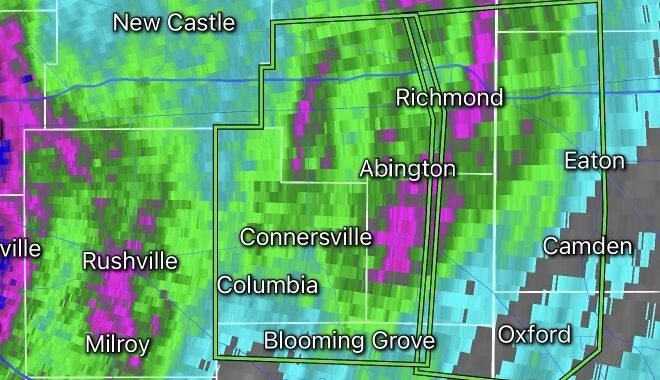
Mariners across eastern North Carolina should prepare for deteriorating boating conditions as the National Weather Service has issued Gale Warnings and Small Craft Advisories for portions of the coastal waters, sounds, and offshore marine zones surrounding Cape Hatteras and Ocracoke.
A strengthening weather system approaching the region is expected to produce strong southwesterly winds, rough seas, dangerous boating conditions, and the potential for thunderstorms and waterspouts through Thursday night and Friday. (National Data Buoy Center)
Gale Warning for Offshore Waters
A Gale Warning has been issued for the offshore waters from Cape Hatteras to Ocracoke Inlet, including portions of the Monitor National Marine Sanctuary.
Forecast conditions include:
- Sustained southwest winds of 20 to 30 knots
- Wind gusts up to 35 knots
- Seas building between 5 and 8 feet nearshore
- Offshore seas reaching 6 to 9 feet in some locations
- Increased risk of thunderstorms and waterspouts Thursday night into Friday (National Data Buoy Center)
These conditions can create extremely hazardous situations for small vessels and even challenge larger recreational boats.
Small Craft Advisories in Effect
Small Craft Advisories have been issued across several marine zones, including:
Pamlico Sound
The advisory remains in effect from Thursday morning through Friday evening. Southwest winds are expected to increase to 20 to 25 knots with waves building to 2 to 4 feet. Conditions may become especially dangerous for smaller fishing boats and recreational vessels. (National Data Buoy Center)
Albemarle Sound and Nearby Rivers
Advisories are also in effect for Albemarle Sound, the Pamlico and Pungo Rivers, and the Neuse and Bay Rivers. Gusts up to 25 knots are expected with choppy waters developing throughout Thursday. (National Data Buoy Center)
Coastal Waters Near Cape Hatteras
Nearshore waters from Oregon Inlet to Cape Hatteras and areas southward toward Ocracoke will experience hazardous boating conditions as strong winds and elevated seas spread across the region. (National Data Buoy Center)
Thunderstorms and Waterspout Threat
In addition to dangerous marine conditions, forecasters are monitoring the potential for thunderstorms capable of producing strong wind gusts, frequent lightning, heavy rain, and isolated waterspouts. Mariners should closely monitor weather updates and have multiple ways to receive warnings while on the water. (National Data Buoy Center)
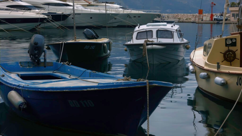
Safety Tips for Mariners
If you plan to be on the water:
- Check the latest marine forecast before departure.
- Wear a properly fitted life jacket at all times.
- Secure loose gear and equipment.
- Avoid venturing offshore during Gale Warning conditions.
- Have a reliable marine radio onboard.
- Return to port immediately if thunderstorms develop.
- Inform someone onshore of your travel plans.
Looking Ahead
Marine conditions are expected to remain hazardous through Thursday night and portions of Friday before gradually improving behind an approaching cold front. Boaters should continue monitoring forecasts and marine advisories for any additional warning expansions or changes. (Marine Weather)