
What Are Training Thunderstorms?
Training thunderstorms occur when multiple thunderstorms repeatedly move over the same location, much like train cars moving along the same railroad track.
Instead of a storm passing through once and moving away, new storms continue to develop and follow the same path. This can dump several inches of rain over a small area in just a few hours.
Why Do Training Thunderstorms Happen?
Training storms typically develop when:
- A slow-moving front is present.
- Winds at different levels of the atmosphere steer storms along the same corridor.
- Warm, humid air continuously feeds new thunderstorm development.
- A stationary boundary acts as a focus for repeated storm formation.
Meteorologists often watch for training storms during the summer because they are one of the leading causes of flash flooding.
How Training Storms Cause Flash Flooding
When thunderstorms repeatedly hit the same location:
- Rainfall accumulates rapidly.
- The ground becomes saturated and can no longer absorb water.
- Creeks, streams, and drainage systems overflow.
- Water begins to rush across roads and low-lying areas.
Even areas that have not experienced recent rain can flood if rainfall rates become intense enough.
Warning Signs
🚨 The risk of flash flooding increases when:
- Rainfall rates exceed 1–2 inches per hour.
- Storms are moving slowly.
- Multiple rounds of storms are forecast.
- The area is urbanized with lots of pavement.
- Soil is already saturated from previous rainfall.
Weather Alerts You May See
- Flood Watch: Conditions are favorable for flooding.
- Flash Flood Warning: Flash flooding is occurring or imminent.
- Flood Warning: General flooding is expected or ongoing.
- Flash Flood Emergency: A rare, life-threatening flooding situation is underway.
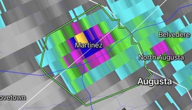
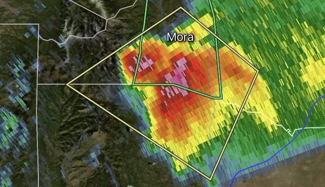
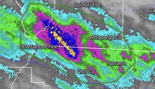
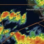
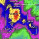
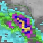
What Radar Looks Like
Meteorologists often identify training storms on radar when thunderstorm cells appear to move over the same counties or communities repeatedly, forming a line where storms “train” over one area.