Tropical Storm Arthur Becomes the First Named Storm of the 2026 Atlantic Hurricane Season
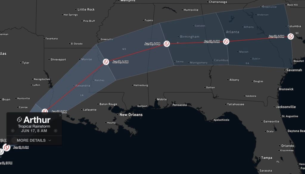
The 2026 Atlantic Hurricane Season has officially reached a significant milestone as Tropical Storm Arthur has formed in the western Gulf of Mexico, becoming the first named storm of the season. Arthur developed from what was previously known as Potential Tropical Cyclone One and is now bringing heavy rainfall, gusty winds, coastal flooding concerns, and an increased risk of flash flooding across portions of the Gulf Coast. (Houston Chronicle)
Current Status of Tropical Storm Arthur
As of June 17, 2026, Tropical Storm Arthur is located near the Texas Gulf Coast with maximum sustained winds of approximately 40 mph. The storm is moving northeast and is expected to track along the Texas coastline before making landfall near the Texas-Louisiana border and moving inland across Louisiana. Forecasts indicate Arthur is likely to remain a relatively weak tropical storm and is expected to weaken after landfall. (Houston Chronicle)
Tropical Storm Warnings have been issued for portions of the Texas and Louisiana coastline as tropical-storm-force winds, heavy rain bands, and coastal flooding impacts continue to spread across the region. (Houston Chronicle)
Greatest Threat: Flooding Rainfall
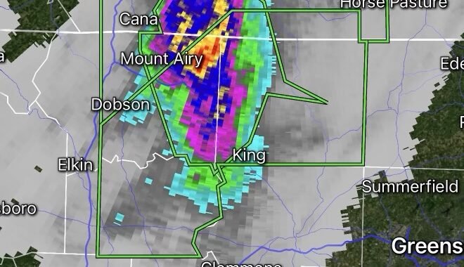
While Arthur is not expected to become a major wind event, the storm’s biggest concern is excessive rainfall. Forecast rainfall totals of 4 to 8 inches are expected across parts of Texas, Louisiana, Mississippi, Alabama, and portions of the western Florida Panhandle. Some isolated areas could receive up to 12 inches of rain, increasing the threat of flash flooding and river flooding. (Beaumont Enterprise)
The National Hurricane Center has warned that slow-moving rain bands may produce prolonged periods of heavy rainfall, especially across low-lying and flood-prone areas. (AP News)
Coastal Flooding and Storm Surge Concerns
In addition to heavy rainfall, residents along portions of the Gulf Coast should remain alert for storm surge and coastal flooding. Forecasts suggest water levels could rise 2 to 4 feet above normally dry ground in some coastal locations if peak surge coincides with high tide. (Beaumont Enterprise)
Dangerous rip currents, rough surf, and hazardous marine conditions are also expected along portions of the Texas and Louisiana coastlines.
Tornado Risk
As Arthur moves inland, forecasters are also monitoring the potential for isolated tornadoes, particularly across coastal Louisiana, Mississippi, Alabama, and portions of the Florida Panhandle. Tropical systems often produce brief tornadoes within outer rain bands, even when the storm itself remains relatively weak. (Beaumont Enterprise)
What Residents Should Do Now
Residents in areas under Tropical Storm Warnings should:
- Monitor forecasts and official updates from local emergency management and the National Hurricane Center.
- Avoid driving through flooded roadways.
- Prepare for localized power outages.
- Secure outdoor items that could become airborne in gusty winds.
- Have multiple ways to receive weather alerts, especially overnight.
Looking Ahead
Arthur serves as a reminder that even weaker tropical storms can produce significant impacts through flooding rainfall and coastal hazards. While the storm is expected to weaken after landfall, flooding concerns may continue well after the center moves inland.
Radar Watch HQ will continue monitoring Tropical Storm Arthur and provide updates on rainfall totals, flood warnings, storm surge impacts, and any additional tropical developments throughout the 2026 hurricane season.