Tropical Storm Warning Remains in Effect
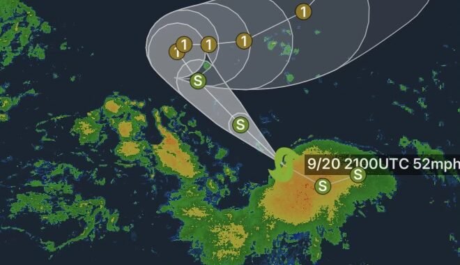
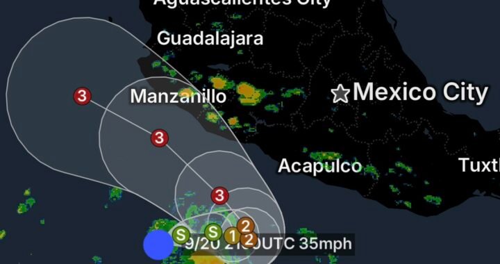
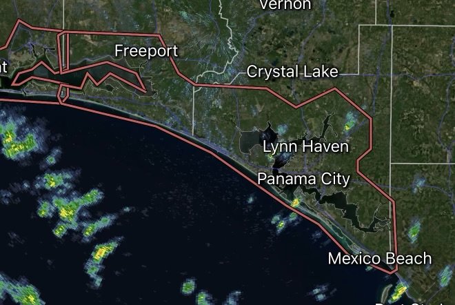
A Tropical Storm Warning continues for Santa Rosa Beach, Sandestin, and Freeport, Florida, as tropical weather associated with Tropical Storm Bertha threatens portions of the Florida Panhandle. While the current local forecast suggests sustained winds may remain below tropical storm strength, residents should not let their guard down. Tropical systems can shift quickly, and forecast uncertainty remains a significant factor.
Understanding the Forecast Uncertainty
The National Weather Service emphasizes a “threat to life and property that includes typical forecast uncertainty in track, size, and intensity.” This means that even small changes in the storm’s path or strength could result in stronger winds, heavier rainfall, and greater coastal impacts than currently forecast.
Current projections include:
- Potential for tropical-storm-force winds of 39 to 57 mph
- Local forecast winds of 15–25 mph with gusts up to 35 mph
- Conditions may become more hazardous if the storm shifts closer to the coast.
Storm Surge Threat Continues
Residents along the Gulf Coast should closely monitor water levels as localized storm surge flooding remains possible.
Forecast highlights include:
- 1 to 3 feet of storm surge possible in surge-prone areas
- Flooding concerns continue through Wednesday afternoon
- Low-lying roads, beaches, and waterfront properties could experience inundation.
Heavy Rain and Localized Flooding
Although rainfall totals are not expected to be extreme, tropical downpours may still create dangerous travel conditions.
Expected impacts include:
- Around 1 inch of additional rainfall
- Localized flash flooding in poor drainage areas
- Rising creeks, ditches, and small streams
- Temporary road closures and ponding on highways.
Dangerous Surf and Rip Currents
Even if the center of the storm remains offshore, dangerous marine conditions are expected.
Additional coastal hazards include:
- High surf with waves reaching 3 to 11 feet
- A High Rip Current Risk
- Minor coastal flooding in vulnerable shoreline locations
- Hazardous conditions for swimmers and boaters.
Tornado Risk Remains Low
At this time, the National Weather Service indicates that tornadoes are not expected. However, isolated thunderstorms with gusty winds remain possible as rainbands move through the area.
Safety Tips for Residents
Residents in Santa Rosa Beach, Sandestin, and Freeport should:
- Stay informed with updates from the National Weather Service.
- Avoid flooded roads and never drive through standing water.
- Secure outdoor furniture, umbrellas, and loose objects.
- Charge phones and emergency devices.
- Stay away from beaches due to dangerous surf and rip currents.
- Be prepared to act quickly if watches or warnings are upgraded.
Final Thoughts
Although forecast confidence suggests the strongest winds may remain offshore, tropical systems can change rapidly. The National Weather Service continues to stress the uncertainty surrounding the storm’s track, size, and intensity. Residents across Santa Rosa Beach, Sandestin, and Freeport should remain weather-aware, complete preparations, and continue monitoring official forecasts until the threat has passed.
Affiliate Disclosure: As an Amazon Associate, Radar Watch HQ earns from qualifying purchases.
Radar Watch HQ Top 5 Essential Emergency Preparedness Picks
Whether you’re preparing for severe thunderstorms, flash flooding, hurricanes, wildfires, or extended power outages, these five emergency essentials can help keep your household safer when severe weather strikes.
A portable power station provides reliable backup electricity during outages, allowing you to power phones, medical devices, laptops, lights, small appliances, and communication equipment without fuel.
Best for:
- Extended power outages
- Severe thunderstorms
- Hurricanes
- Winter storms
- Wildfires
2. Flood Protection Barriers & Sandless Flood Bags
Flood barriers help divert or absorb water before it enters garages, doorways, and low-lying areas. They deploy quickly and can help reduce property damage during flash flooding.
Best for:
- Flash Flood Warnings
- Heavy rainfall
- River flooding
- Coastal flooding
3. Rechargeable LED Flashlights
Bright, dependable flashlights are essential when the power goes out. Rechargeable or solar-powered models provide long-lasting illumination for navigating safely indoors and outdoors.
Best for:
- Overnight power outages
- Emergency evacuations
- Storm damage inspections
Keep phones, tablets, weather radios, and USB-powered devices charged when the electrical grid is unavailable. A solar power bank offers an additional charging option during prolonged emergencies.
Best for:
- Communication during outages
- Emergency weather alerts
- Travel and evacuation
A NOAA Weather Radio delivers official weather alerts directly from the National Weather Service, even when cellular networks or internet service are unavailable. It remains one of the most dependable ways to receive life-saving warnings.
Best for:
- Tornado warnings
- Severe thunderstorm warnings
- Flash flood warnings
- Hurricane alerts
- Winter storm emergencies
Why Radar Watch HQ Recommends These Essentials
At Radar Watch HQ, preparedness is just as important as staying informed. These five emergency essentials can help you stay connected, protect your property, and safely navigate severe weather events. Having supplies ready before storms arrive allows you to respond quickly when warnings are issued and conditions begin to deteriorate.