Tropical Storm Simon and Another Area to Watch
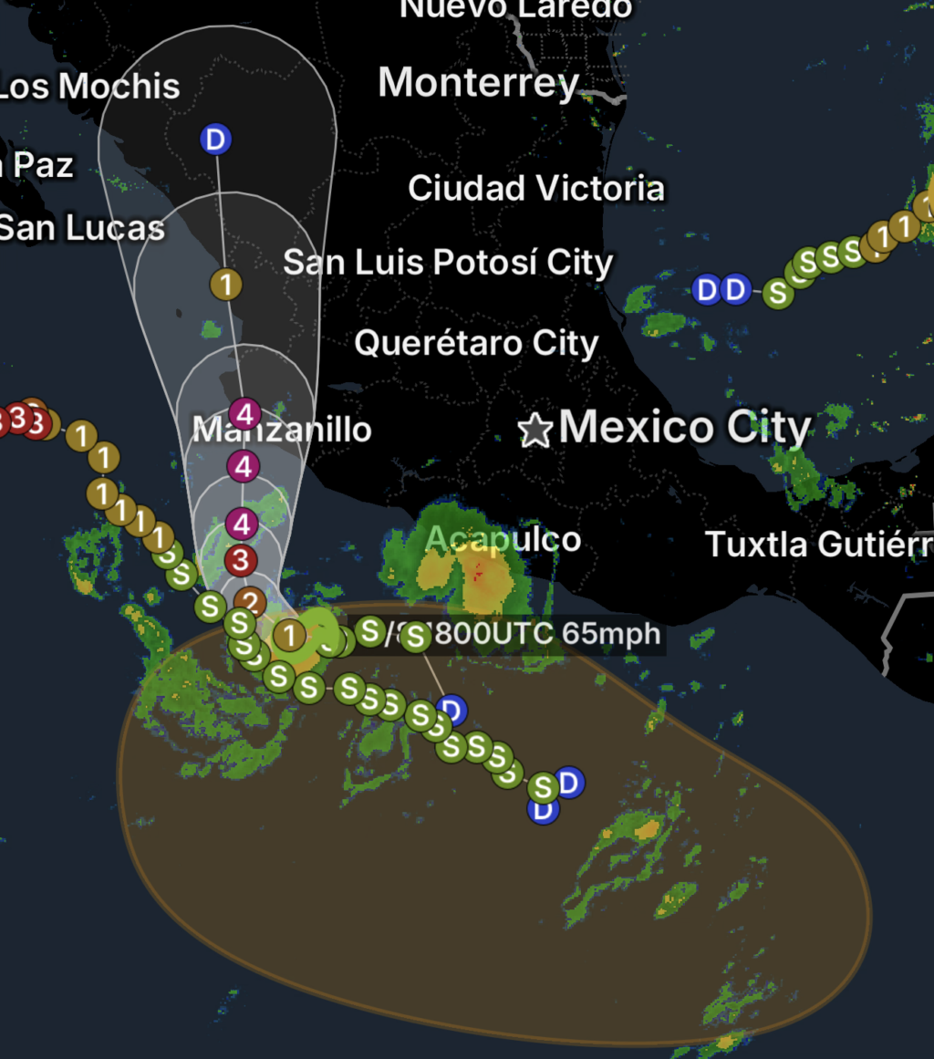
The eastern Pacific remains active on Thursday, October 8, 2026, with Tropical Storm Simon being monitored while another area of disturbed weather is expected to develop south of Guatemala.
Forecasters are watching the potential new system because environmental conditions appear favorable for gradual tropical development after the low-pressure area forms.
While development is not guaranteed, the system could eventually become a tropical depression as it moves generally west-northwestward.
New Low Pressure Area Expected South of Guatemala
An area of low pressure is forecast to form south of the coast of Guatemala early next week.
Once the disturbance develops, environmental conditions are expected to be conducive for some gradual organization.
If the system becomes sufficiently organized, it could develop into a tropical depression.
At this stage, the system remains several days from formation, so details concerning its eventual strength and track remain uncertain.
West-Northwestward Movement Expected
The developing system is forecast to move generally west-northwestward at around 10 MPH.
A west-northwestward trajectory would generally take the system farther into the eastern Pacific rather than immediately toward Central America.
However, tropical systems can change direction and intensity as environmental conditions evolve, making continued monitoring important.
Gradual Development Possible
Several environmental factors can influence whether a tropical disturbance becomes organized enough to develop into a depression or stronger tropical cyclone.
Forecasters will be watching:
- 🌡️ Ocean temperatures
- 💨 Wind shear
- 🌧️ Thunderstorm organization
- 🌀 Development of a closed circulation
- 🌬️ Moisture surrounding the disturbance
- 🧭 Changes in its forward track
Even if development is slow initially, conditions can change over several days.
Tropical Storm Simon
Meanwhile, Tropical Storm Simon remains part of the active eastern Pacific tropical pattern.
The presence of multiple areas of tropical activity highlights the need for residents, mariners and coastal interests across the eastern Pacific to continue monitoring official forecasts throughout the remainder of the hurricane season.
Is There a Threat to Land?
At this time, the developing low-pressure area is expected to move generally west-northwestward over the eastern Pacific.
It is too early to determine whether the system will eventually affect land, and no specific impacts should be assumed based solely on its current forecast track.
Residents and coastal interests in Central America should continue monitoring updates as the disturbance forms and becomes better organized.
Essentials: What to Watch
🌀 Monitor the forecast: Tropical systems can strengthen or change direction as conditions evolve.
📱 Follow official updates: Use National Hurricane Center and local meteorological agency information for the latest forecasts.
🌊 Mariners should remain alert: Developing tropical systems can produce increasing winds, thunderstorms and rough seas.
🌧️ Watch Central American rainfall: Even developing disturbances can produce periods of heavy rain near the coast.
⏳ Don’t focus on the long-range forecast: Track and intensity forecasts become more reliable as a system actually forms.
Bottom Line
Tropical Storm Simon is being monitored as the eastern Pacific remains active, while a new area of low pressure is expected to form south of Guatemala early next week.
Environmental conditions appear favorable for some gradual development, and the system could eventually become a tropical depression while moving generally west-northwestward at approximately 10 MPH.
For now, the system remains in the early stages of development, and residents should continue monitoring official forecasts for changes.