Flooding Concerns Grow as Heavy Rain Raises Risks for Creeks, Streams and Low-Lying Areas
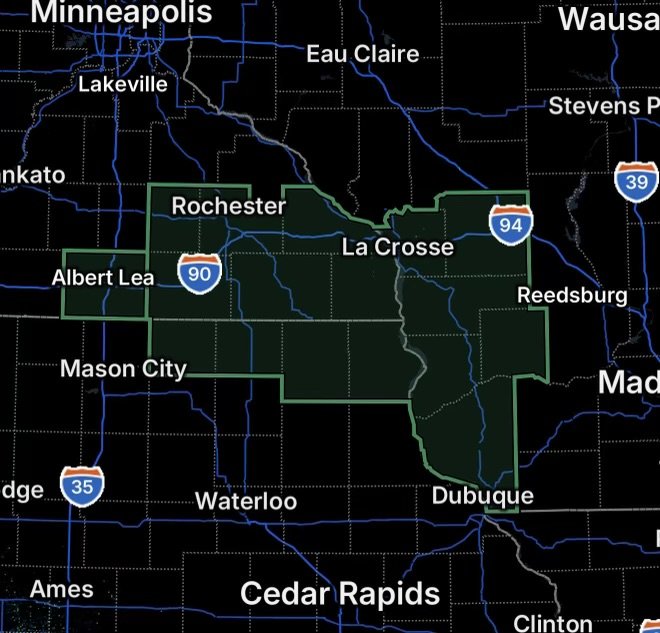
A Flood Watch is in effect for portions of northeast Iowa and southwest Wisconsin, where periods of heavy rainfall could produce flooding in areas that receive repeated or excessive rain.
The threat includes Crawford, Grant, La Crosse, Monroe, Richland, and Vernon Counties in Wisconsin, along with portions of northeast Iowa.
The National Weather Service La Crosse area continues to monitor the potential for additional rounds of heavy rain across northeast Iowa and southwest Wisconsin. The latest hazardous weather outlook notes that additional heavy rainfall could contribute to areal and river flooding, particularly along more responsive rivers and streams, with the heaviest rainfall potential extending into Friday and Saturday. (National Weather Service)
Why the Flood Risk Matters
A Flood Watch means conditions are favorable for flooding, but flooding is not necessarily occurring everywhere within the watch area.
Heavy rainfall can quickly overwhelm drainage systems, cause water to collect on roadways, and push smaller creeks and streams out of their banks. Areas that receive repeated rounds of rain can become increasingly vulnerable as the ground loses its ability to absorb additional water.
Low-lying areas, poor-drainage locations, waterways and areas that have already received substantial rainfall can experience problems first.
Wisconsin Counties to Watch
The Flood Watch concerns several communities across southwest Wisconsin, including:
- Crawford County
- Grant County
- La Crosse County
- Monroe County
- Richland County
- Vernon County
These counties are within the area served by the National Weather Service La Crosse office, which provides forecasts and hazardous-weather information for portions of southwest Wisconsin, northeast Iowa and southeast Minnesota. (National Weather Service)
Residents near rivers, creeks and other waterways should monitor changing water levels and be prepared for rapidly changing conditions if additional heavy rain develops.
Northeast Iowa Flooding Concerns
Northeast Iowa is also included in the broader area being monitored for heavy rainfall and potential flooding.
Rainfall can produce different impacts from one location to another. A storm that produces manageable rainfall in one community may generate significant runoff in another, particularly where storms repeatedly track over the same area.
The National Weather Service is monitoring the potential for additional heavy rain and flooding across the region into the weekend. (National Weather Service)
Roads Can Become Dangerous Quickly
Flooding does not need to be deep to create dangerous driving conditions.
Water covering a roadway can hide washed-out pavement, debris or damaged sections of road. Moving water can also affect vehicle control and make it difficult to determine how deep the water actually is.
Never drive through a flooded roadway. Turn around and find another route.
Drivers should also watch for rapidly changing conditions near creeks, low-water crossings and areas prone to drainage problems.
What Residents Should Do Now
If you live in or travel through the Flood Watch area:
- Monitor the latest National Weather Service forecasts and alerts.
- Know whether your home or route is near a creek, river or flood-prone area.
- Avoid driving through flooded roads or standing water.
- Move vehicles and important belongings away from areas that commonly flood.
- Keep phones charged in case conditions deteriorate or power outages occur.
- Be prepared to act quickly if a Flood Warning is issued for your location.
- Never ignore evacuation instructions from local officials.
A Flood Watch is the time to prepare. If a Flood Warning is issued, flooding is occurring, imminent or expected in the warned area and immediate action may be necessary.
What to Watch Through the Weekend
The flood threat may not end with a single round of rainfall. Additional showers and thunderstorms could bring more water to the region, increasing runoff and river levels.
Because the exact location and timing of the heaviest rainfall can change, residents should continue checking updated forecasts rather than relying on a single forecast issued earlier in the event. The National Weather Service currently notes uncertainty regarding the precise timing and location of the heaviest rainfall while highlighting the potential for additional flooding into the weekend. (National Weather Service)
Radar Watch HQ Final Thoughts
The combination of heavy rainfall and additional rounds of precipitation can make flooding conditions change quickly across northeast Iowa and southwest Wisconsin.
Residents in Crawford, Grant, La Crosse, Monroe, Richland, and Vernon Counties should remain weather-aware, especially if they live near waterways or in locations that have experienced flooding in the past.
Stay informed, avoid flooded roads, and follow instructions from local emergency officials and the National Weather Service as conditions evolve.