Flood Watch Expands Across Montana and Wyoming
A significant late-season weather pattern is developing across parts of the northern Rockies, with Flood Watches covering large portions of Montana and Wyoming while strong thunderstorms move across parts of eastern Idaho.
The National Weather Service says a strong, slow-moving fall storm system is expected to affect the region from Friday night through Sunday, bringing above-normal atmospheric moisture and the potential for periods of heavy rainfall. Embedded thunderstorms could increase the risk of flash flooding, particularly over recent burn scars.
Flood Watch Across South-Central and Southeastern Montana
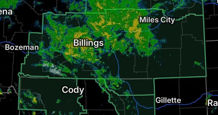
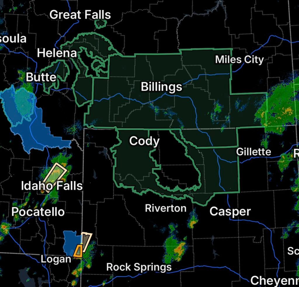
A Flood Watch is in effect for all of south-central Montana, portions of southeastern Montana, and Sheridan County, Wyoming.
The watch is scheduled to begin Friday evening and continue through Sunday afternoon. The primary concern is flooding from excessive rainfall, with additional potential for flash flooding over recent burn scars.
Communities and locations included within the broader watch area include portions of the Billings region, Sheridan, Red Lodge, Livingston, Big Timber, Hardin, Broadus, Forsyth, Colstrip, Cooke City, and surrounding areas.
Rainfall could become especially concerning where repeated showers and thunderstorms move over the same locations. Burn scars can respond rapidly to heavy rainfall because vegetation and soil conditions have been altered by wildfire.
Flood Watch Also Covers Central, North-Central and Northwest Wyoming
Additional Flood Watch areas extend across portions of central, north-central, and northwest Wyoming.
The threat will not necessarily be limited to areas receiving the heaviest continuous rainfall. Thunderstorms embedded within the larger storm system could produce locally intense rainfall, creating faster runoff and isolated flash-flood concerns.
Forecast information for the Wyoming mountains also indicates periods of showers and thunderstorms, with some thunderstorms capable of producing heavy rainfall.
Residents in flood-prone locations, along waterways, near steep terrain, and downstream from recent wildfire burn scars should remain alert as the wetter pattern develops.
Strong Thunderstorms Move Across Eastern Idaho
A Special Weather Statement has also been issued for portions of eastern Idaho.
The National Weather Service reported strong thunderstorms impacting southwestern Fremont, north-central Jefferson, northwestern Madison, and central/east-central Clark County areas. The storms were moving northeast at approximately 40 mph, with radar indicating potential for 50–55 mph wind gusts and half-inch hail.
Strong thunderstorms can quickly produce dangerous conditions even when a location is not under a severe thunderstorm warning.
Gusty winds can break branches, move unsecured outdoor objects, and cause minor property damage. Hail can also damage vehicles, windows, crops, and outdoor equipment.
Earlier storms in the same general region were capable of even stronger wind gusts and larger hail, demonstrating how quickly thunderstorm intensity can increase across eastern Idaho.
Strong Thunderstorms Near Salt River Pass
A separate Special Weather Statement covers the Salt River Pass area, where strong thunderstorms can create rapidly changing travel conditions.
Mountain passes can experience reduced visibility, gusty crosswinds, lightning, hail, and sudden heavy rainfall as thunderstorms move through.
Drivers traveling through the pass should be prepared for changing conditions and avoid stopping in exposed areas when lightning or strong winds are occurring.
Why This Weather Pattern Matters
The combination of moisture, a slow-moving storm system, and thunderstorms is the primary concern.
NWS Billings notes that the potential for at least one-half inch of rainfall is elevated across southern Montana and northern Wyoming, with the potential for one inch or more particularly notable across parts of south-central Montana.
Thunderstorms can make rainfall totals highly uneven. One community may receive manageable rainfall while another nearby location experiences a much heavier downpour.
That becomes especially important around recent burn scars, where runoff can increase rapidly.
Flood Safety Reminders
If you’re in an area covered by a Flood Watch:
- Monitor updated forecasts and local National Weather Service information.
- Be prepared for rapidly changing conditions as thunderstorms develop.
- Never drive through a flooded roadway.
- Turn around if water begins covering a road.
- Avoid camping or parking near streams and low-lying drainage areas when heavy rain is expected.
- Stay alert for rapidly rising water near burn scars.
- Have multiple ways to receive weather alerts, especially overnight.
- If flooding begins, move to higher ground when instructed by local officials.
For thunderstorms, move indoors when thunder is heard. Keep away from windows during strong winds and hail, and secure loose outdoor items before storms arrive.
Radar Watch HQ Final Thoughts
The weather threat across Montana, Wyoming, and eastern Idaho is evolving into a multi-day concern rather than a single isolated storm event. Flood Watches highlight the potential for excessive rainfall and flash flooding, while strong thunderstorms are creating additional risks from gusty winds, hail, lightning, and locally heavy rainfall.
The greatest concern will be where heavy rain overlaps vulnerable terrain, drainage areas, and recent wildfire burn scars.
Stay weather-aware through the weekend, monitor official updates from the National Weather Service, and take flooding seriously even when rainfall appears manageable at first.
Stay informed, stay prepared, and never drive through floodwater.