Flood Watch Covers Large Areas of Montana and Wyoming
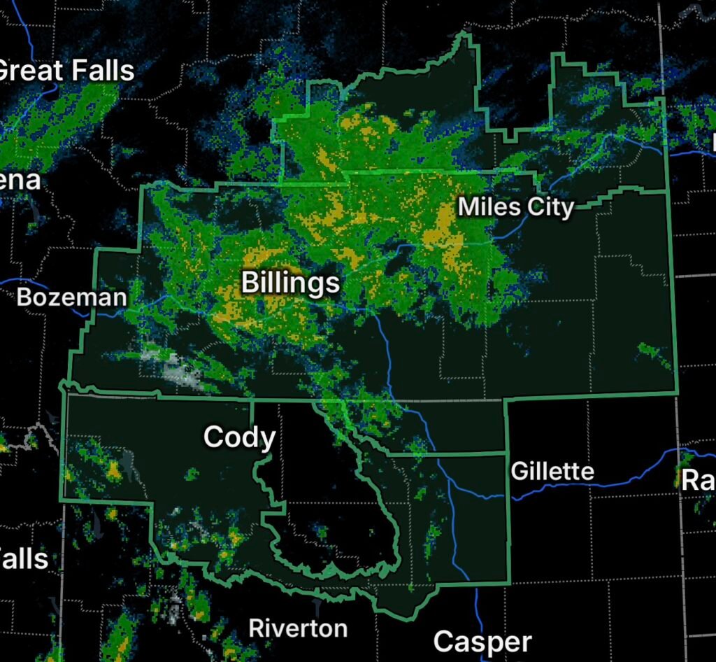
A broad flood threat is developing across Montana and Wyoming as a slow-moving weather system brings periods of rain and thunderstorms to the region. Flood Watches are in effect for portions of northeast Montana, all of south-central and southeast Montana, Sheridan County in Wyoming, and portions of central, north-central, and northwest Wyoming.
The National Weather Service says excessive rainfall could produce flooding, with some locations also facing the potential for flash flooding. In parts of Montana, the threat is heightened near recent burn scars, where rainfall can quickly generate runoff, debris flows, and dangerous flooding.
Northeast Montana
Portions of northeast Montana are included in the broader Flood Watch area. Periods of rain and thunderstorms could cause water to accumulate rapidly in areas with poor drainage, low-lying locations, and areas that have already received significant rainfall.
Residents should monitor changing conditions, particularly if thunderstorms repeatedly move across the same locations.
South-Central and Southeast Montana
The Flood Watch covers all of south-central and southeast Montana, where the National Weather Service expects excessive rainfall to remain a concern through Sunday afternoon. Current guidance indicates that 1 to 3 inches of rain may be common, with locally higher totals possible where thunderstorms persist.
Communities and locations within the watch include areas around Billings, Red Lodge, Miles City, Hardin, Livingston, Broadus, Baker, Forsyth, Colstrip, Big Timber, Roundup, Harlowton, Absarokee, and surrounding areas.
Recent burn scars deserve particular attention. The National Weather Service specifically identifies the Robertson Draw, East Side, Elk, and McGhee-Remington burn scars as especially vulnerable to flash flooding and debris flows. Other burn scars from this summer may also have elevated flash-flood potential.
Sheridan County, Wyoming
Sheridan County is also included in the Flood Watch. Heavy rainfall and thunderstorms could produce excessive runoff, especially around creeks, drainage areas, and locations prone to flooding.
Residents should be prepared for rapidly changing conditions, particularly if thunderstorms produce intense rainfall over a short period.
Central, North-Central and Northwest Wyoming
Additional portions of Wyoming are under Flood Watches as the unsettled weather pattern spreads across the region. Areas of central, north-central, and northwest Wyoming could experience periods of moderate to heavy rainfall, with localized flooding possible.
Mountainous terrain can increase runoff and cause water to move quickly into valleys, streams, and drainage areas. Drivers should also be prepared for reduced visibility, ponding on roads, and rapidly changing travel conditions during heavier rainfall.
Why Burn Scars Increase the Flood Risk
Wildfire burn scars can be especially vulnerable to flooding because vegetation that normally slows rainfall and helps absorb water has been removed or damaged. Intense rain can instead run rapidly across the ground, carrying mud, rocks, ash, and debris into drainage channels.
That means flooding near a burn scar can develop much faster than people might expect, even when rainfall is occurring several miles away.
Flood Safety: What to Do Now
If you are inside a Flood Watch area:
- Monitor forecasts and official alerts throughout the day.
- Be prepared for a Flood Warning or Flash Flood Warning.
- Avoid driving through flooded roadways.
- Never drive around barricades blocking a flooded road.
- Move to higher ground if flooding begins near your location.
- Stay away from fast-moving water, creeks, rivers, and drainage channels.
- If you live near a burn scar, be prepared for rapid runoff and possible debris flows.
- Keep children and pets away from flooded areas.
- Allow extra travel time and expect sudden changes in road conditions.
Remember: Turn Around, Don’t Drown. Even relatively shallow moving water can sweep vehicles from the roadway.
What to Watch Through Sunday
The Flood Watch across Montana and Wyoming means flooding is possible; it does not mean every location will flood. The greatest concern will be areas receiving repeated or particularly heavy rainfall, along with low-lying areas, poor-drainage locations, waterways, and recent burn scars.
The National Weather Service advises residents in flood-prone areas to monitor later forecasts and be prepared to take action if flooding develops.
Radar Watch HQ Final Thoughts
This is a situation where conditions can change quickly. Keep alerts enabled, monitor rainfall and radar trends, and take any Flood Warning or Flash Flood Warning seriously. If water begins rising around your home, neighborhood, or roadway, move to a safer location before conditions become dangerous.
Stay weather-aware across Montana and Wyoming, especially through the weekend as periods of heavy rain and thunderstorms continue.