Storm Expected to Reach Hurricane Strength While Remaining Far Offshore
Tropical Storm Odalys is strengthening over the eastern Pacific Ocean, but the storm remains far from land and currently poses no direct land threat.
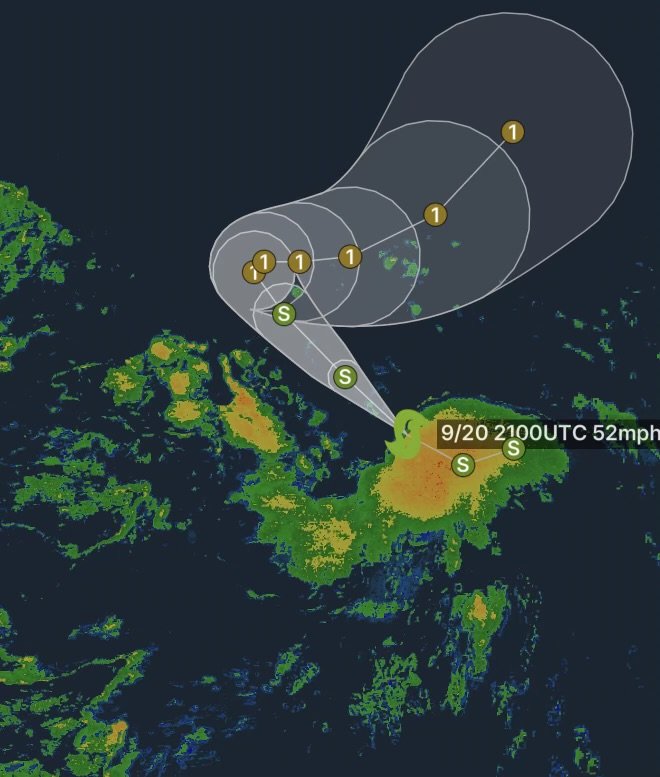
As of Sunday, September 20, Odalys was located approximately 1,345 miles west-southwest of the southern tip of Baja California, according to the latest storm information. The system is moving west-northwest and is expected to turn more toward the northwest before eventually slowing and turning northward. (National Hurricane Center)
The National Hurricane Center indicates that Odalys is gradually strengthening, with environmental conditions favorable for additional intensification. The storm is forecast to become a hurricane by Monday. (National Hurricane Center)
Current Status of Tropical Storm Odalys
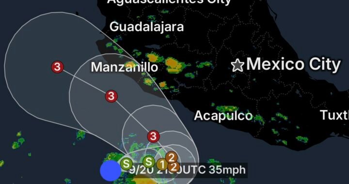
Odalys is positioned well over open Pacific waters, keeping the immediate impacts away from the Mexican coastline.
The latest National Hurricane Center advisory places the storm near 11.1°N, 125.5°W, with maximum sustained winds around 45 mph and a minimum central pressure near 1003 mb. Tropical-storm-force winds extend outward up to approximately 70 miles from the center. (National Hurricane Center)
The storm’s large distance from Baja California means there are currently no coastal watches or warnings in effect. (National Hurricane Center)
Forecast Track
Odalys is expected to continue generally west-northwest before turning northwest. Forecast guidance then calls for the system to slow and eventually turn toward the north and northeast.
The National Hurricane Center’s forecast has Odalys remaining over the open Pacific during the next several days. The latest forecast discussion calls for the storm to reach hurricane strength Monday evening, followed by little change in intensity later in the week. (National Hurricane Center)
Because tropical cyclone forecasts can change as new observations and model guidance become available, residents and mariners should continue monitoring official updates if Odalys’ projected track changes.
Why Odalys Is Strengthening
Odalys is moving through an environment that is currently supportive of tropical cyclone intensification. Satellite imagery and National Hurricane Center analysis show organized thunderstorms surrounding the circulation.
Ocean conditions and the broader atmospheric environment are expected to allow the storm to continue strengthening over the next couple of days. (National Hurricane Center)
The National Hurricane Center is forecasting Odalys to reach hurricane strength while it remains well away from the Mexican coast.
Impacts Right Now
For communities along the Baja California peninsula and southwestern Mexico, there are currently no direct land impacts associated with Odalys.
The storm is far enough offshore that its strongest winds and thunderstorms remain over the open Pacific. However, conditions at sea near the circulation are becoming increasingly hazardous, with seas already reaching around 12 feet according to the National Hurricane Center’s tropical weather discussion. (National Hurricane Center)
Mariners operating anywhere near the storm’s forecast path should closely monitor official marine forecasts and avoid the strongest portions of the circulation.
What to Watch Next
The most important developments over the next 24 to 48 hours will be:
- Further strengthening of Odalys
- The potential transition to hurricane strength
- Changes in the storm’s forward speed
- The expected turn toward the northwest
- Longer-range changes to the forecast track
- Any future effects on offshore waters
At this time, Odalys remains a far-off Pacific storm with no coastal watches or warnings in effect. (National Hurricane Center)
Radar Watch HQ Final Thoughts
Tropical Storm Odalys is strengthening over the open eastern Pacific, with forecasters expecting the system to become a hurricane while remaining well southwest of Baja California.
Although there is no immediate threat to land, tropical systems can change in strength and track. Radar Watch HQ will continue following the latest official information as Odalys develops.
For the latest storm information, continue monitoring updates from the National Hurricane Center and local emergency management officials.