


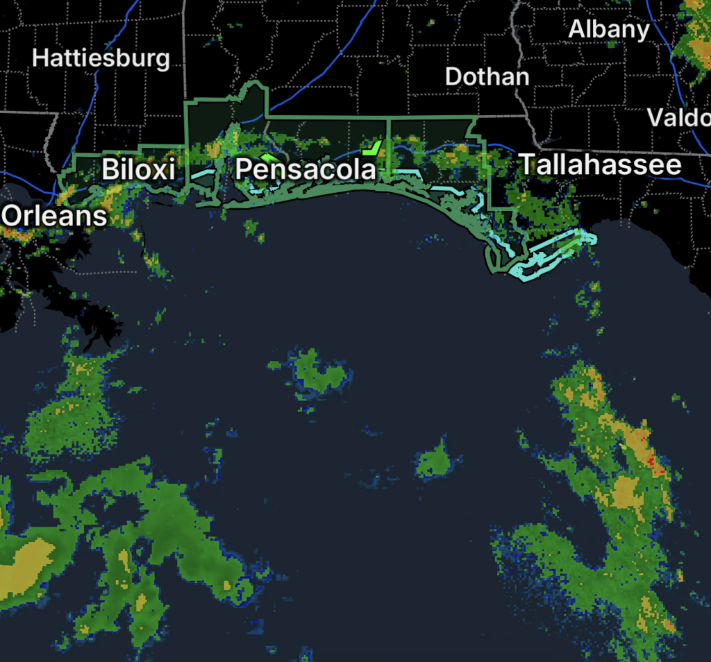
Multiple Weather Hazards Affect the Gulf Coast
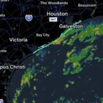
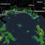
A combination of dangerous rip currents and a developing heavy-rainfall threat is affecting portions of the Florida Panhandle and Gulf Coast on Saturday, October 3, 2026.
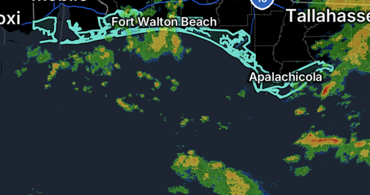
The National Weather Service has issued a High Rip Current Risk for Walton and Bay County beaches, while a Flood Watch is in effect for portions of the Florida Panhandle because of the potential for excessive rainfall. (National Weather Service)
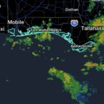
Farther west, a separate High Rip Current Risk covers Mobile and Baldwin Coastal Counties in Alabama, along with Escambia, Santa Rosa and Okaloosa Coastal Counties in Florida. That rip-current threat is expected to continue through Monday evening. (National Weather Service)
🌊 High Rip Current Risk for Walton and Bay County Beaches
The National Weather Service reports that a High Rip Current Risk remains in effect for Walton and Bay County beaches through late Saturday night.
Dangerous rip currents can sweep even strong swimmers away from shore and into deeper water. (National Weather Service)
Beachgoers should:
- 🏖️ Swim near a lifeguard.
- 🚩 Check local beach flags before entering the water.
- 🌊 Avoid swimming when conditions are unsafe.
- 👀 Closely supervise children near the surf.
- 📱 Keep up with local beach safety information.
If Caught in a Rip Current
Do not try to swim directly against the current.
Instead:
- Stay calm.
- Relax and float to conserve energy.
- Swim parallel to the shoreline if you are able.
- Once out of the current, swim toward shore.
- If you cannot escape, face the shore and wave or call for help.
These are the safety actions recommended by the National Weather Service. (National Weather Service)
🌧️ Flood Watch for Portions of the Florida Panhandle
A Flood Watch is in effect beginning Saturday morning and continuing through Monday morning across portions of the Florida Panhandle.
The watch includes portions of:
- Walton County
- Bay County
- Gulf County
- Holmes County
- Washington County
The National Weather Service says flooding caused by excessive rainfall is possible, including flooding of rivers, creeks, streams and other low-lying or flood-prone areas. Poor-drainage and urban areas may also experience flooding. (National Weather Service)
Heavy Rain Could Produce Significant Flooding
Multiple rounds of heavy rainfall are expected from Saturday afternoon through at least early Monday morning.
The current forecast calls for approximately 3 to 6 inches of additional rainfall, with locally higher amounts of up to 10 inches possible in some locations. Repeated thunderstorms over the same areas could increase the potential for flash flooding. (National Weather Service)
Residents in flood-prone areas should prepare before the heaviest rain arrives.
Flood Safety
- 🚗 Never drive through flooded roads.
- 🌊 Turn around when water covers a roadway.
- 🚧 Never move or drive around barricades.
- 🏠 Move important belongings to higher areas if flooding is possible.
- 📱 Monitor Flood Watches and Flash Flood Warnings.
- ⚠️ Be especially careful in poor-drainage and low-lying areas.
Turn around, don’t drown.
🌊 Rip Current Risk Extends Into Coastal Alabama and Northwest Florida
The High Rip Current Risk farther west includes:
Alabama
- Mobile Coastal County
- Baldwin Coastal County
Florida
- Escambia Coastal County
- Santa Rosa Coastal County
- Okaloosa Coastal County
The National Weather Service says the High Rip Current Risk remains in effect through Monday evening. (National Weather Service)
Rip currents can quickly pull swimmers away from shore, even when surf conditions do not appear especially dangerous.
Coastal Flooding and Beach Impacts
Along the western Gulf Coast, additional coastal impacts are also possible.
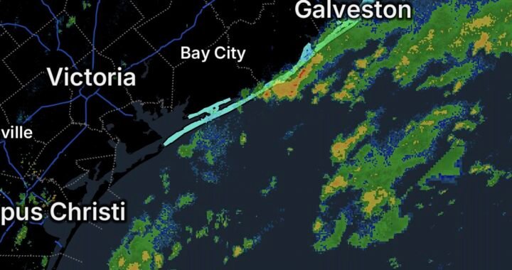
The National Weather Service has reported minor coastal flooding, with wave runup and overwash possible along Gulf-facing beaches. Some locations may experience impacts to roads and low-lying coastal areas. (National Weather Service)
This means residents and visitors may need to contend with both water coming from the Gulf and heavy rainfall coming from above.
What Residents and Visitors Should Know
Saturday through Monday could bring changing conditions across the Gulf Coast.
Beach visitors should check rip-current conditions before entering the water, while inland and coastal residents should monitor the Flood Watch and be prepared for rapidly changing conditions during heavy rainfall.
If thunderstorms repeatedly move over the same location, localized flooding could develop quickly.
Essentials
📅 Date: October 3, 2026
🌊 Beach Hazard: High Rip Current Risk
🌧️ Inland Hazard: Flood Watch
📍 Florida Panhandle Flood Watch: Portions of Walton, Bay, Gulf, Holmes and Washington counties
📍 Florida Beaches: Walton and Bay County beaches
📍 Alabama: Mobile Coastal and Baldwin Coastal Counties
📍 Florida: Escambia Coastal, Santa Rosa Coastal and Okaloosa Coastal Counties
🌧️ Additional Rain: 3–6 inches, with locally higher amounts up to 10 inches possible in the Flood Watch area
⏰ Flood Watch: Saturday morning through Monday morning
⏰ Walton/Bay Rip Current Risk: Through late Saturday night
⏰ Western Gulf Coast Rip Current Risk: Through Monday evening
Bottom Line
The Florida Panhandle and northern Gulf Coast face two significant water-related hazards on October 3, 2026: dangerous rip currents and the potential for heavy-rainfall flooding.
Beachgoers should follow lifeguard and beach-flag instructions and avoid dangerous surf. Residents in the Flood Watch area should monitor forecasts and be prepared for flooding, especially in low-lying, poor-drainage and urban locations. (National Weather Service)
Never drive through floodwater, and never underestimate a rip current.