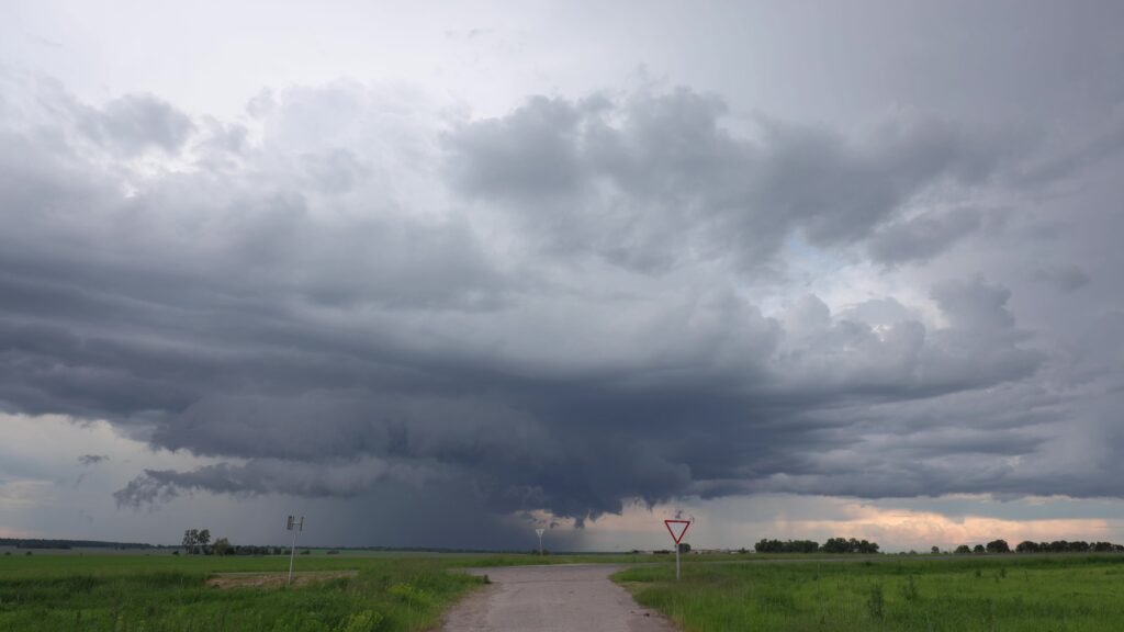
The Upper Midwest is facing a significant severe weather threat as powerful thunderstorms develop across parts of the region. Meteorologists are monitoring conditions that could support damaging winds, large hail, torrential rainfall, and isolated tornadoes.
Warm, humid air flowing northward is colliding with a stronger, cooler air mass, creating an unstable atmosphere capable of producing intense thunderstorms. Some storms may rapidly organize into clusters or rotating supercells capable of producing severe weather.
Main Threats
🌩️ Damaging Wind Gusts
Strong thunderstorm winds can exceed 60-80 mph, bringing down trees, power lines, and causing scattered power outages.
🧊 Large Hail
Some storms may produce hail larger than golf balls. Large hail can damage vehicles, roofs, crops, and outdoor property.
🌪️ Isolated Tornadoes
While not every storm will produce a tornado, atmospheric conditions may support a few rotating thunderstorms capable of spawning tornadoes.
🌧️ Flash Flooding
Heavy rainfall rates could overwhelm drainage systems and cause flash flooding, especially in urban areas and locations that receive repeated rounds of storms.
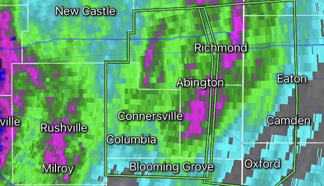
What Are Training Thunderstorms?
A major concern with this weather setup is the potential for training thunderstorms.
Training thunderstorms occur when multiple storms move over the same area repeatedly, much like train cars moving along the same track. When this happens, rainfall accumulates quickly and can lead to dangerous flash flooding.
Even areas that have not experienced recent flooding can become vulnerable if storms repeatedly pass over the same location for several hours.
Areas Most at Risk
The highest risk currently stretches across portions of the Upper Midwest, including parts of:
- Minnesota
- Wisconsin
- Iowa
- South Dakota
- North Dakota
The exact corridor of greatest impact may shift as storms develop and evolve throughout the day.
Safety Tips
- Monitor weather alerts and warnings closely.
- Have multiple ways to receive emergency notifications.
- Move vehicles indoors if hail is expected.
- Secure loose outdoor objects before storms arrive.
- Never drive through flooded roadways.
- Seek sturdy shelter immediately if a tornado warning is issued.
Looking Ahead
The severe weather threat may continue into the overnight hours as storm complexes track eastward. Residents across the Upper Midwest should remain weather-aware and be prepared for rapidly changing conditions.
Bottom Line: Powerful thunderstorms capable of producing damaging winds, large hail, flash flooding, and isolated tornadoes are expected across portions of the Upper Midwest. Stay informed and be ready to take action if warnings are issued for your area.