Flash Flood Warning Issued for Central Buchanan County, Virginia: Heavy Rain Sparks Dangerous Flooding Threat
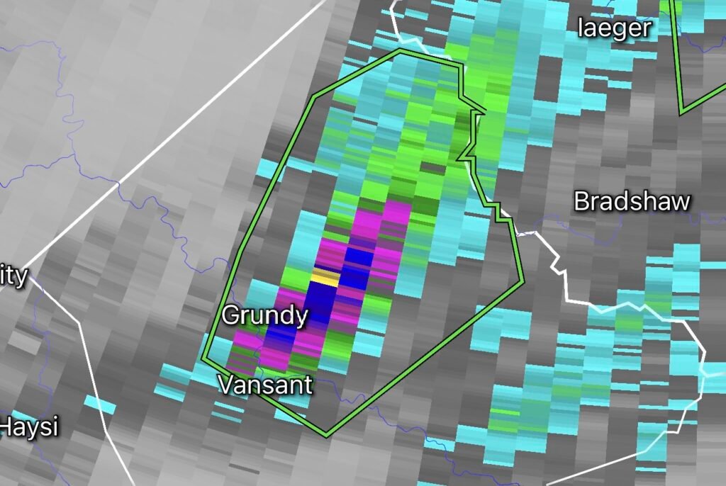
The National Weather Service (NWS) has issued a Flash Flood Warning for Central Buchanan County in southwestern Virginia as heavy thunderstorms continue to move across the region. Radar and rain gauge estimates indicate that between 1.5 and 2 inches of rain have already fallen, with additional downpours expected to develop over the warned area. The warning highlights the potential for rapid flooding of roads, creeks, streams, and low-lying locations. (Facebook)
Why Flooding Is Developing
The current weather pattern features slow-moving thunderstorms capable of producing intense rainfall over the same locations for an extended period. When storms repeatedly move across the same area—a process known as “training”—rainfall quickly overwhelms creeks, drainage systems, and small streams.
Southwest Virginia’s rugged terrain also contributes to flash flooding. Water runs rapidly downhill through narrow valleys and hollows, causing streams to rise within minutes during periods of heavy rain.
Recent Weather Pattern Across the Region
Over the past several weeks, portions of the central and eastern United States have experienced an active summertime weather pattern with abundant Gulf moisture, frequent afternoon thunderstorms, and repeated rounds of heavy rainfall. Similar conditions have produced numerous flash flood warnings from the Appalachian region into the Mid-Atlantic, increasing the risk for flooding wherever storms repeatedly develop. (ABC News)
Buchanan County is especially vulnerable due to its mountainous landscape and history of significant flooding events. The county has experienced several major floods in recent years, prompting investments in improved flood monitoring and warning systems to better protect residents. (Cardinal News)
Areas Most at Risk
Residents should remain alert if they live near:
- Small creeks and streams
- Low-water crossings
- Flood-prone roads
- Valleys and hollows
- Poor drainage areas
- Campgrounds or locations near waterways
Flash flooding can develop rapidly, often with little warning, especially after sunset when rising water is difficult to see.
National Weather Service Safety Recommendations
The National Weather Service urges residents to:
- Never drive across flooded roadways.
- Turn Around, Don’t Drown®—most flood fatalities occur in vehicles.
- Move immediately to higher ground if floodwaters begin rising.
- Stay informed by monitoring NOAA Weather Radio, trusted local media, and official weather alerts.
- Delay unnecessary travel until the warning has expired. (National Weather Service)
Looking Ahead
Additional thunderstorms remain possible while this unsettled weather pattern persists. Even if rainfall decreases temporarily, saturated ground and elevated stream levels mean new storms could quickly trigger additional flash flooding.
Residents throughout Central Buchanan County should continue monitoring updated forecasts and warnings from the National Weather Service until conditions improve.
Final Thoughts
Flash flooding remains one of the deadliest weather hazards because of how quickly conditions can change. If you are in Central Buchanan County, Virginia, stay weather-aware, avoid flooded roads, and be prepared to move to higher ground immediately should flooding worsen. Continue following official National Weather Service updates for the latest information as this dangerous weather situation evolves.