Heavy Rain Could Trigger Flash Flooding Across Multiple Regions
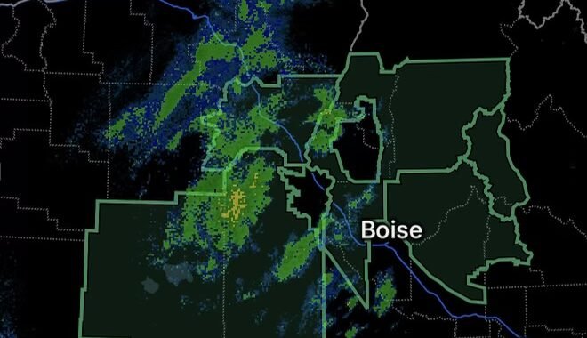
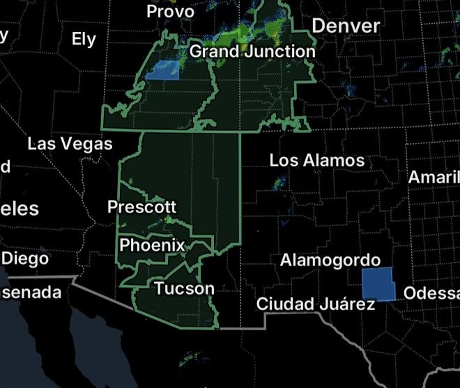
A broad Flood Watch is affecting portions of Colorado, Utah and Arizona, with numerous mountain, canyon, plateau, valley and urban areas included. Periods of heavy rainfall could produce excessive runoff, rapid rises in waterways and localized flash flooding, particularly in areas where terrain channels water quickly.
Colorado Flood Watch Areas
The Flood Watch covers a large portion of western and central Colorado, including:
- Central Colorado River Basin
- Central Gunnison and Uncompahgre River Basin
- Central Yampa River Basin
- Debeque to Silt Corridor
- Flat Tops
- Four Corners/Upper Dolores River
- Gore and Elk Mountains/Central Mountain Valleys
- Grand Valley
- Grand and Battlement Mesas
- Northwest San Juan Mountains
- Paradox Valley/Lower Dolores River
- Roan and Tavaputs Plateaus
- Southwest San Juan Mountains
- Uncompahgre Plateau and Dallas Divide
- Upper Gunnison River Valley
- West Elk and Sawatch Mountains
Why Colorado Is Vulnerable
Colorado’s mountainous terrain can dramatically increase flood risk when heavy rain develops over steep slopes. Water can quickly drain into narrow canyons, creeks and river systems, while burn scars and areas with saturated soils may experience faster runoff.
Additionally, roads crossing low-water areas and mountain drainage channels can become dangerous with little warning.
Utah Flood Watch Covers Mountains, Canyons and Desert Terrain
The Flood Watch also encompasses a large section of Utah, including:
- Arches/Grand Flat
- Canyonlands/Natural Bridges
- La Sal and Abajo Mountains
- Southeast Utah
- Tavaputs Plateau
Another Flood Watch includes:
- Castle Country
- Central Mountains
- Eastern Juab/Millard Counties
- San Rafael Swell
- Sanpete Valley
- Sevier Valley
- Bryce Canyon Country
- Capitol Reef National Park and Vicinity
- Glen Canyon Recreation Area/Lake Powell
- South Central Utah
- Southern Mountains
- Upper Sevier River Valleys
- Western Canyonlands
- Lower Washington County
- Zion National Park
Canyons Can Become Dangerous Quickly
Utah’s canyon and desert environments present a unique flash-flood threat. Rain falling miles away can send a surge of water downstream into a canyon even when skies overhead appear relatively calm.
Visitors hiking or camping near slot canyons, washes, creeks and low-water crossings should remain particularly alert. Never enter a flooded canyon or attempt to cross moving water.
Arizona Flood Watch Includes Three Counties
A separate Flood Watch covers Apache County, Coconino County and Navajo County.
Heavy rainfall across northern Arizona could result in excessive runoff, flooding of normally dry washes and rapid rises along streams and drainage channels. Mountainous terrain and areas affected by previous wildfire activity can further increase runoff potential.
Travelers should avoid driving through flooded roadways, especially where water covers the pavement and the depth cannot be determined.
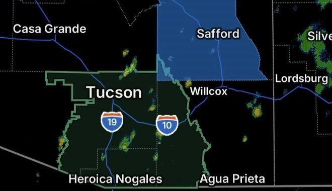
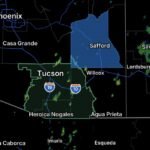
Tucson Metro Area Flood Watch
The Tucson Metro Area is also under a Flood Watch, highlighting the potential for heavy rainfall and localized flooding across southern Arizona.
Urban areas can experience flooding when intense rainfall temporarily overwhelms storm drains, washes and drainage systems. Low-lying roadways, underpasses and intersections can become hazardous rapidly.
Residents should be prepared for changing conditions, especially during periods of intense thunderstorms.
Flash Flood Safety: What You Should Do
If heavy rain develops, take flooding seriously even if your immediate location has not received significant rainfall.
1. Avoid Flooded Roads
Turn around rather than attempting to drive through floodwater. Water can conceal washed-out pavement, debris and damaged roads.
2. Stay Away From Moving Water
Just a small amount of fast-moving water can affect vehicle stability. Keep children and pets away from flooded streams, washes and drainage channels.
3. Watch for Rapidly Rising Water
If water begins entering your home, campground or other location, move to higher ground immediately when it is safe to do so.
4. Know Your Surroundings
In Colorado, Utah and Arizona, floodwater can travel rapidly through mountain valleys, washes and canyon systems. A storm may be nearby or upstream rather than directly overhead.
5. Check Conditions Before Traveling
Weather conditions can change quickly during active monsoon and late-summer storm patterns. Check updated forecasts, road conditions and emergency notifications before heading into mountainous or remote areas.
Radar Watch HQ Weather Update
This widespread Flood Watch is a reminder that heavy rainfall does not have to occur directly over a community to create a dangerous flooding situation. Mountain terrain, narrow canyons, washes and urban drainage systems can all concentrate runoff and turn heavy rain into a significant hazard.
Residents and visitors across Colorado, Utah and Arizona should remain weather-aware and be prepared to change plans if storms intensify.
Radar Watch HQ Final Thoughts
Flood Watches are issued when conditions are favorable for flooding. They do not mean that flooding is occurring everywhere within the watch area, but they are an important signal to prepare before storms arrive.
Keep monitoring updated weather information, especially if you live in or are traveling through mountainous terrain, canyons, washes or flood-prone communities.
When water rises, don’t take chances—move to higher ground and never drive through a flooded roadway.
Stay alert. Stay prepared. Stay weather-aware with Radar Watch HQ.

Affiliate Disclosure: As an Amazon Associate, Radar Watch HQ earns from qualifying purchases.
Radar Watch HQ Top 5 Essential Emergency Preparedness Picks
Whether you’re preparing for severe thunderstorms, flash flooding, hurricanes, wildfires, or extended power outages, these five emergency essentials can help keep your household safer when severe weather strikes.
A portable power station provides reliable backup electricity during outages, allowing you to power phones, medical devices, laptops, lights, small appliances, and communication equipment without fuel.
Best for:
- Extended power outages
- Severe thunderstorms
- Hurricanes
- Winter storms
- Wildfires
2. Flood Protection Barriers & Sandless Flood Bags
Flood barriers help divert or absorb water before it enters garages, doorways, and low-lying areas. They deploy quickly and can help reduce property damage during flash flooding.
Best for:
- Flash Flood Warnings
- Heavy rainfall
- River flooding
- Coastal flooding
3. Rechargeable LED Flashlights
Bright, dependable flashlights are essential when the power goes out. Rechargeable or solar-powered models provide long-lasting illumination for navigating safely indoors and outdoors.
Best for:
- Overnight power outages
- Emergency evacuations
- Storm damage inspections
Keep phones, tablets, weather radios, and USB-powered devices charged when the electrical grid is unavailable. A solar power bank offers an additional charging option during prolonged emergencies.
Best for:
- Communication during outages
- Emergency weather alerts
- Travel and evacuation
A NOAA Weather Radio delivers official weather alerts directly from the National Weather Service, even when cellular networks or internet service are unavailable. It remains one of the most dependable ways to receive life-saving warnings.
Best for:
- Tornado warnings
- Severe thunderstorm warnings
- Flash flood warnings
- Hurricane alerts
- Winter storm emergencies
Why Radar Watch HQ Recommends These Essentials
At Radar Watch HQ, preparedness is just as important as staying informed. These five emergency essentials can help you stay connected, protect your property, and safely navigate severe weather events. Having supplies ready before storms arrive allows you to respond quickly when warnings are issued and conditions begin to deteriorate.