

















Easterly Gusts Could Reach 20–25 Knots Early This Evening
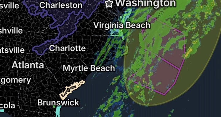
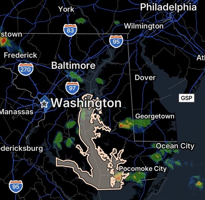
August 31, 2026 — Thunderstorms developing over the Eastern Shore of Maryland could create a period of easterly wind gusts around 20 to 25 knots early this evening, prompting a Marine Weather Statement for area waters.
Although these winds may be brief, sudden gusts associated with thunderstorms can create hazardous conditions for boaters, particularly those operating smaller vessels or those with limited experience navigating changing marine conditions.
Thunderstorms May Produce Sudden Wind Gusts
Thunderstorms can produce rapid changes in wind direction and speed. As storms move across or near the Eastern Shore, gusty outflow could spread across nearby waterways.
The expected winds are primarily from the east, with gusts potentially reaching 20 to 25 knots.
For mariners, the most important concern is not simply the sustained wind but the potential for sudden increases in wind speed as thunderstorms approach.
Why Thunderstorm Gusts Can Be Dangerous
Thunderstorm outflow can arrive ahead of the heaviest rain. That means boaters may experience a noticeable wind shift or sudden gust before the storm itself reaches their location.
Additionally, stronger winds can quickly create choppier water conditions, making navigation more difficult for smaller boats.
Who Should Exercise Extra Caution?
Inexperienced mariners and operators of smaller vessels should use particular caution during the period of thunderstorm activity.
Boaters should consider delaying departure if thunderstorms are approaching or seeking a safe harbor before conditions deteriorate.
If already on the water, monitor changing skies, wind direction, radar information, and marine weather statements.
Marine Safety Tips for This Evening
Before heading onto the water, mariners should:
- Check the latest marine forecast and weather alerts.
- Monitor thunderstorms approaching the area.
- Wear a properly fitted life jacket while underway.
- Secure loose equipment and gear.
- Be prepared for sudden wind shifts and stronger gusts.
- Avoid navigating directly toward thunderstorms.
- Seek safe harbor if conditions become threatening.
- Keep a reliable means of communication available.
Don’t Underestimate a Short-Lived Wind Event
Even if the strongest winds last only a short time, conditions can change quickly around thunderstorms. A relatively calm period can transition into gusty winds and rougher water with little warning.
For smaller vessels, those rapid changes can significantly affect handling and stability.
What Mariners Should Watch For
The combination of thunderstorms and gusty winds means conditions can become locally hazardous even if widespread severe weather does not develop.
Mariners should pay close attention to:
- Easterly wind gusts: Around 20–25 knots are possible.
- Thunderstorm outflow: Sudden wind increases may occur near storms.
- Wind shifts: Direction can change quickly as storms move through.
- Increasing waves: Stronger winds can rapidly make waters choppier.
- Visibility reductions: Heavy rain can temporarily reduce visibility.
Radar Watch HQ Final Thoughts
Thunderstorms over Maryland’s Eastern Shore can produce rapidly changing marine conditions this evening. With easterly wind gusts around 20 to 25 knots possible, inexperienced mariners and operators of smaller vessels should exercise extra caution.
When thunderstorms are nearby, the safest decision may be to remain in port or move to a protected location until conditions improve.
Stay weather-aware, monitor the latest marine information, and put safety first whenever thunderstorms threaten the waters.
This article is for weather awareness and preparedness. Always follow the latest official marine forecasts, warnings, and instructions from the National Weather Service and local authorities.

Affiliate Disclosure: As an Amazon Associate, Radar Watch HQ earns from qualifying purchases.
Radar Watch HQ Top 5 Essential Emergency Preparedness Picks
Whether you’re preparing for severe thunderstorms, flash flooding, hurricanes, wildfires, or extended power outages, these five emergency essentials can help keep your household safer when severe weather strikes.
A portable power station provides reliable backup electricity during outages, allowing you to power phones, medical devices, laptops, lights, small appliances, and communication equipment without fuel.
Best for:
- Extended power outages
- Severe thunderstorms
- Hurricanes
- Winter storms
- Wildfires
2. Flood Protection Barriers & Sandless Flood Bags
Flood barriers help divert or absorb water before it enters garages, doorways, and low-lying areas. They deploy quickly and can help reduce property damage during flash flooding.
Best for:
- Flash Flood Warnings
- Heavy rainfall
- River flooding
- Coastal flooding
3. Rechargeable LED Flashlights
Bright, dependable flashlights are essential when the power goes out. Rechargeable or solar-powered models provide long-lasting illumination for navigating safely indoors and outdoors.
Best for:
- Overnight power outages
- Emergency evacuations
- Storm damage inspections
Keep phones, tablets, weather radios, and USB-powered devices charged when the electrical grid is unavailable. A solar power bank offers an additional charging option during prolonged emergencies.
Best for:
- Communication during outages
- Emergency weather alerts
- Travel and evacuation
A NOAA Weather Radio delivers official weather alerts directly from the National Weather Service, even when cellular networks or internet service are unavailable. It remains one of the most dependable ways to receive life-saving warnings.
Best for:
- Tornado warnings
- Severe thunderstorm warnings
- Flash flood warnings
- Hurricane alerts
- Winter storm emergencies
Why Radar Watch HQ Recommends These Essentials
At Radar Watch HQ, preparedness is just as important as staying informed. These five emergency essentials can help you stay connected, protect your property, and safely navigate severe weather events. Having supplies ready before storms arrive allows you to respond quickly when warnings are issued and conditions begin to deteriorate.