

















Fire Weather Watch Threatens Northern CA & NV
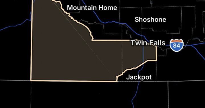
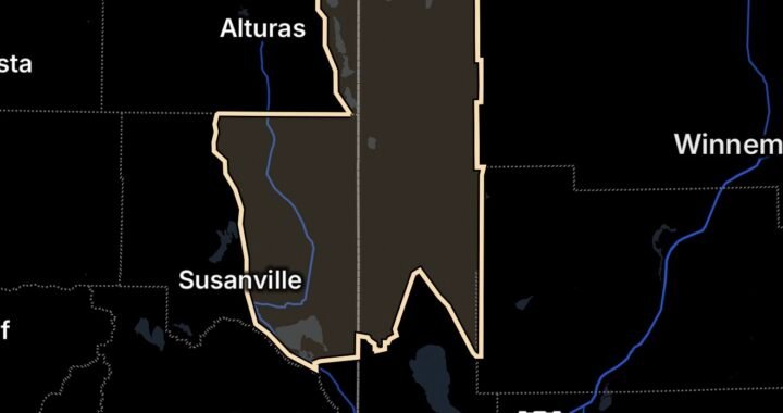
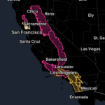
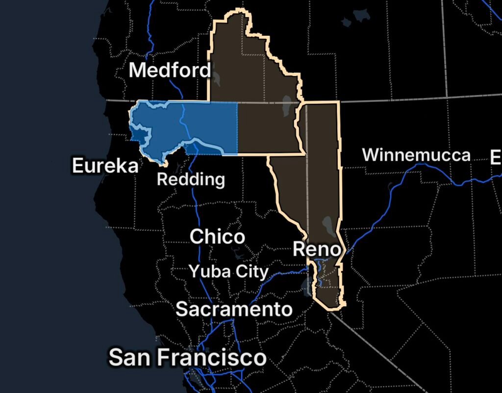
A Fire Weather Watch is in effect for portions of Northern California, Nevada and southern Oregon as a combination of gusty winds and very low relative humidity creates conditions capable of allowing wildfires to spread rapidly. The National Weather Service has also issued a separate Fire Weather Watch for portions of Northeast California, Northwest Nevada and the Western Nevada Sierra Front.
For Radar Watch HQ, the biggest concern is the potential for any new ignition to become difficult to control once winds increase and vegetation dries further.
Fire Weather Watch: What You Need to Know
A Fire Weather Watch means critical fire-weather conditions are possible during the watch period. It does not mean a wildfire is currently burning in every affected area.
However, residents should take the threat seriously because the expected combination of wind and low humidity can cause a new fire to grow quickly. The National Weather Service advises following local fire restrictions and avoiding activities that could create sparks.
Northern California and Southern Oregon Fire Weather Threat
The National Weather Service Medford office says the Fire Weather Watch remains in effect Monday afternoon through Monday evening for portions of California and Oregon.
The affected California areas include:
- Scott Valley in Fire Weather Zone 280
- Fire Weather Zone 281
- Fire Weather Zone 284, except the southeast portion
- Fire Weather Zone 285
In Oregon, the watch covers Fire Weather Zone 624, except for the Highway 97 corridor from Modoc Point to Chemult.
Forecast conditions include:
- Scott Valley: South winds 10–20 mph, gusting to 30 mph
- Shasta Valley: South winds 15–25 mph, gusting to 35 mph
- Elsewhere: Southwest winds 10–20 mph, with gusts around 30 mph
- Minimum relative humidity: approximately 9% to 15%
Those conditions can rapidly dry fine fuels while allowing flames to spread faster across grass, brush and other receptive vegetation.
Northeast California, Northwest Nevada and Western Nevada Sierra Front
A second Fire Weather Watch has been issued by the National Weather Service Reno office for Tuesday morning through Tuesday evening.
The affected area includes portions of:
- Northeast California
- Northwest Nevada
- Western Nevada Sierra Front
Specific fire-weather zones include California Fire Weather Zone 270, Surprise Valley; California Fire Weather Zone 278, Eastern Lassen County; Nevada Fire Weather Zone 420, Northern Sierra Front; and Nevada Fire Weather Zone 458, Northern Washoe County.
Forecast conditions include:
- Southwest winds of 15–25 mph
- Wind gusts of 30–40 mph
- Relative humidity potentially falling to 10–15%
- A period of approximately 3–6 hours of heightened fire-weather conditions
The National Weather Service warns that the combination of strong winds and low humidity can cause fires to rapidly grow in size and intensity before firefighters can contain them.
Why Wind and Low Humidity Matter
Wildfire behavior can change dramatically when dry fuels meet stronger winds.
Low humidity removes moisture from grasses, brush and other fine fuels. Once those fuels become sufficiently dry, they can ignite more easily.
Wind then becomes a major factor.
Strong or gusty winds can:
- Push flames into unburned vegetation.
- Increase the rate of fire spread.
- Carry burning embers ahead of the main fire.
- Make fire behavior more unpredictable.
- Complicate firefighting operations.
That means an ignition from a vehicle, equipment, power-line problem, debris burning or another spark could become a serious wildfire threat in a short period of time.
Siskiyou County Power Outage Concern
Siskiyou County is also facing heightened preparedness concerns as fire weather develops.
California’s Office of Emergency Services maintains a statewide power-outage dataset that is updated from utility outage information, with current outage data available for monitoring.
Residents experiencing a power outage should treat downed or damaged power lines as live and extremely dangerous. Stay well away from fallen lines and report them to the appropriate utility or emergency authorities.
Power outages can also create additional challenges during wildfire conditions, particularly for residents who rely on electrically powered equipment, communications devices or well pumps.
Siskiyou County’s Office of Emergency Services provides emergency information and evacuation resources, including its Emergency Event Viewer and evacuation-zone information.
Fire Restrictions Are Especially Important
Siskiyou County is currently reporting that residential burning is suspended by Cal Fire until further notice. The county also warns against burning during windy conditions.
With humidity expected to fall into the single digits or lower teens in portions of the region, residents should avoid unnecessary ignition sources.
That includes:
- Outdoor burning
- Campfires where prohibited
- Sparks from equipment
- Welding or grinding near vegetation
- Parking vehicles on dry grass
- Activities that can create sparks
- Improper disposal of smoking materials
One spark can become a wildfire when fuels are extremely dry.
Prepare Before Conditions Deteriorate
Fire Weather Watches are issued ahead of potentially dangerous conditions, giving residents time to prepare.
Now is a good time to:
Know Your Evacuation Routes
Identify at least two ways out of your neighborhood if possible. Do not wait until smoke or flames are visible to determine where you would go.
Keep Your Vehicle Ready
Keep your vehicle fueled and parked where you can leave quickly if an evacuation order is issued.
Prepare Important Items
Have medications, important documents, identification, chargers, pets and other essential items ready to go.
Monitor Official Alerts
Weather conditions can change quickly. A Fire Weather Watch can potentially be upgraded to a Red Flag Warning if confidence increases that critical conditions will occur.
Residents should monitor the National Weather Service, local emergency management agencies, fire officials and county alert systems.
Radar Watch HQ Final Thoughts
The upcoming fire-weather setup is a reminder that wildfire danger is not determined by temperature alone. In this case, the combination of very low humidity and gusty winds is the primary concern across multiple areas of Northern California, Nevada and southern Oregon.
The Scott Valley, Shasta Valley, portions of Siskiyou and Modoc counties, the Klamath Basin and portions of the Nevada Sierra Front will need to remain especially alert as the strongest conditions develop.
If you live or travel in an affected area, avoid anything that could create a spark, follow local fire restrictions and have an evacuation plan ready before conditions become critical.
Stay weather aware. Stay prepared. Stay safe.

Affiliate Disclosure: As an Amazon Associate, Radar Watch HQ earns from qualifying purchases.
Radar Watch HQ Top 5 Essentials – Wildfire Preparedness
Helps reduce exposure to wildfire smoke, ash, and fine particles.
Provides alerts during power outages or when cell service is unavailable.
Go Bag / Emergency Preparedness Kit
Includes important documents, medications, water, food, flashlights, and basic supplies for quick evacuation.
Fire-Resistant Outdoor Supplies
Items such as fire-resistant gloves, protective clothing, and tools for creating defensible space around property.
Portable Power Bank & Backup Charging Supplies
Keeps phones and emergency devices powered during wildfire emergencies.