Flood Watch Covers Multiple Areas Across the Midwest
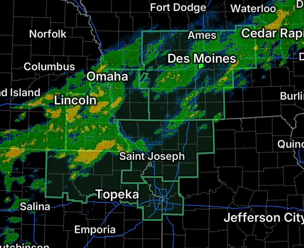
A broad flooding concern is developing across portions of the Midwest and Central Plains, with Flood Watches in effect for parts of central and southern Iowa, Kansas, west central Missouri, southwest Iowa and eastern Nebraska.
The National Weather Service says Flood Watches are issued when conditions are favorable for flooding, including flooding caused by excessive rainfall. Current National Weather Service information highlights the potential for heavy to excessive rainfall across parts of the Central Plains and Upper Midwest.
A Flood Watch does not mean flooding is occurring everywhere within the watch area. Instead, it means residents should be prepared for flooding to develop if rainfall becomes sufficiently heavy.
Central and Southern Iowa
Portions of central and southern Iowa are under a Flood Watch as periods of heavy rainfall could create rapid rises in water levels, ponding of water and flooding of low-lying areas.
Repeated thunderstorms over the same locations can be especially problematic because rainfall can accumulate faster than the ground, drainage systems and smaller waterways can handle.
Residents should monitor changing conditions, particularly overnight and during periods of heavier rain when visibility and travel conditions can deteriorate quickly.
Kansas and West Central Missouri
The Flood Watch also covers portions of Kansas and west central Missouri.
Heavy rainfall across this region could result in flooding of creeks, streams, drainage areas and roadways. Areas that receive multiple rounds of rainfall may become increasingly vulnerable as water accumulates.
Drivers should never attempt to cross a flooded roadway. Even shallow-looking water can hide washed-out pavement, debris or dangerous currents.
Southwest Iowa and Nebraska
Another area of concern stretches across southwest Iowa and parts of Nebraska, including:
- Cass County
- Douglas County
- Gage County
- Johnson County
- Lancaster County
- Nemaha County
- Otoe County
- Pawnee County
- Richardson County
- Sarpy County
The watch includes communities across and around the Omaha and Lincoln areas, as well as portions of southeastern Nebraska and southwest Iowa.
The combination of heavy rainfall and already-wet locations can increase the potential for water to collect quickly in urban areas, rural drainage systems and low-lying roadways.
Why a Flood Watch Matters
A Flood Watch provides time to prepare before flooding becomes an immediate emergency.
People within the watch area should:
- Monitor updated forecasts and National Weather Service alerts.
- Avoid driving through flooded roads.
- Move vehicles away from locations that commonly flood.
- Clear leaves and debris from nearby storm drains when it is safe to do so.
- Be prepared for rapidly changing road conditions.
- Have multiple ways to receive weather warnings, especially overnight.
- Be ready to move to higher ground if flooding develops.
If a Flash Flood Warning or Flood Warning is issued for your location, take the warning seriously and follow instructions from local officials.
Flooding Can Develop Quickly
The biggest concern during periods of heavy rainfall is that conditions can change faster than expected. Water may rise rapidly in creeks, drainage channels and low-lying areas, while roads can become hazardous with little notice.
The National Weather Service emphasizes that flooding threats can vary significantly by location depending on rainfall intensity, terrain, drainage and existing water levels.
For residents across Iowa, Kansas, Missouri and Nebraska, staying ahead of the weather is the best defense. A Flood Watch is the time to prepare, not wait until water is already rising.
Radar Watch HQ will continue tracking the latest weather alerts and developing flood threats across the region. Stay weather-aware, monitor official updates, and never drive through flooded roadways.