Flood Watch Expands Across All Main Hawaiian Islands
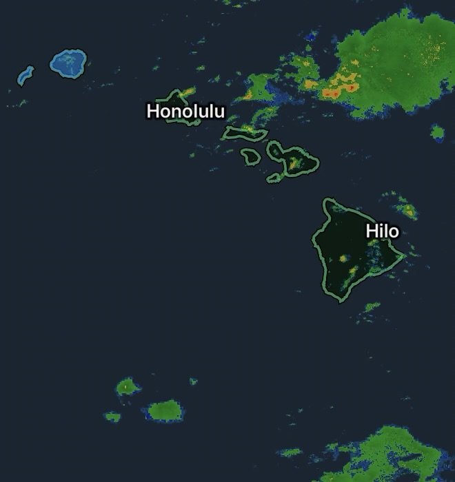
A Flood Watch remains in effect across all of the main Hawaiian Islands as moisture associated with the remnants of former Tropical Storm Norbert moves across the state. The National Weather Service in Honolulu says periods of moderate to heavy showers are expected, particularly across windward areas, with the threat continuing through tonight.
The watch includes Kauai, Niihau, Oahu, Molokai, Lanai, Kahoolawe, Maui and Hawaii Island. The current NWS watch extends into Friday morning, with localized heavy rainfall capable of producing flooding in vulnerable areas.
Why Flooding Is a Concern
Tropical moisture can produce bursts of intense rainfall in a short period of time. On Hawaii’s steep terrain, heavy rain can quickly overwhelm drainage systems and send water into streams, low-lying areas and roadways.
Residents should be especially cautious near:
- Streams and drainage channels
- Low-lying roads
- Areas with poor drainage
- Steep slopes and mountainous terrain
- Locations that have recently experienced heavy rain or storm damage
Even when rainfall is intermittent, additional water can create dangerous conditions in areas where the ground and infrastructure are already vulnerable.
Kauai County Power Outages Add to the Concerns
Kauai County is continuing recovery efforts following Hurricane Lowell, with crews working to restore electricity and other essential services. Local reporting on Thursday indicated that some communities, particularly along the North Shore, were still dealing with recovery impacts while crews prepared for additional rainfall.
Power outages can become more challenging when heavy rain returns. Downed trees, damaged utility infrastructure and saturated ground can complicate restoration work and create additional hazards.
Residents without power should keep emergency supplies available, including flashlights, backup batteries, drinking water and essential medications. Never approach a downed power line, even if it appears to be inactive.
Flood Safety Across Hawaii
During periods of heavy rain, avoid driving through flooded roads. Water can be deeper and faster-moving than it appears, and road conditions can deteriorate rapidly.
If a roadway is covered by moving water, turn around and find another route.
People living near streams, drainage areas or steep terrain should monitor changing conditions and be prepared to move to a safer location if flooding develops.
Those experiencing a power outage should also use extra caution around intersections and roads where traffic signals may not be operating.
What to Watch Tonight
The greatest concern is localized heavy rainfall capable of causing rapid rises in water levels, roadway flooding and difficult travel conditions. Windward and mountainous areas may experience the heaviest showers.
The Flood Watch is an indication that conditions are favorable for flooding; it is not the same as a Flood Warning. If a warning is issued for your specific area, take immediate action based on instructions from local officials and the National Weather Service.
For Kauai County, the combination of ongoing recovery, remaining power outages and additional rainfall makes continued caution particularly important.
Radar Watch HQ will continue monitoring the latest weather alerts and conditions across Hawaii. Stay aware, avoid flooded roadways, and keep emergency supplies ready while the Flood Watch remains in effect.