















Tropical Depression Fifteen-E Strengthening South of Hawaii
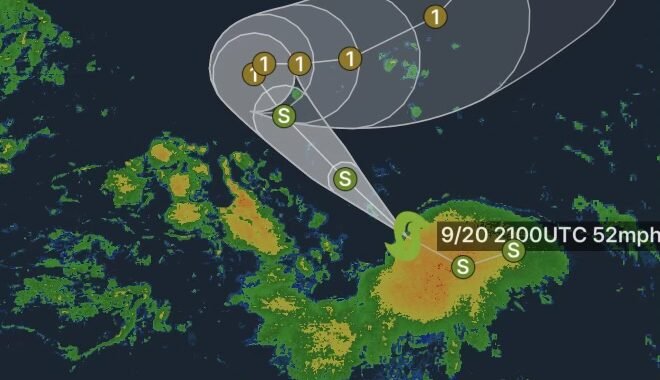
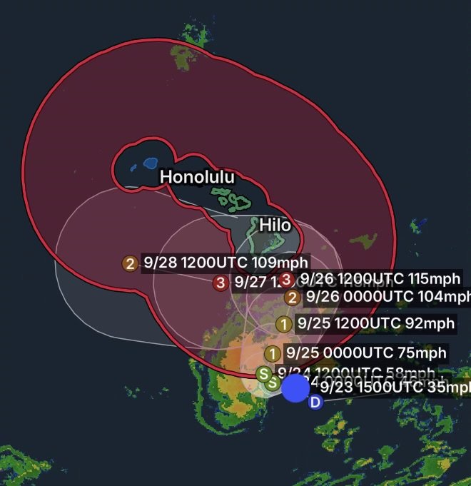
Tropical Depression Fifteen-E is becoming better organized over the central Pacific as it moves toward the Hawaiian Islands. As of the 5 a.m. HST September 23 advisory, the system was located about 320 miles south-southeast of South Point, Hawaii, and approximately 525 miles south-southeast of Honolulu.
The depression was moving west-northwest near 6 mph, with maximum sustained winds of 35 mph and higher gusts. The National Weather Service expects the system to strengthen into a tropical storm later Wednesday, with hurricane strength possible Thursday and potentially major-hurricane strength by the weekend.
The forecast remains highly dependent on the storm’s eventual track and how quickly it strengthens.
Hurricane Warning for Hawaiian Offshore Waters
A Hurricane Warning is in effect for the Hawaiian Offshore Waters, where conditions are expected to deteriorate as Fifteen-E strengthens.
The offshore forecast covers waters generally beyond 40 nautical miles from the Hawaiian Islands. Forecasters expect tropical-storm conditions south of 17°N east of 160°W Thursday, with hurricane conditions expected in that area Thursday and Thursday night. Hurricane conditions may remain possible across portions of the offshore waters from Friday through Sunday.
Winds and seas will become increasingly hazardous for mariners, with thunderstorms adding another threat to already dangerous conditions.
Big Island and Maui Face Increasing Rainfall Threat
The greatest rainfall concerns are currently focused on the Big Island and Maui.
According to the National Hurricane Center, the Big Island could receive 15 to 20 inches of rainfall, with maximum amounts around 35 inches. Such rainfall could produce catastrophic, life-threatening flooding and mudslides, particularly across steep terrain.
Maui could receive 5 to 10 inches, with locally higher amounts up to 20 inches. The remainder of the Hawaiian Islands could see generally lower totals, although isolated flooding remains possible.
Because tropical rainfall can become concentrated over mountainous terrain, rainfall totals and flooding impacts may vary considerably over short distances.
Dangerous Surf and Rip Currents
The storm will also affect Hawaii’s coastal waters.
Swells generated by Fifteen-E are expected to reach the east- and south-facing shores of the Big Island Friday, spreading westward and building through the weekend. These swells could create life-threatening surf and rip-current conditions.
Beachgoers should closely monitor local National Weather Service products and avoid entering the ocean when dangerous surf or rip-current conditions are present.
What to Watch Thursday Through the Weekend
The forecast calls for a significant increase in hazards as Fifteen-E strengthens and approaches the islands.
Wednesday:
The depression is expected to strengthen into a tropical storm. Conditions begin deteriorating over the southern offshore waters.
Thursday:
Hurricane-strength conditions are expected across portions of the offshore waters. The system is forecast to turn northward, with heavy rainfall becoming an increasing concern.
Friday:
The storm is expected to approach the Big Island, with hurricane conditions possible in portions of the surrounding waters. Heavy rain, rising surf and dangerous marine conditions could expand.
Saturday and Sunday:
The exact track remains uncertain, but significant wind, rainfall, flooding, surf and marine impacts remain possible across Hawaii.
Why the Forecast Track Matters
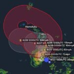
Tropical Depression Fifteen-E is moving through an environment that could support substantial strengthening. The National Hurricane Center is forecasting a turn toward the north and north-northeast before the system approaches the Big Island later in the week.
Small changes in the storm’s track or intensity could significantly change which communities experience the strongest winds and heaviest rainfall.
For that reason, residents and visitors should not wait for the final track to become clear before reviewing preparedness plans.
Hawaii Residents Should Prepare Now
Anyone across Hawaii, particularly on the Big Island and Maui, should monitor official forecasts closely and be prepared for rapidly changing conditions.
Important preparations include:
- Secure outdoor furniture, equipment and loose objects before winds increase.
- Keep phones and emergency communication devices charged.
- Have several days of essential supplies available.
- Review evacuation routes and emergency shelter information.
- Avoid driving through flooded roads.
- Stay away from streams, drainage channels and rapidly rising water.
- Avoid beaches and coastal waters when dangerous surf develops.
- Mariners should remain out of hazardous waters as conditions deteriorate.
- Follow instructions from local emergency management officials.
The National Weather Service is emphasizing that interests across the Hawaiian Islands should closely monitor Fifteen-E as the system evolves.
Radar Watch HQ Final Thoughts
Tropical Depression Fifteen-E is an evolving tropical system with the potential to become a significant threat to Hawaii later this week. The Hurricane Warning for Hawaiian Offshore Waters highlights how quickly marine conditions are expected to deteriorate as the storm strengthens.
The biggest concerns are not limited to wind. Heavy rainfall, catastrophic flooding, mudslides, dangerous surf, rip currents and hazardous marine conditions could all become major issues, especially near the Big Island and Maui.
Forecast details can change quickly with tropical systems. Continue monitoring the latest National Weather Service and Central Pacific Hurricane Center updates as the storm approaches.
Stay informed, prepare early, and take changing conditions seriously.