Tropical Development Becoming More Likely
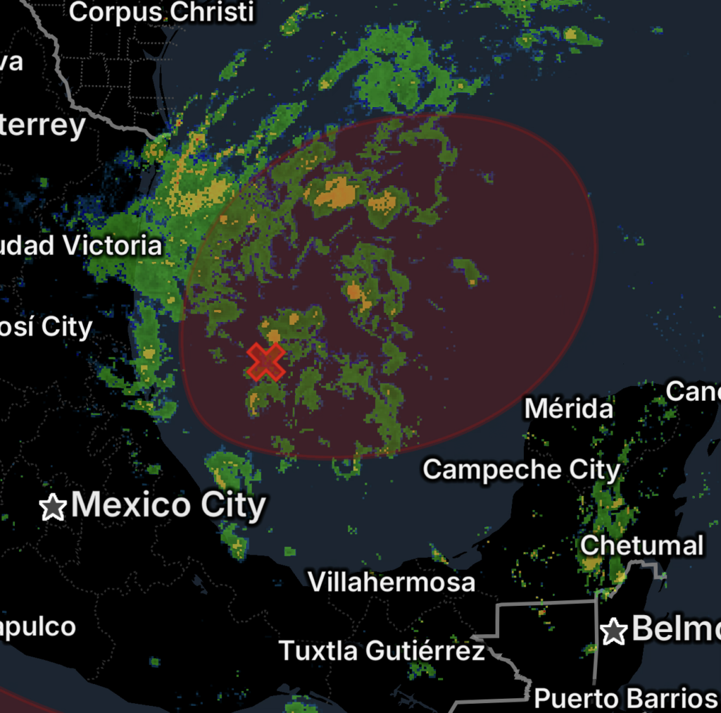
A trough of low pressure over the southwestern Gulf of America is producing disorganized showers and thunderstorms as of Monday, October 5, 2026.
The National Hurricane Center says environmental conditions remain marginally conducive, but gradual development is becoming more likely. A tropical depression is expected to form during the middle portion of this week. (National Hurricane Center)
The disturbance is currently designated AL92 by the National Hurricane Center.
📈 Current Development Chances
As of the latest NHC Tropical Weather Outlook:
- 60% chance of formation within 48 hours
- 80% chance of formation within 7 days
- Tropical depression development is expected during the middle portion of the week. (National Hurricane Center)
These probabilities can change as the system becomes better organized and forecasters receive additional observations.
🌀 Expected Movement
The system is expected to drift eastward over the next couple of days before turning northward.
That projected movement is important because the eventual track will determine which portions of the northern Gulf Coast could experience impacts.
At this time, however, the National Hurricane Center emphasizes that it is too early to determine the specific impacts to the northern Gulf Coast. (National Hurricane Center)
🌧️ Disorganized Showers and Thunderstorms
The disturbance is currently producing disorganized showers and thunderstorms across the southwestern Gulf.
As organization increases, thunderstorms could become more concentrated around the developing circulation. Heavy rainfall, gusty winds, rough seas and locally higher waves could eventually become concerns depending on how the system evolves.
Residents should not focus solely on whether the system receives a tropical designation. Rain and thunderstorms can create hazards before a system becomes a tropical depression or storm.
🌊 Northern Gulf Coast Interests Should Monitor the System
People along the northern Gulf Coast should closely monitor forecast updates during the next several days.
However, it is too early to determine:
- Where the system will ultimately move ashore
- Whether it will strengthen beyond tropical-depression status
- Exact rainfall amounts
- Potential wind speeds
- Storm surge impacts
- Which communities could experience the greatest effects
Forecast confidence should improve as the system develops and its circulation becomes better defined.
🗺️ What Could Happen Next?
The general forecast scenario calls for the disturbance to:
1. 🌧️ Remain over the southwestern Gulf
Showers and thunderstorms continue while the system gradually organizes.
2. ➡️ Drift eastward
The system is expected to move eastward over the next couple of days.
3. 🌀 Turn northward
A northward turn is anticipated after the initial eastward movement.
4. 🌴 Potentially affect the northern Gulf Coast
Specific impacts remain uncertain and will depend heavily on the eventual track and intensity.
⚠️ Essentials: What Gulf Coast Residents Should Do Now
📱 Monitor forecasts: Keep checking updates from the National Hurricane Center and local National Weather Service offices.
🌀 Don’t focus only on the storm category: Heavy rain and thunderstorms can cause dangerous conditions even before a tropical system forms.
🏠 Review your hurricane plan: Make sure you know where you would go if evacuation orders become necessary.
🔋 Check emergency supplies: Have flashlights, batteries, chargers, medications and basic supplies ready.
🚗 Avoid waiting until the last minute: If the forecast becomes more threatening, preparation is easier before conditions deteriorate.
🌊 Boaters should monitor marine forecasts: Developing tropical systems can rapidly worsen conditions over the Gulf.
🚨 Bottom Line
🌊 The southwestern Gulf of America is becoming increasingly active, with a trough of low pressure producing disorganized showers and thunderstorms.
The latest NHC outlook gives the system, AL92, a 60% chance of tropical formation within 48 hours and an 80% chance within seven days. A tropical depression is expected to form during the middle portion of the week. (National Hurricane Center)
The system is forecast to move eastward before turning northward, but it is still too early to determine specific impacts along the northern Gulf Coast.
Gulf Coast residents should closely monitor this system throughout the week as the forecast becomes clearer.