Funnel Clouds Possible Across Parts of Illinois This Afternoon
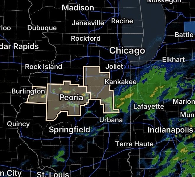
Residents across portions of northern and central Illinois should remain weather-aware this afternoon as funnel clouds are possible, according to Special Weather Statements covering several areas.
The potential extends across a broad region, including communities from the Illinois River Valley and western Illinois into parts of north-central Illinois. While a funnel cloud does not automatically mean a tornado is occurring, it can indicate strong, rotating air beneath a developing thunderstorm and deserves attention.
Weather conditions can change quickly during the afternoon, making it important for residents to monitor updated weather information and be prepared to seek shelter if a tornado warning is issued.
Areas Where Funnel Clouds Are Possible
One Special Weather Statement covers La Salle, Grundy, Livingston, and Ford Counties, including:
- Ottawa
- Streator
- La Salle
- Mendota
- Marseilles
- Morris
- Coal City
- Minooka
- Pontiac
- Dwight
- Fairbury
- Paxton
- Gibson City
Another statement includes Knox, Stark, Peoria, Marshall, Woodford, Fulton, and Tazewell Counties, including:
- Galesburg
- Toulon
- Peoria
- Lacon
- Eureka
- Canton
- Pekin
A third Special Weather Statement covers Henderson and Warren Counties, including:
- Oquawka
- Monmouth
Why Funnel Clouds Can Form
Funnel clouds develop when rotating air beneath a thunderstorm becomes concentrated enough for condensation to make the circulation visible.
They can appear as narrow, cone-shaped or elongated clouds extending downward from the storm base. Some funnels remain aloft, while others can strengthen and reach the ground as tornadoes.
Because conditions can evolve quickly, residents should not assume that a funnel cloud will remain harmless.
What Residents Should Watch For
Keep an eye on the sky and continue monitoring reliable weather information throughout the afternoon. Watch for:
- A rotating or lowering cloud base
- A visible funnel extending from a thunderstorm
- Rapidly changing wind conditions
- Large hail
- Frequent lightning
- Heavy rainfall
- A tornado warning issued for your location
If a tornado warning is issued, move immediately to a sturdy shelter.
The safest location is a basement or a small interior room on the lowest floor, away from windows. Protect your head and neck with your arms, a helmet, or sturdy blankets or cushions if available.
Stay Weather-Aware This Afternoon
The broad geographic coverage of these Special Weather Statements means residents in several communities should remain attentive to changing conditions. A funnel cloud may be brief and localized, but the storm producing it can continue to evolve.
Do not wait for a funnel to appear before taking a warning seriously. If meteorologists issue a tornado warning for your area, seek shelter immediately.
Radar Watch HQ will continue tracking the weather situation. Stay alert, monitor updates, and know where you will go if severe weather develops.