A supercell thunderstorm is a rotating storm with a persistent updraft called a mesocyclone. These storms often produce large hail, damaging winds, and tornadoes.
Sometimes, individual supercells can merge together and evolve into a bowing line of storms, also known as a bow echo on radar.
How the Transition Happens
- Multiple storms develop
- Several supercells form along the same front or instability boundary.
- Storms begin interacting
- Outflow from one storm collides with neighboring storms.
- Cold air spreads outward, creating a stronger gust front.
- Line formation occurs
- Instead of remaining isolated, storms organize into a continuous line.
- The strongest winds become concentrated along the leading edge.
- The line bows outward
- Powerful winds descending from thunderstorms surge ahead.
- On radar, the line develops a curved or “bowed” shape.
Why It Matters
When supercells evolve into a bow echo, the primary threat often shifts from tornadoes to:
- Widespread damaging straight-line winds
- Power outages
- Tree damage
- Structural damage
- Flash flooding if storms repeatedly move over the same area
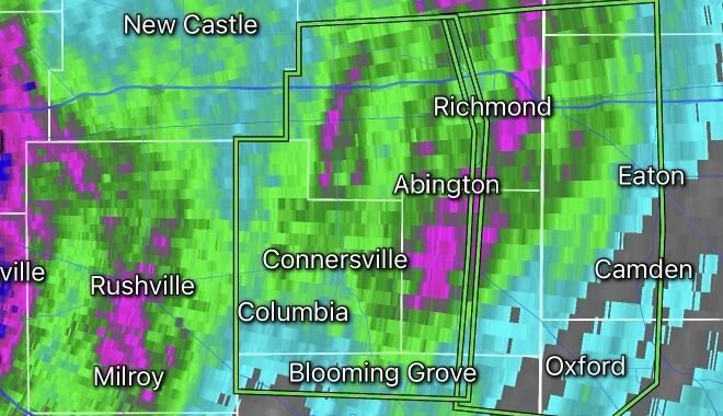
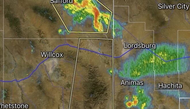
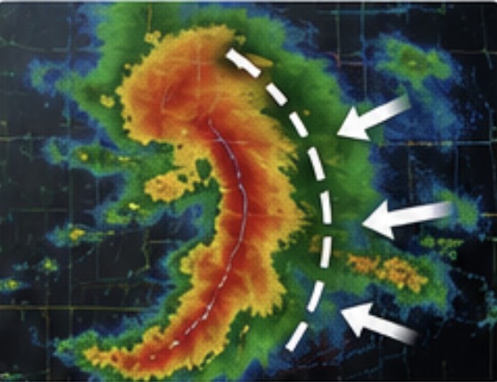
On radar:
- Supercells often show hook echoes and isolated storm structures.
- Bow echoes appear as a curved line pushing outward.
- Small tornado-producing circulations called mesovortices can develop within the bowing segment.
Can Tornadoes Still Occur?
Yes. Even after a supercell becomes part of a bowing line, tornadoes remain possible. Embedded circulations within the line can quickly spin up tornadoes, often with little warning compared to classic supercell tornadoes.
Meteorologists are monitoring supercells that may eventually merge into a bowing line of storms. While the initial threat includes large hail and isolated tornadoes, the greatest concern later may become widespread damaging winds as storms organize into a bow echo. Residents should remain alert for rapidly changing weather conditions and possible severe thunderstorm or tornado warnings.