Severe Thunderstorm Warning for Pierce County, North Dakota
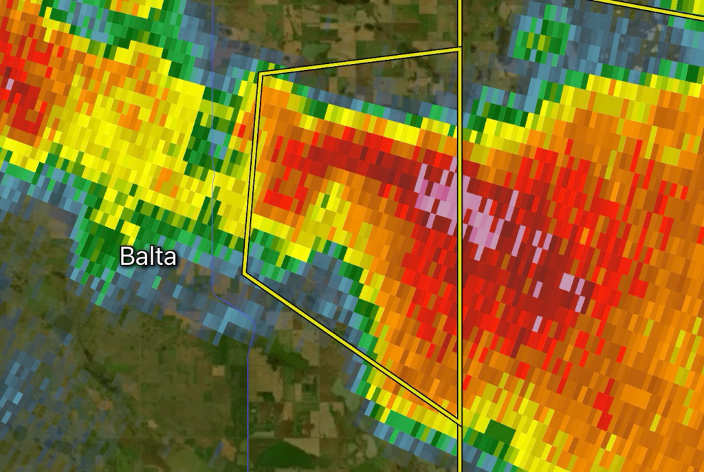
Residents of Pierce County, North Dakota, should take immediate precautions as a Severe Thunderstorm Warning has been issued for the area. Meteorologists are tracking a dangerous thunderstorm capable of producing baseball-sized hail up to 2.50 inches in diameter, damaging wind gusts reaching 60 MPH, and a considerable damage threat.
Storms of this intensity can quickly become life-threatening, producing significant damage to homes, vehicles, crops, and infrastructure within minutes.
Hazard Details
- Location: Pierce County, North Dakota
- Hazard: Severe Thunderstorm Warning
- Maximum Hail Size: 2.50 inches
- Maximum Wind Gusts: 60 MPH
- Damage Threat: Considerable
Large hail of this size can easily shatter windows, destroy siding and roofing materials, dent vehicles beyond repair, and severely damage agricultural fields. Winds approaching 60 MPH are capable of breaking large tree limbs, toppling weakened trees, and causing scattered power outages.
What Does a Considerable Damage Threat Mean?
A Considerable Damage Threat is reserved for particularly dangerous severe thunderstorms capable of producing widespread damage.
Impacts may include:
- Extensive damage to roofs, siding, and windows
- Vehicles sustaining major hail damage
- Fallen trees blocking roads
- Power lines brought down
- Damage to barns, grain bins, and farm equipment
- Hazardous travel conditions during the storm
Even if tornadoes are not expected, storms with this designation should be treated with the same level of urgency.
Stay Safe During the Storm
If you are in Pierce County:
- Move indoors immediately.
- Stay away from windows and glass doors.
- Park vehicles inside a sturdy garage if it is safe to do so.
- Bring pets inside before the storm arrives.
- Secure outdoor furniture, grills, and loose objects.
- Avoid unnecessary travel until the storm has passed.
- Continue monitoring official weather alerts for updates or additional warnings.
If you are driving when the storm arrives, avoid stopping beneath highway overpasses. Instead, seek shelter in a sturdy building whenever possible.
Protect Your Home Before Severe Weather Arrives
Large hail can strike with little warning. Preparing beforehand can significantly reduce property damage.
Consider these steps:
- Close blinds and curtains to reduce flying glass hazards.
- Move outdoor equipment into covered storage.
- Charge mobile devices and backup batteries.
- Keep flashlights readily available.
- Prepare for temporary power outages with emergency supplies.
Agricultural Concerns
Pierce County’s agricultural communities may experience significant impacts from hail this large. Crops can suffer severe losses, while livestock should be moved to shelter whenever possible. Farm equipment left outdoors is also vulnerable to costly damage.
Continue Monitoring Weather Conditions
Severe thunderstorms can strengthen rapidly and produce changing hazards with little notice. Continue monitoring trusted weather sources for updated warnings, additional severe thunderstorm activity, or any tornado warnings that may be issued if storm rotation develops.
Radar Watch HQ will continue providing updates as new information becomes available.

Affiliate Disclosure: As an Amazon Associate, Radar Watch HQ earns from qualifying purchases.
Radar Watch HQ Top 5 Essential Emergency Preparedness Picks
Whether you’re preparing for severe thunderstorms, flash flooding, hurricanes, wildfires, or extended power outages, these five emergency essentials can help keep your household safer when severe weather strikes.
A portable power station provides reliable backup electricity during outages, allowing you to power phones, medical devices, laptops, lights, small appliances, and communication equipment without fuel.
Best for:
- Extended power outages
- Severe thunderstorms
- Hurricanes
- Winter storms
- Wildfires
2. Flood Protection Barriers & Sandless Flood Bags
Flood barriers help divert or absorb water before it enters garages, doorways, and low-lying areas. They deploy quickly and can help reduce property damage during flash flooding.
Best for:
- Flash Flood Warnings
- Heavy rainfall
- River flooding
- Coastal flooding
3. Rechargeable LED Flashlights
Bright, dependable flashlights are essential when the power goes out. Rechargeable or solar-powered models provide long-lasting illumination for navigating safely indoors and outdoors.
Best for:
- Overnight power outages
- Emergency evacuations
- Storm damage inspections
Keep phones, tablets, weather radios, and USB-powered devices charged when the electrical grid is unavailable. A solar power bank offers an additional charging option during prolonged emergencies.
Best for:
- Communication during outages
- Emergency weather alerts
- Travel and evacuation
A NOAA Weather Radio delivers official weather alerts directly from the National Weather Service, even when cellular networks or internet service are unavailable. It remains one of the most dependable ways to receive life-saving warnings.
Best for:
- Tornado warnings
- Severe thunderstorm warnings
- Flash flood warnings
- Hurricane alerts
- Winter storm emergencies
Why Radar Watch HQ Recommends These Essentials
At Radar Watch HQ, preparedness is just as important as staying informed. These five emergency essentials can help you stay connected, protect your property, and safely navigate severe weather events. Having supplies ready before storms arrive allows you to respond quickly when warnings are issued and conditions begin to deteriorate.