Tropical Storm Elida Strengthens Over the Eastern Pacific
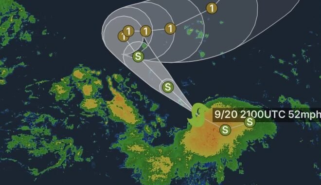
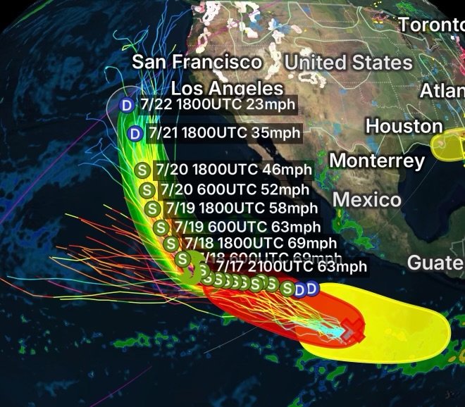
Tropical Storm Elida continues to strengthen over the Eastern Pacific, with maximum sustained winds reaching 63 MPH and wind gusts up to 75 MPH. The storm is currently located approximately 875 miles west-southwest of the southern tip of Baja California as it moves across open waters.
At this time, Tropical Storm Elida remains far offshore, with no direct land impacts expected. However, residents and interests across the Eastern Pacific should continue monitoring updates as tropical activity remains elevated across the basin.
Meteorologists are tracking Elida closely as conditions remain favorable for continued organization and possible changes in intensity.
Eastern Pacific Area of Interest #1: High Chance of Tropical Cyclone Formation
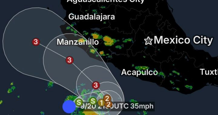
The National Hurricane Center is monitoring a tropical wave located several hundred miles south-southwest of the coast of southwestern Mexico.
This system is currently producing a large area of disorganized showers and thunderstorms, but environmental conditions appear favorable for development.
There is a 90% chance of tropical cyclone formation within the next 7 days.
A tropical depression is expected to form as the system moves:
- West-northwestward to northwestward
- Around 10 to 15 MPH
- Across the central portion of the Eastern Pacific
Additional strengthening will be possible if the system becomes better organized and maintains favorable atmospheric conditions.
Eastern Pacific Area of Interest #2: Low Development Chance
A second area of interest is being monitored well south of Mexico.
A broad area of low pressure is forecast to develop during the middle to latter part of next week. Some gradual development may occur afterward as the system moves:
- Westward to west-northwestward
- Across the Eastern and Central Pacific Ocean
Current outlook:
7-Day Tropical Cyclone Formation Probability: 30%
While development chances remain low, tropical conditions across the basin will continue to be monitored.
Eastern Pacific Area of Interest #3: Additional Disturbance Being Monitored
A third and final area of interest is also being watched by forecasters.
A broad area of low pressure may develop well south of Mexico from the middle to end of next week. Environmental conditions could support some gradual organization as the system moves westward to west-northwestward across the Eastern and Central Pacific.
Current outlook:
7-Day Tropical Cyclone Formation Probability: 20%
At this time, confidence remains low, but continued monitoring will be needed as forecast conditions evolve.
Active Eastern Pacific Tropical Weather Pattern Continues
The Eastern Pacific remains active with Tropical Storm Elida and multiple areas being monitored for potential tropical cyclone development.
While Elida is not currently threatening land areas, tropical systems can change quickly, and conditions across the basin may evolve over the coming days.
Radar Watch HQ will continue monitoring Tropical Storm Elida and all areas of interest for updates, strengthening trends, and any potential impacts.
Stay weather aware and follow Radar Watch HQ for the latest tropical weather alerts, storm tracking updates, and emergency information as conditions develop.