Iselle Strengthens as More Tropical Waves Keep the Pacific Busy
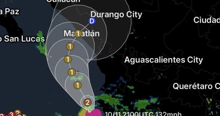
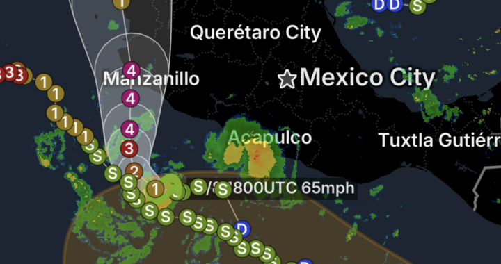
The Eastern Pacific remains highly active, with Tropical Storm Iselle strengthening well offshore of Mexico while several additional areas of low pressure are being monitored across the Pacific. For Hawaii, the activity comes at a particularly difficult time as communities continue recovering from the impacts of Hurricane Lala and Tropical Storm Moke.
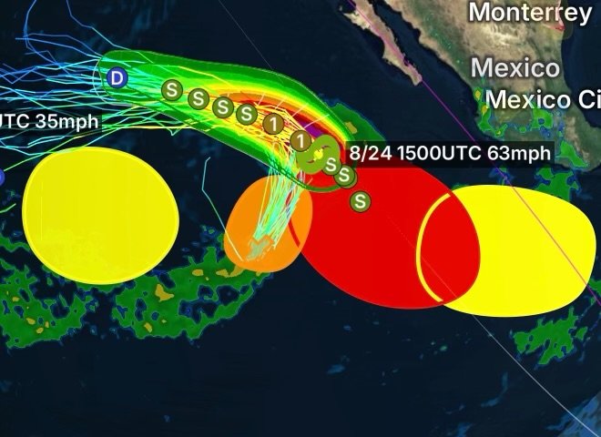
According to the National Hurricane Center, Iselle was located several hundred miles southwest of the southern tip of the Baja California Peninsula and was moving generally northwestward. The latest tropical cyclone information showed Iselle strengthening, with maximum sustained winds near 65 mph. (National Hurricane Center)
Although Iselle is not currently a direct threat to the Hawaiian Islands, its development is part of a much larger pattern of tropical activity across the Eastern and Central Pacific.
Tropical Storm Iselle Continues to Organize
Tropical Storm Iselle has become the primary named system in the eastern Pacific being watched by forecasters.
Satellite imagery and environmental conditions indicate that Iselle has been able to maintain and strengthen its circulation while traveling northwestward over open ocean. The system remains well offshore of Mexico, keeping the greatest immediate impacts away from the mainland coastline.
Iselle’s development also demonstrates why tropical weather patterns can change quickly. Warm ocean water, sufficient atmospheric moisture and favorable upper-level winds can allow a tropical disturbance to organize into a stronger tropical cyclone.
For now, Iselle’s primary hazards are expected to remain over the open Pacific, including strong winds, dangerous seas and large swells. The latest tropical weather discussion indicated seas near Iselle reaching around 20 feet. (NOAA NHC)
Another Disturbance Southwest of Baja
A small area of low pressure well southwest of the southern tip of the Baja California Peninsula has become somewhat better defined, according to satellite wind observations.
However, its shower and thunderstorm activity remains disorganized.
Forecasters indicate that environmental conditions could still allow this disturbance to briefly develop into a tropical depression during the next day or so. The system is expected to move generally northward before potentially becoming absorbed by the circulation or broader weather pattern associated with Tropical Storm Iselle. (NHC)
This is an important reminder that not every disturbance in the tropics becomes a named storm. Tropical systems need persistent thunderstorms near a developing circulation, favorable ocean temperatures and an atmospheric environment that allows the circulation to become better organized.
More Tropical Development Expected Across the Eastern Pacific
The activity does not stop with Iselle.
Another area of low pressure is expected to develop well south of the southern tip of Baja California during the next couple of days. Environmental conditions are forecast to become favorable for additional development, with a tropical depression potentially forming later this week as the disturbance moves generally west-northwestward.
Another possible disturbance could develop well offshore of southern Mexico late this week. Forecasters are watching for gradual development over the weekend as the system moves westward to west-northwestward at roughly 10 to 15 mph.
Meanwhile, farther west, another broad area of low pressure could develop east-southeast of the Hawaiian Islands during the middle portion of the week. Some slow development may occur later as this system moves northward or northeastward across the western East Pacific. (National Weather Service)
Why Hawaii Is Watching the Pacific So Closely
The increased tropical activity is especially significant for Hawaii because the islands have already experienced a remarkable sequence of tropical weather impacts.
Hurricane Lala recently brought destructive winds, extreme rainfall, flooding, infrastructure damage and widespread power outages across parts of Hawaii. Hawaiian Electric reported that tens of thousands of customers remained without power during the recovery period, with some of the hardest-hit areas expected to require considerably longer restoration efforts. (Hawaiian Electric)
Then came Tropical Storm Moke, which brought another round of heavy rainfall, gusty winds and flooding concerns to the Big Island while recovery operations from Lala were still underway. Forecast rainfall from Moke reached several inches, with significantly higher amounts possible in some locations. (AP News)
That sequence creates a major concern: the ground does not recover as quickly as the atmosphere changes.
Areas damaged by one storm can remain vulnerable when another tropical system arrives only days later.
Saturated Ground Increases Flood and Landslide Risks
One of the most important effects of an active tropical pattern is the potential for repeated rainfall.
When soils become saturated, additional rainfall can run off much more quickly instead of soaking into the ground. Streams and drainage channels can rise rapidly, while steep terrain becomes more vulnerable to mudslides and landslides.
This is particularly important on Hawaii Island, where mountainous terrain can concentrate rainfall into valleys and drainage basins.
Even a tropical system that is considerably weaker than a hurricane can therefore produce dangerous conditions if it moves over an area that has already received extreme rainfall.
Power Restoration Becomes More Difficult After Repeated Storms
The Pacific’s active pattern also complicates recovery efforts.
Hurricane Lala damaged electrical infrastructure across Hawaii, including remote areas where crews faced difficult terrain and access problems. Hawaiian Electric reported that restoration work involved Hawaii Island, Oahu and Maui, with some severely damaged remote areas requiring significantly more time. (Hawaiian Electric)
Additional tropical weather can slow those efforts.
Strong winds can bring down additional trees and power lines, while heavy rain can damage roads and bridges that crews depend on to reach affected communities. Flooding can also prevent utility workers and emergency personnel from safely accessing damaged infrastructure.
As a result, residents who have recently regained electricity should still maintain emergency supplies in case another outage occurs.
Hawaii’s Recovery Is Happening While the Pacific Remains Active
The biggest story surrounding Tropical Storm Iselle is not that Iselle is currently heading toward Hawaii.
Instead, it is the larger tropical pattern surrounding the islands.
With Iselle developing in the Eastern Pacific, additional disturbances being monitored south of Mexico and another potential area of low pressure expected farther west, forecasters have several systems to watch simultaneously.
At the same time, Hawaii continues dealing with the aftermath of Lala and Moke.
That combination makes this an important period for residents, emergency managers, utility crews and mariners. Tropical activity can shift quickly, and disturbances that initially appear weak can become better organized when atmospheric conditions become more favorable.
What Hawaii Residents Should Watch
Residents across the Hawaiian Islands should continue monitoring official forecasts, particularly if they live in areas that recently experienced flooding, landslides, power outages or infrastructure damage.
Key concerns include:
- Heavy rainfall and flash flooding
- Mudslides and landslides
- Strong wind gusts
- Dangerous surf and rip currents
- Additional power outages
- Falling trees and branches
- Road closures and difficult travel
- Continued damage to already weakened infrastructure
Residents should avoid flooded roadways and stay away from downed power lines. Those still dealing with storm damage should also be prepared for additional rainfall that could worsen existing problems.
Radar Watch HQ Final Thoughts
Tropical Storm Iselle is only one piece of a much larger and increasingly active Pacific weather pattern.
While Iselle remains well offshore of Mexico, multiple additional disturbances are being monitored across the Eastern and Western Pacific. For Hawaii, the concern is amplified because communities are still recovering from Hurricane Lala and Tropical Storm Moke.
The Pacific can produce one system after another, but the effects on the ground can last much longer. Damaged infrastructure, saturated soil, weakened trees and disrupted utilities can remain vulnerable even after a storm moves away.
For that reason, Hawaii residents should continue to follow official forecasts and remain prepared for additional changes in the tropical pattern.
Stay weather-aware, stay prepared, and continue following Radar Watch HQ for updates as Tropical Storm Iselle and the active Pacific evolve.