Red Flag Warnings Signal Dangerous Fire Conditions
A widespread fire-weather threat is developing across portions of Northern Nevada and Northern California, with the National Weather Service issuing Red Flag Warnings for Tuesday, September 1. The warnings highlight a combination of gusty winds, very low humidity and dry vegetation capable of allowing wildfires to spread rapidly.
The most significant concern is that fires can become established and grow quickly when wind pushes flames and embers through receptive fuels. Even a small ignition can become difficult for firefighters to control under these conditions.
Northern Sierra Front Under a Red Flag Warning
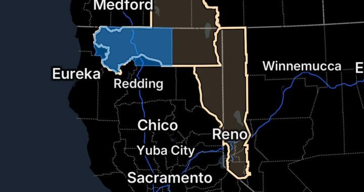
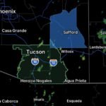
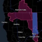
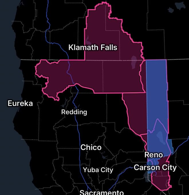
The Northern Sierra Front, Fire Weather Zone 420, is under a Red Flag Warning from 11 AM to 11 PM PDT Tuesday.
The warning covers:
- Carson City
- Douglas County
- Storey County
- Southern Washoe County
- Western Lyon County
- Far Southern Lassen County
Forecasters expect southwest winds of 15 to 25 mph, with gusts reaching 30 to 40 mph. Ridgetop gusts could reach 45 to 50 mph before winds shift more westerly during the late afternoon and evening. Relative humidity is expected to fall to approximately 10% to 15% during the afternoon.
That combination is particularly dangerous because wind can rapidly carry flames and embers while extremely dry air allows vegetation to ignite and burn efficiently.
Washoe County Faces an Additional Concern
Washoe County is included within the affected Northern Sierra Front and Northern Washoe County fire-weather zones.
A power outage has also been reported in Washoe County, adding another potential challenge for residents. Anyone experiencing an outage should keep phones and emergency equipment charged when possible and remain alert for additional information from local officials and utility providers.
Residents in wildfire-prone areas should also be prepared for the possibility that rapidly changing fire conditions could lead to evacuation warnings or orders.
Northeast California and Northern Washoe County
Another Red Flag Warning covers Fire Weather Zone 270 Surprise Valley, California; Fire Weather Zone 278 Eastern Lassen County; and Fire Weather Zone 458 Northern Washoe County.
This area also includes the S-1 Vya Fire, making the forecast particularly important for residents and firefighters in and around the affected area.
The National Weather Service expects:
- Southwest winds of 15 to 25 mph
- Wind gusts of 30 to 40 mph
- Ridgetop gusts up to 45 mph
- Afternoon relative humidity falling to approximately 12% to 17%
- A shift toward westerly winds during the late afternoon and evening
The warning is in effect 11 AM to 11 PM PDT Tuesday.
Why the Wind Matters
Strong winds are one of the most important factors in rapid wildfire growth. Wind can:
- Push a fire front into unburned vegetation.
- Carry burning embers ahead of the main fire.
- Produce unpredictable changes in fire direction.
- Make aerial and ground firefighting operations more difficult.
- Increase the likelihood of spot fires.
When combined with very low humidity, fuels can dry further and become highly receptive to ignition.
Scott Valley Also Under a Red Flag Warning
Northern California’s Scott Valley is facing a separate fire-weather threat.
The National Weather Service’s Medford office says the Red Flag Warning remains in effect through 8 PM PDT Monday, August 31, for strong gusty winds and low relative humidity across several fire-weather zones, including Scott Valley in Fire Weather Zone 280.
In Scott Valley, south winds are expected to reach 10 to 20 mph, with gusts up to 30 mph. Stronger winds are expected in nearby areas, including the Shasta Valley.
The warning is another reminder that elevated and critical fire-weather conditions are occurring across a broad portion of the northern California interior.
What Residents Should Do Now
During a Red Flag Warning, residents should treat outdoor ignition sources seriously.
Avoid Creating Sparks
Avoid activities that could ignite dry vegetation, including:
- Outdoor burning
- Campfires where prohibited
- Welding or grinding near vegetation
- Using equipment that can create sparks
- Target shooting where restrictions apply
- Other activities capable of producing an ignition
The National Weather Service specifically recommends avoiding spark-producing outdoor activities near dry vegetation and following local fire restrictions.
Prepare for a Fast-Moving Wildfire
If you live in or near a wildfire-prone area, take time now to:
- Keep your vehicle fueled and ready.
- Charge phones and backup batteries.
- Gather important medications and documents.
- Keep pets and livestock plans ready.
- Know multiple evacuation routes.
- Monitor emergency alerts.
- Be prepared to leave immediately if officials issue an evacuation order.
Do not wait for flames to become visible before preparing to evacuate.
The Bigger Fire-Weather Picture
The current setup illustrates why late-summer fire danger can become especially dangerous across the Great Basin and northern Sierra.
The National Weather Service’s fire-weather forecast previously highlighted increasing winds and low humidity Tuesday, with conditions expected to become cooler and more humid Wednesday, potentially reducing the critical fire-weather threat.
However, the most dangerous period comes when wind, low humidity and dry fuels overlap. Those ingredients can turn a small ignition into a rapidly expanding wildfire in a matter of hours.
Radar Watch HQ Final Thoughts
The August 31–September 1 fire-weather setup deserves close attention across Northern Nevada and Northern California. From the Northern Sierra Front and Washoe County to Surprise Valley, Eastern Lassen County, Northern Washoe County and Scott Valley, residents are facing conditions that can support rapid wildfire growth.
The presence of the S-1 Vya Fire makes the Red Flag Warning affecting Northern Washoe County and surrounding northeast California areas especially important. Meanwhile, the reported Washoe County power outage adds another preparedness concern for residents.
Stay informed, avoid activities that could start a fire, and have an evacuation plan ready before conditions deteriorate.
Radar Watch HQ will continue monitoring significant fire-weather developments, wildfire threats and changing conditions across the region.

Affiliate Disclosure: As an Amazon Associate, Radar Watch HQ earns from qualifying purchases.
Radar Watch HQ Top 5 Essentials – Wildfire Preparedness
Helps reduce exposure to wildfire smoke, ash, and fine particles.
Provides alerts during power outages or when cell service is unavailable.
Go Bag / Emergency Preparedness Kit
Includes important documents, medications, water, food, flashlights, and basic supplies for quick evacuation.
Fire-Resistant Outdoor Supplies
Items such as fire-resistant gloves, protective clothing, and tools for creating defensible space around property.
Portable Power Bank & Backup Charging Supplies
Keeps phones and emergency devices powered during wildfire emergencies.