Flash Flood Risk Increases Across the Northern Rockies
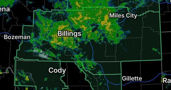
A developing heavy-rain and thunderstorm pattern is increasing the potential for flash flooding across portions of southwest Montana and Idaho on Friday, September 18. Slow-moving showers and thunderstorms are capable of producing locally intense rainfall, with areas near recent wildfire burn scars facing an elevated risk of rapid runoff and debris flows.
The National Weather Service has issued a Flash Flood Watch for a portion of southwest Montana, including Northwest Beaverhead County, while Flash Flood Warnings are in effect for portions of central and southwestern Idaho.
Flash Flood Watch: Northwest Beaverhead County, Montana
The Flash Flood Watch covers Northwest Beaverhead County, including areas around Dewey, Big Hole Pass, Wise River, Chief Joseph Pass, and Wisdom.
The watch is focused particularly on the Sand Creek and Bobcat Lakes burn scars. The National Weather Service says heavy rainfall over these areas could trigger flash flooding and debris flows. The watch extends from Friday afternoon through Saturday afternoon.
Rainfall over recently burned terrain can become hazardous quickly because vegetation and soil conditions may allow water to run off rapidly. Mud, rocks, trees and other debris can be swept into drainage areas and roadways.
The National Weather Service is also monitoring a broader southwest Montana pattern involving unusually high atmospheric moisture, showers and thunderstorms, and relatively slow storm movement. Those conditions can allow heavy rain to persist over the same locations.
Areas Near Burn Scars Need Extra Caution
Residents, travelers and anyone recreating near the Sand Creek and Bobcat Lakes burn scars should remain alert for rapidly changing conditions.
Particular attention is warranted around:
- Drainages and small streams
- Low-lying roads
- Mountain passes
- Areas downstream from burn scars
- Campgrounds and recreational areas
- The Pioneer Mountains Scenic Byway
A Flash Flood Watch means conditions are favorable for flash flooding. It does not mean flooding is occurring everywhere within the watch area.
Flash Flood Warnings Across Idaho
Idaho is also dealing with an active flash-flood threat.
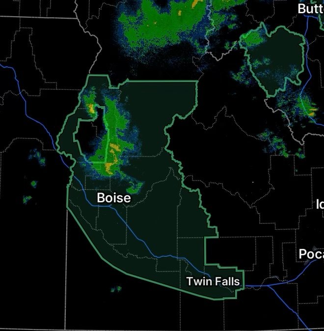
The National Weather Service has issued Flash Flood Warnings for portions of central and southwestern Idaho, including areas affected by heavy thunderstorms and vulnerable wildfire burn scars.
One warning covered the MM115 Highway 20 burn scar in central Elmore County in southwestern Idaho, where thunderstorms were producing heavy rainfall. The National Weather Service warned that excessive rainfall over the burn scar could result in debris flows involving rock, mud, vegetation and other loose material.
Another Flash Flood Warning covers portions of northeastern Blaine County, southeastern Custer County and southwestern Butte County, where radar indicated thunderstorms producing heavy rain and rainfall rates exceeding one-half inch per hour.
Why Burn Scars Can Flood So Quickly
Wildfire burn scars can dramatically change how water moves across a landscape. Areas that have lost vegetation can experience faster runoff when intense rainfall arrives.
Instead of gradually soaking into the ground, water can rush downhill toward creeks, roads and lower elevations. The runoff can also pick up loose material and create dangerous debris flows.
This means flooding can occur even when rainfall is concentrated over higher terrain away from a community.
Flash Flood Safety
If a Flash Flood Warning is issued for your location, take action immediately.
- Move to higher ground if flooding begins or officials direct you to evacuate.
- Never drive through a flooded roadway.
- Turn around if you encounter water covering a road.
- Stay away from fast-moving water, creeks and drainage channels.
- Avoid areas below or downstream from wildfire burn scars during intense rainfall.
- Do not camp or remain in low-lying areas when flash flooding is possible.
- Keep up with National Weather Service and local emergency-management updates.
- If you are outdoors in mountainous terrain, identify higher ground before storms arrive.
Remember that water can rise rapidly, and debris flows can move with little warning.
What to Watch Tonight
The combination of abundant moisture, showers and thunderstorms will keep flash-flood concerns elevated across portions of the Northern Rockies. Southwest Montana faces particular concern near recent burn scars, while active warnings in Idaho highlight the potential for flooding and debris flows where heavy thunderstorms develop.
Conditions can change quickly. Residents and travelers should continue monitoring the latest alerts and be prepared to move to higher ground if a Flash Flood Warning is issued.
Radar Watch HQ encourages everyone in or near the affected areas to stay weather-aware, avoid flooded roads and take flash-flood warnings seriously.