Hurricane Polo’s Moisture Is Spreading Into the Southwest
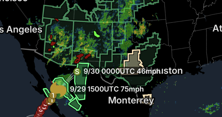
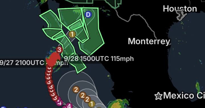
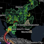
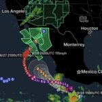
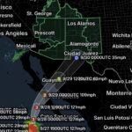
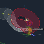
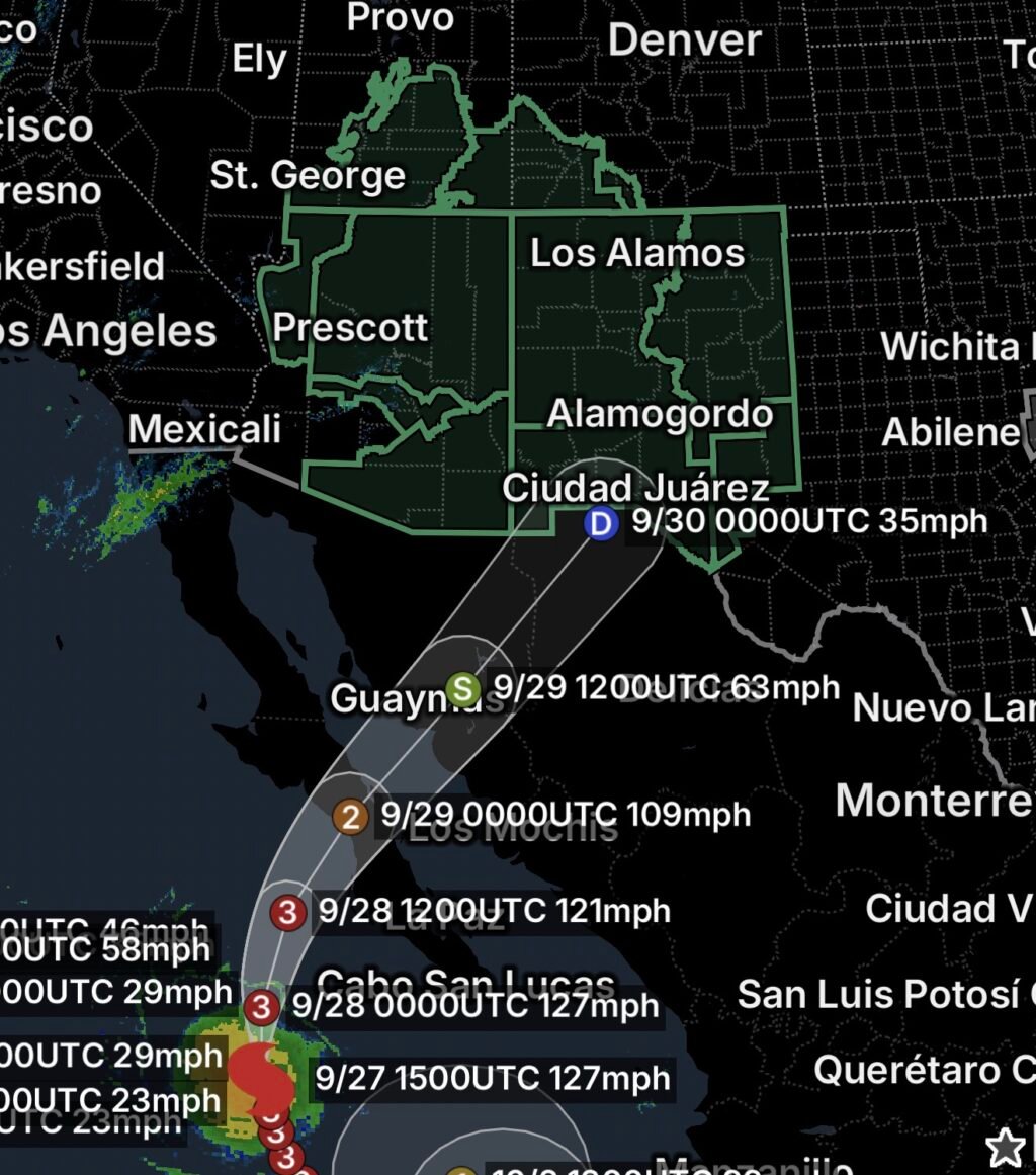
A powerful Category 3 Hurricane Polo in the eastern Pacific is helping transport a deep plume of tropical moisture northward toward the Southwest. The National Weather Service says Polo was a Category 3 hurricane Sunday morning with maximum sustained winds around 120 mph, while its moisture is expected to contribute to a prolonged period of heavy rain across the Four Corners and surrounding areas. (National Weather Service)
The resulting setup is producing a broad and potentially dangerous flooding threat. The Weather Prediction Center has highlighted a Moderate Risk of Excessive Rainfall for portions of the Southwest and Four Corners for Monday, September 28, as unusually high atmospheric moisture combines with upper-level weather systems. (National Weather Service)
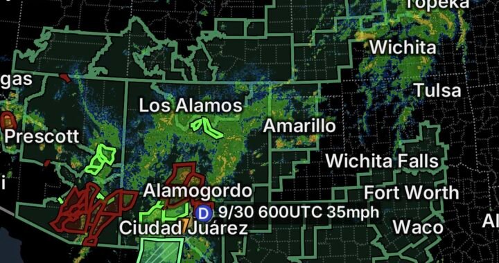
New Mexico is facing an especially significant concern. The National Weather Service office in Albuquerque says the risk of flash flooding will increase statewide Monday afternoon through Wednesday, with widespread and long-duration showers and thunderstorms expected. (National Weather Service)
Flood Watch Covers Large Portions of New Mexico
A broad Flood Watch is affecting areas along and west of the central mountain chain, including:
- West slopes of the Sangre de Cristo Mountains
- Sandia and Manzano Mountains
- South-central mountains
- Rio Grande Valley westward toward the Arizona border
Communities and metro areas included in the broader threat area include:
- Albuquerque
- Santa Fe
- Española
- Taos
- Socorro
- Ruidoso
- Los Alamos
- Grants
- Gallup
- Farmington
The Albuquerque NWS office warns that flash flooding could become a major concern in poorly drained locations, urban arroyo systems and areas affected by recent wildfires. Persistent rainfall later in the event could also increase the potential for river flooding. (National Weather Service)
Arizona Faces Widespread Flooding Concerns
Flood Watches also extend across northern and central Arizona, with another Flood Watch covering southeastern Arizona and the Tucson metropolitan area.
The Tucson area is expected to see a significant increase in tropical moisture Monday and Tuesday. The National Weather Service says a Flash Flood Watch is in effect from Monday into Tuesday night, with rainfall capable of producing flooding in normally dry washes, roadway dips and other low-lying areas. (National Weather Service)
Forecast rainfall amounts in southeastern Arizona are generally expected to range from 0.5 to 3 inches, with locally higher amounts possible, particularly east of Tucson. (National Weather Service)
The combination of tropical moisture, thunderstorms and mountainous terrain means some locations could experience rapid runoff even where rainfall totals are not especially high.
Utah Flood Watch Expands Across Multiple Regions
Utah is also included in the broader Southwest flooding setup.
Flood Watch areas include:
- Castle Country
- Central Mountains
- San Rafael Swell
- Bryce Canyon Country
- Capitol Reef National Park and vicinity
- Glen Canyon Recreation Area and Lake Powell
- South-Central Utah
- Southern Mountains
- Upper Sevier River Valleys
- Western Canyonlands
- Lower Washington County
- Zion National Park
Mountainous terrain, narrow canyons and normally dry washes can make these areas particularly vulnerable to rapid runoff and flash flooding.
Visitors to national parks and recreation areas should be prepared for changing conditions and should avoid entering washes, slot canyons or other flood-prone terrain when thunderstorms are nearby.
Southern New Mexico and Far West Texas
The flooding threat also extends into southern New Mexico and Far West Texas, with another Flood Watch covering portions of southeastern New Mexico.
The National Weather Service reports that tropical moisture from the remnants of Hurricane Polo will contribute to the heavy-rain threat across southeastern New Mexico and nearby southwest Texas. Flooding could affect rivers, creeks, streams, low-lying areas and locations with poor drainage. (National Weather Service)
Areas near the Guadalupe and Delaware Mountains, Van Horn and the Highway 54 corridor are among locations included in the southeastern New Mexico/southwest Texas Flood Watch. (National Weather Service)
Why Flooding Could Become Dangerous
The primary concern is not simply how much rain falls in one location. Tropical moisture can produce high rainfall rates, and repeated thunderstorms over the same areas can quickly overwhelm drainage systems.
The threat is greater in:
- Burn scars
- Steep mountain terrain
- Canyons and slot canyons
- Arroyos
- Normally dry washes
- Low-water crossings
- Urban drainage systems
- Areas near rivers and streams
- Roads through mountainous terrain
The Albuquerque NWS office specifically notes that the remnants of Polo could produce exceptionally high atmospheric moisture, supporting repeated rounds of heavy showers and thunderstorms. (National Weather Service)
Essentials: How to Stay Safe
🌧️ Take Flood Watches Seriously
A Flood Watch means conditions are favorable for flooding. Be prepared to move to higher ground if warnings are issued.
🚗 Never Drive Through Floodwater
Even shallow water can hide washed-out roads, debris or damaged pavement.
Turn around, don’t drown.
🏜️ Avoid Washes and Arroyos
Dry washes can transform into fast-moving channels with little warning.
⛰️ Use Extra Caution in Mountain Areas
Heavy rainfall upstream can produce flooding downstream even when it is not raining where you are.
🔥 Stay Away From Burn Scars
Recently burned areas can experience extremely rapid runoff, debris flows and mudslides.
📱 Monitor Local Alerts
Keep emergency alerts enabled and monitor the National Weather Service for Flash Flood Warnings and other updates.
🏕️ Reconsider Outdoor Plans
If you are camping, hiking, boating or visiting a national park, check conditions before entering remote or flood-prone terrain.
What Happens Next
The Southwest flooding threat is expected to become increasingly active beginning Monday and continuing into the middle of the week. New Mexico officials and forecasters are particularly concerned about repeated rounds of thunderstorms and prolonged rainfall, with river flooding becoming more likely later in the event. (National Weather Service)
Hurricane Polo itself is expected to weaken as it moves toward Baja California and eventually inland, but its moisture plume can continue influencing weather far from the storm’s center. The National Weather Service marine forecast indicates Polo is expected to weaken to a tropical storm and then a tropical depression as it moves inland later in the week. (National Weather Service)
Bottom Line
September 27, 2026: Hurricane Polo is contributing to a major surge of tropical moisture into the Southwest, creating a widespread flood threat from Arizona and Utah through New Mexico and into parts of Texas.
With Flood Watches covering numerous communities, mountain ranges, recreation areas and metropolitan regions, residents and visitors should be prepared for flash flooding, rapid runoff, dangerous travel conditions and eventually river flooding.
The greatest concern will be areas where heavy thunderstorms repeatedly move over the same locations, as well as burn scars, steep terrain, washes and urban areas.
Stay weather-aware, avoid flooded roads and never underestimate rapidly rising water.