A Major Surge of Tropical Moisture Is Moving Into the Southwest
The Southwest is entering an unusually active weather pattern as tropical moisture from the eastern Pacific interacts with a large upper-level weather system over the western United States.
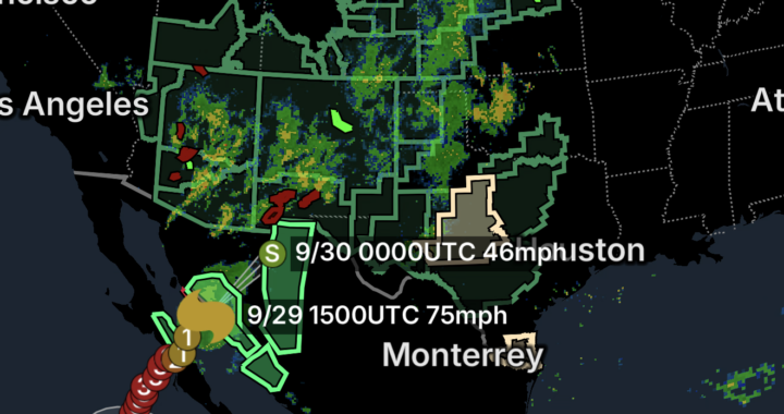
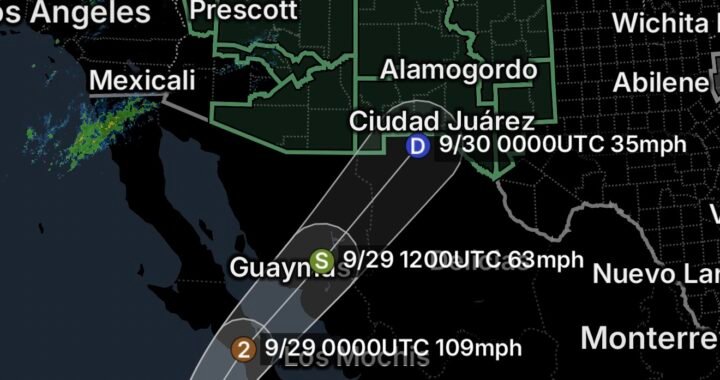
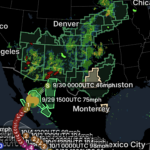
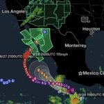
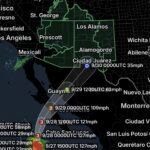
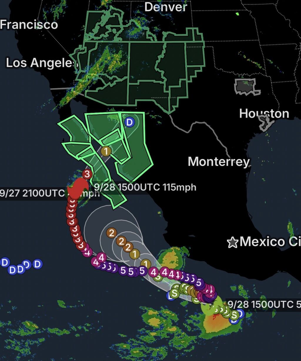
Category 3 Hurricane Polo remains the dominant tropical system contributing moisture to the Southwest. The National Hurricane Center reported Polo with maximum sustained winds of 120 mph late Sunday night as it moved north toward Baja California. The storm is expected to cross the Baja Peninsula and approach northwestern Mexico, weakening along the way. (National Weather Service)
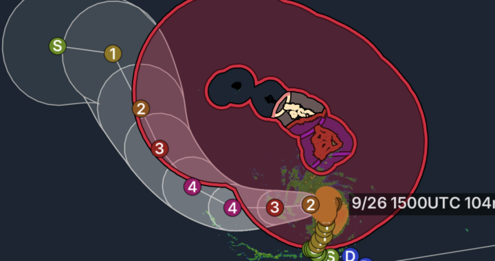
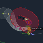
At the same time, Tropical Storm Rachel has formed well south of Mexico. Rachel was moving west-northwest over the eastern Pacific with maximum sustained winds of 40 mph. The National Hurricane Center said the center was expected to remain well south of the southern Mexican coast during the next several days. (National Hurricane Center)
Although Rachel is not expected to directly strike the Southwest, the broader tropical environment is adding to a moisture-rich pattern across the region.
Hurricane Polo’s Moisture Is the Main Southwest Concern
Polo’s circulation is transporting deep tropical moisture northward. The National Weather Service Weather Prediction Center has identified a Moderate Risk of Excessive Rainfall across portions of the Southwest and Four Corners for Monday, September 28.
Forecasters say moisture associated with Polo will spread northeastward ahead of a large upper-level low moving through the West. Atmospheric moisture levels are expected to rise to roughly 2 to 3.5 standard deviations above normal across much of the region. (Marine Weather)
That combination can produce heavy rainfall when thunderstorms develop, particularly across mountainous terrain.
Coastal Southwest and Baja California Impacts
The most direct coastal effects are occurring along the Baja California Peninsula and western Mexico, where Polo is approaching.
The National Hurricane Center reported hurricane and tropical-storm warnings for portions of Mexico, with life-threatening winds and flash flooding expected across portions of Baja California Sur and Sonora. (National Weather Service)
Polo’s large circulation is also generating dangerous seas and heavy surf along portions of the Pacific coast.
Even as the hurricane weakens after moving inland, its moisture can continue traveling northward and eastward into the United States.
Southern California
Southern California is farther removed from Polo’s center, but the storm’s moisture plume can still influence the region.
Forecast guidance has indicated the possibility of increased cloud cover and rain chances, particularly across San Diego County and portions of Southern California, although impacts are expected to be much weaker than those occurring closer to Polo’s core. (ABC7 Los Angeles)
The most important concern farther inland is not necessarily the hurricane itself, but the interaction between tropical moisture and western weather systems.
Arizona Faces Increasing Rain and Flooding Concerns
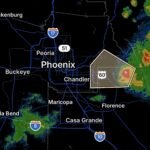
Arizona is positioned near the center of the developing moisture plume.
The National Weather Service in Tucson says deep tropical moisture will move into southeastern Arizona Monday and Tuesday, while an upper-level low moving in from the West interacts with that moisture.
This setup is expected to produce widespread showers and thunderstorms. (National Weather Service)
Flooding concerns include:
- Tucson metro
- Southeast Arizona
- Northern Arizona
- Central Arizona
- Northwest Arizona
- Mountain communities
- Normally dry washes and arroyos
- Burn scars
- Low-water crossings
Heavy thunderstorms could produce rapid runoff even when rainfall is localized.
New Mexico Faces a Major Inland Flood Threat
New Mexico is one of the areas facing the greatest inland concerns.
Tropical moisture moving northward from the Pacific is combining with a developing upper-level weather system, creating conditions capable of producing prolonged rainfall and repeated thunderstorms.
Flooding can become especially dangerous in:
- The Rio Grande Valley
- Albuquerque
- Santa Fe
- Española
- Taos
- Socorro
- Ruidoso
- Los Alamos
- Grants
- Gallup
- Farmington
- Mountain communities
- Burn-scar areas
The concern extends beyond flash flooding. Repeated rainfall can saturate soils and increase runoff into streams and rivers, creating the potential for longer-duration river flooding.
Utah and the Four Corners
The moisture plume is also reaching Utah and the broader Four Corners region.
Areas around Zion National Park, Bryce Canyon, Capitol Reef, Lake Powell, the San Rafael Swell, southern Utah and the Upper Sevier River Valley can be particularly vulnerable to rapid runoff.
Slot canyons and narrow drainage channels pose an additional danger because water can travel considerable distances from storms occurring upstream.
Visitors should not assume an area is safe simply because skies overhead appear dry.
Southern New Mexico and Far West Texas
The tropical moisture surge also extends into southern New Mexico, southeastern New Mexico and Far West Texas.
Heavy rainfall over elevated terrain can send water downstream into normally dry channels, while repeated thunderstorms may increase the potential for flash flooding.
Far West Texas is especially vulnerable around:
- Mountain ranges
- Desert washes
- Low-water crossings
- Canyons
- Burn scars
- Rural roads
Rainfall can also create dangerous driving conditions because water can quickly cover roads that are normally dry.
Tropical Moisture Can Produce Impacts Far From the Storm
One of the most important aspects of this weather pattern is that Polo does not have to remain a hurricane to affect the Southwest.
Once a tropical system interacts with a larger weather pattern, its moisture can be transported hundreds of miles away.
That is exactly what forecasters are watching across the Southwest. The upper-level trough moving through the West is helping draw the tropical moisture plume north and northeastward.
The result is a complicated setup involving:
Tropical moisture + mountainous terrain + thunderstorms + an upper-level low = increased flooding potential.
Tropical Storm Rachel’s Role
Rachel is a separate tropical cyclone and is currently located well south of Mexico.
The National Hurricane Center reported Rachel as a tropical storm with 40-mph maximum sustained winds Sunday afternoon. Its forecast track keeps the center well south of the Mexican coast during the immediate period. (National Hurricane Center)
Rachel therefore presents a different situation from Polo.
Polo: Its moisture is directly involved in the Southwest’s developing heavy-rainfall pattern.
Rachel: It is farther south and is not currently expected to directly impact the Southwest, but it remains an active tropical system that forecasters are monitoring.
What Residents and Travelers Should Watch For
The biggest hazards across the Southwest are likely to be:
🌧️ Heavy rainfall
⛈️ Slow-moving thunderstorms
🌊 Flash flooding
🏜️ Flooding in normally dry washes
🏔️ Mountain runoff
🔥 Burn-scar flooding
🚗 Dangerous road conditions
🌊 River rises
🪨 Mud and debris flows
Flooding can develop quickly, especially where thunderstorms repeatedly move across the same drainage basin.
Essentials: How to Stay Safe
🚗 Never Drive Through Floodwater
A road that appears passable can be washed out underneath the water.
Turn around, don’t drown.
🏜️ Stay Out of Washes
Never camp, park or hike in a normally dry wash when thunderstorms are possible upstream.
⛰️ Be Careful in Mountain Areas
Rain falling miles away can rapidly send water into canyons and valleys.
🔥 Avoid Burn Scars
Recently burned landscapes can experience rapid runoff, mudslides and debris flows.
🏕️ Check Conditions Before Recreation
If visiting Zion, Bryce Canyon, Capitol Reef, Lake Powell, the Grand Canyon region or other Southwest recreation areas, check weather and park alerts before entering remote terrain.
📱 Monitor Flash Flood Warnings
A Flood Watch means flooding is possible. A Flash Flood Warning means dangerous flooding is occurring or imminent.
Bottom Line
September 28, 2026: Tropical Storm Rachel and Category 3 Hurricane Polo are part of an active eastern Pacific pattern, but Polo’s moisture is the primary tropical contributor to the major flooding threat now developing across the Southwest.
From Baja California and the Pacific coast to Arizona, Utah, New Mexico and Far West Texas, tropical moisture is interacting with western weather systems to produce an increasingly favorable environment for heavy rain and flooding.
The greatest inland concerns include flash flooding, rapid mountain runoff, flooded washes, burn-scar flooding and rising rivers.
Residents and visitors should remain weather-aware through the coming days, particularly in areas covered by Flood Watches.