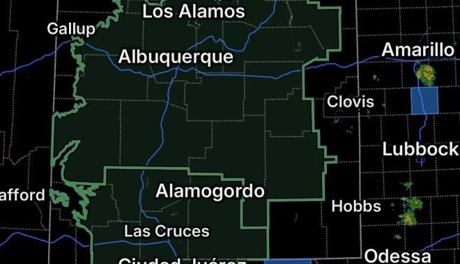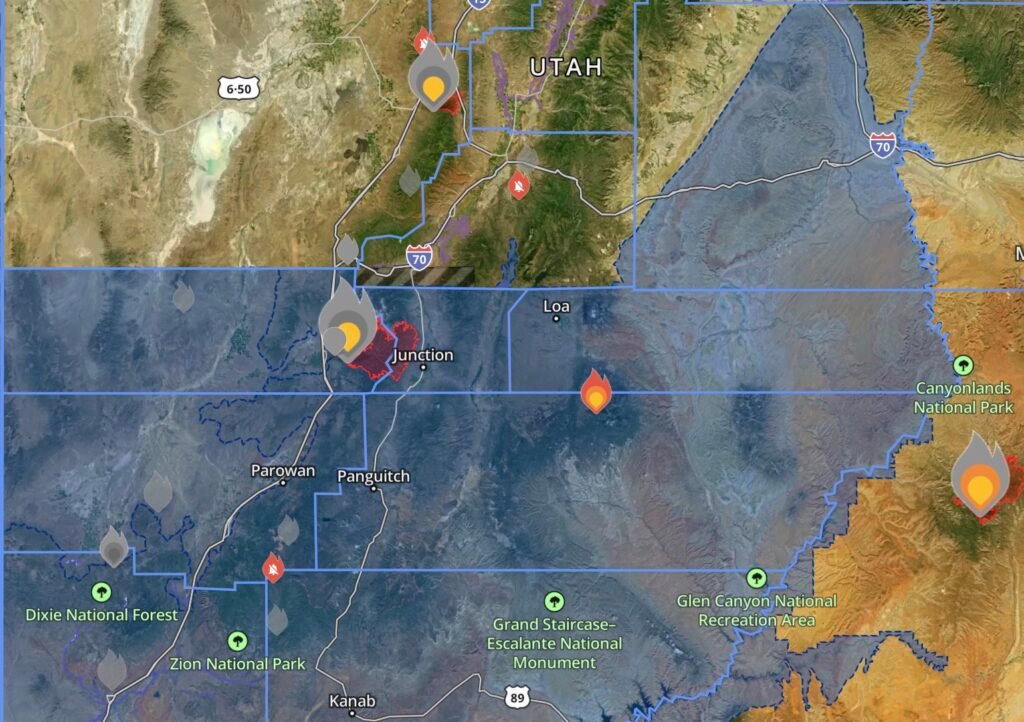
The wildfire emergency across southern Utah has entered a dangerous new phase as heavy rainfall and thunderstorms move over areas recently burned by the Cottonwood Fire and the nearby Boulder Top Fire, creating an elevated risk of flash flooding, debris flows, and mudslides.
Emergency officials continue to urge residents to remain alert as saturated burn scars can produce life-threatening flooding with very little warning.
Evacuation Order Remains in Effect
Residents in the following Beaver County communities remain under an Evacuation Order:
- HiLo Estates
- Merchant Valley
- Eagle Point
- Arrowhead Summer Homes
- Surrounding areas
Officials continue to encourage residents to follow all evacuation notices and be prepared to leave immediately if conditions worsen.
Boulder Top Fire Also Receiving Rainfall
The nearby Boulder Top Fire, estimated at approximately 15 acres, is also experiencing rainfall from the same weather system affecting the Cottonwood Fire area.
While rain can help slow the spread of smaller wildfires, emergency managers caution that thunderstorms often bring additional hazards including:
- Dangerous lightning
- Sudden wind shifts
- Localized flash flooding
- Difficult travel conditions for firefighting resources
How Rain Changes a Wildfire Disaster
Although rainfall is often welcomed during wildfire season, recently burned landscapes respond much differently than healthy forests.
After an intense wildfire:
- Vegetation that normally absorbs rainfall has been destroyed.
- Burned soil often becomes water-repellent.
- Water rapidly runs downhill instead of soaking into the ground.
- Ash, rocks, burned trees, and debris are carried into creeks, roads, and neighborhoods.
Even a brief period of heavy rain can produce dangerous flooding across burn scars, making these events especially hazardous for nearby communities. Wetting rains have reduced fire behavior in parts of the Cottonwood Fire, but officials warn that the same rainfall significantly increases the risk of mudslides, falling rocks, flooding, and damaged trees within the burn area.
Communities Face Multiple Hazards
Residents across Beaver and Piute Counties are now dealing with several simultaneous threats:
- Active wildfire operations
- Flash flooding
- Mudslides and debris flows
- Road closures
- Reduced visibility
- Potential damage to homes and infrastructure
Emergency responders continue monitoring streams, drainages, and steep terrain where runoff can develop rapidly.
Stay Prepared
If you live near the Cottonwood Fire or Boulder Top Fire burn scars:
- Follow evacuation orders immediately.
- Never drive through flooded roads or low-water crossings.
- Stay away from canyons, washes, and drainage channels during heavy rain.
- Monitor local emergency alerts throughout the day and night.
- Prepare an emergency kit in case evacuation becomes necessary.
Radar Watch HQ
The evolving situation across Beaver and Piute Counties highlights how wildfire season does not end when flames slow. Heavy rainfall can introduce a new set of life-threatening hazards, especially across freshly burned landscapes.
Radar Watch HQ will continue monitoring the Cottonwood Fire, Boulder Top Fire, flash flood warnings, evacuation orders, and changing weather conditions as emergency crews work to protect lives and property across southern Utah.
Affiliate Disclosure: As an Amazon Associate, Radar Watch HQ earns from qualifying purchases.
Radar Watch HQ Top 5 Essential Emergency Preparedness Picks
Whether you’re preparing for severe thunderstorms, flash flooding, hurricanes, wildfires, or extended power outages, these five emergency essentials can help keep your household safer when severe weather strikes.
A portable power station provides reliable backup electricity during outages, allowing you to power phones, medical devices, laptops, lights, small appliances, and communication equipment without fuel.
Best for:
- Extended power outages
- Severe thunderstorms
- Hurricanes
- Winter storms
- Wildfires
2. Flood Protection Barriers & Sandless Flood Bags
Flood barriers help divert or absorb water before it enters garages, doorways, and low-lying areas. They deploy quickly and can help reduce property damage during flash flooding.
Best for:
- Flash Flood Warnings
- Heavy rainfall
- River flooding
- Coastal flooding
3. Rechargeable LED Flashlights
Bright, dependable flashlights are essential when the power goes out. Rechargeable or solar-powered models provide long-lasting illumination for navigating safely indoors and outdoors.
Best for:
- Overnight power outages
- Emergency evacuations
- Storm damage inspections
Keep phones, tablets, weather radios, and USB-powered devices charged when the electrical grid is unavailable. A solar power bank offers an additional charging option during prolonged emergencies.
Best for:
- Communication during outages
- Emergency weather alerts
- Travel and evacuation
A NOAA Weather Radio delivers official weather alerts directly from the National Weather Service, even when cellular networks or internet service are unavailable. It remains one of the most dependable ways to receive life-saving warnings.
Best for:
- Tornado warnings
- Severe thunderstorm warnings
- Flash flood warnings
- Hurricane alerts
- Winter storm emergencies
Why Radar Watch HQ Recommends These Essentials
At Radar Watch HQ, preparedness is just as important as staying informed. These five emergency essentials can help you stay connected, protect your property, and safely navigate severe weather events. Having supplies ready before storms arrive allows you to respond quickly when warnings are issued and conditions begin to deteriorate.