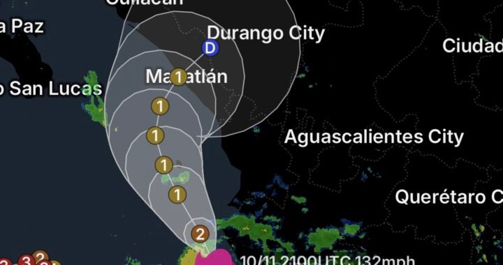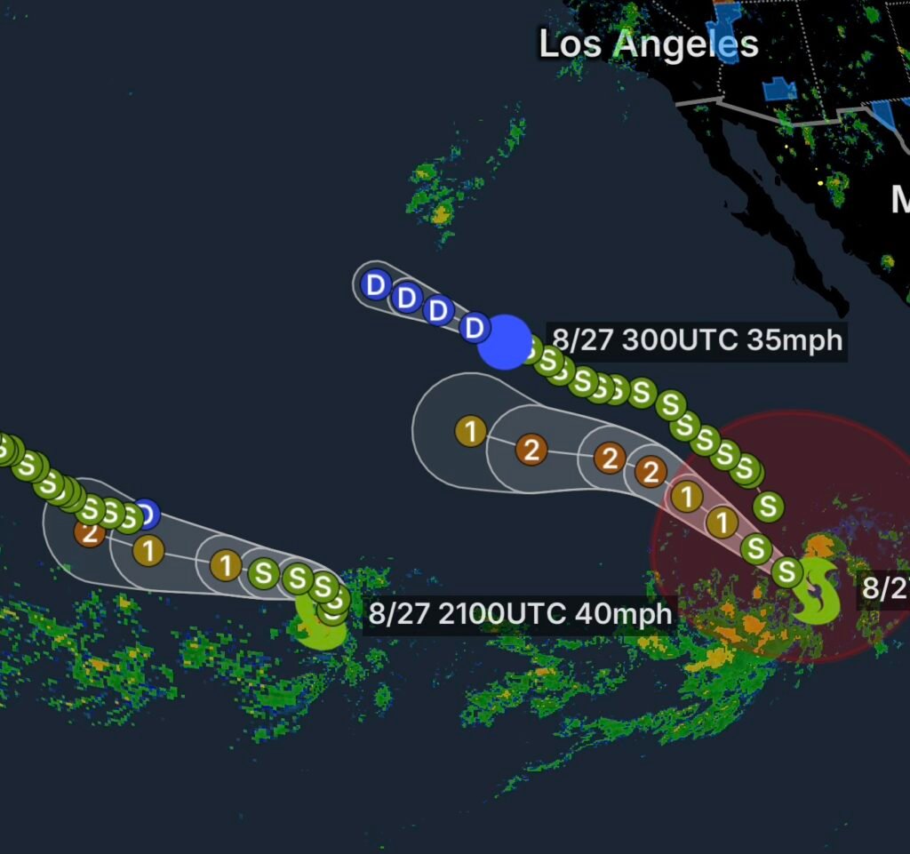
Eastern Pacific Tropical Activity Increasing
The Eastern Pacific is becoming increasingly active as forecasters monitor several tropical systems and a new area of low pressure expected to develop south of southwestern Mexico this weekend.
According to the latest tropical weather information from the National Hurricane Center, environmental conditions are expected to become favorable for gradual tropical development. A tropical depression could form as early as next week while the system moves generally west-northwestward to northwestward at 10 to 15 mph. (National Hurricane Center)
While the developing disturbance is expected to remain well offshore initially, its potential evolution will be important to monitor as it organizes.
New Eastern Pacific Area of Interest
Low Pressure Could Organize This Weekend
The newest area of interest is forecast to develop well south of southwestern Mexico during the weekend.
Forecasters are watching the disturbance because atmospheric conditions appear supportive of gradual organization. If thunderstorms become better organized around a developing circulation, the system could eventually acquire enough structure and intensity to become a tropical depression.
Current expectations call for possible formation early next week, with the system moving toward the west-northwest or northwest at approximately 10 to 15 mph.
That projected motion would generally keep the system over open Pacific waters initially. However, tropical systems can change direction, intensity and structure as environmental conditions evolve.
Why Conditions Matter
Tropical cyclones require several ingredients to develop, including warm ocean water, sufficient atmospheric moisture and relatively favorable upper-level winds.
When those ingredients come together, thunderstorms can become more concentrated around a low-level circulation. Continued organization can eventually lead to tropical depression status and, if winds increase enough, a tropical storm.
Therefore, the current disturbance does not automatically mean a major storm is coming. Instead, it represents a system worth monitoring during the next several days.
Tropical Storm Karina Remains Part of the Eastern Pacific Picture
Tropical Storm Karina is another system being tracked in the Eastern Pacific.
Karina’s presence highlights how multiple tropical disturbances can coexist within the basin during the active portion of hurricane season. Interactions between nearby systems, upper-level winds, ocean temperatures and surrounding pressure patterns can influence how tropical cyclones strengthen or weaken.
For residents along the Pacific coast of Mexico and travelers operating across the Eastern Pacific, staying updated with official forecasts remains important whenever tropical activity increases.
Iselle Becomes Post-Tropical
Iselle Far From Baja California
Iselle is now classified as a post-tropical cyclone, with the system located approximately 1,015 miles west of the southern tip of Baja California.
The transition to post-tropical status means Iselle no longer possesses the characteristics required for classification as a tropical cyclone. However, post-tropical systems can still contain strong winds, heavy rainfall or rough seas depending on their structure and environment.
Because Iselle is located far offshore, its current position presents a very different situation from a tropical cyclone approaching land.
The system nevertheless remains part of the broader Eastern Pacific pattern that forecasters are watching.
Tropical Storm Lowell Also Being Monitored
Tropical Storm Lowell remains another feature of interest across the Eastern Pacific.
Lowell’s position and future intensity will depend on several environmental factors, including sea-surface temperatures, atmospheric moisture and vertical wind shear.
Vertical wind shear is particularly important because strong winds changing direction or speed with height can disrupt a tropical cyclone’s circulation and prevent thunderstorms from remaining concentrated near the center.
Conversely, lower wind shear can allow a tropical system to maintain or improve its organization.
What This Means for Mexico and Baja California
At this stage, the newest disturbance is expected to remain well offshore while forecasters watch for gradual development.
That means residents should not interpret the potential tropical depression as an immediate land threat.
However, tropical weather forecasts can change considerably several days before a system develops. Once a circulation forms, forecasters can better determine its strength, track and potential impacts.
Communities along the Pacific coast of Mexico and the Baja California Peninsula should continue monitoring official updates, particularly if the disturbance becomes better organized.
Eastern Pacific Tropical Outlook
The Eastern Pacific remains active, with:
- A new area of low pressure expected to form south of southwestern Mexico this weekend.
- Potential tropical depression formation early next week.
- West-northwestward to northwestward movement projected at 10 to 15 mph.
- Tropical Storm Karina continuing to be monitored.
- Iselle transitioning to a post-tropical cyclone approximately 1,015 miles west of the southern tip of Baja California.
- Tropical Storm Lowell remaining part of the active Eastern Pacific pattern.
The National Hurricane Center continues to monitor tropical development across the basin and updates its outlooks as conditions change. (National Hurricane Center)
How to Prepare for Possible Tropical Development
Even when a storm is forecast to remain offshore, it is a good time to review basic hurricane-season preparedness.
Residents in coastal areas should:
- Monitor official National Hurricane Center forecasts.
- Keep emergency supplies available.
- Check batteries and backup power sources.
- Review evacuation routes if living in a coastal flood-prone area.
- Secure outdoor objects before strong winds arrive.
- Keep phones and weather-alert devices charged.
- Avoid relying on a single forecast model or social-media post for storm information.
Most importantly, do not focus only on the current forecast track. Tropical systems can strengthen, weaken or change direction as environmental conditions evolve.
Radar Watch HQ Final Thoughts
The Eastern Pacific is showing signs of increasing tropical activity as August continues. The potential development of another tropical depression south of southwestern Mexico, combined with Karina, Lowell and post-tropical Iselle, gives forecasters several systems to monitor.
For now, the newest area of interest is a developing system to watch rather than an immediate threat to land. Conditions will become clearer as the disturbance forms and satellite observations provide more information about its organization.
Radar Watch HQ will continue tracking the Eastern Pacific and highlighting significant changes in tropical development, forecast movement and potential impacts.
Stay weather-aware, follow official forecasts, and check back with Radar Watch HQ for the latest tropical weather updates.