

Flood Watch Remains in Effect Across Parts of New Mexico
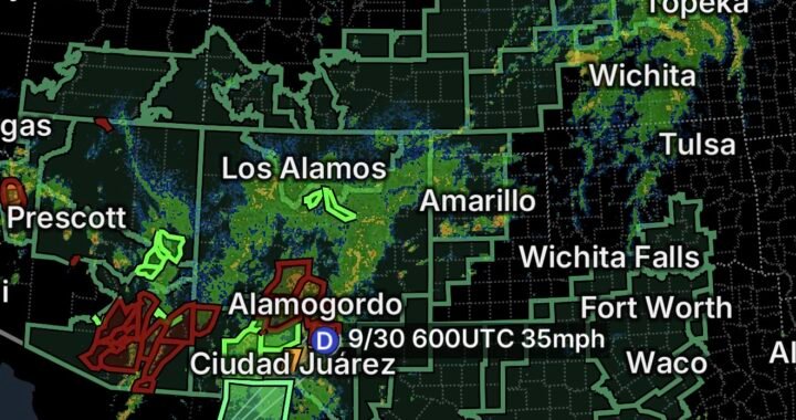
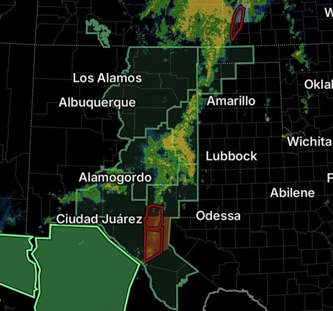
A Flood Watch remains in effect through early Thursday morning across portions of central, east-central, north-central and northeastern New Mexico as excessive rainfall continues to create the potential for flash flooding. The National Weather Service says flash flooding remains possible, with the current watch extending until 6 a.m. MDT Thursday, September 24 for the areas included in the latest advisory.
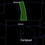
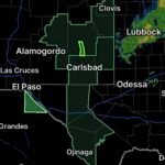
The watch includes areas extending from the Sangre de Cristo Mountains eastward toward Texas, as well as the Santa Fe Metro Area, Central Highlands and Guadalupe County. Portions of southeast New Mexico are also included in the broader flooding threat.
Areas Under the Flood Watch
The latest National Weather Service information identifies several areas where excessive rainfall could produce flooding, including:
- Northern and Southern Sangre de Cristo Mountains
- East Slopes of the Sangre de Cristo Mountains
- Glorieta Mesa and Glorieta Pass
- Santa Fe Metro Area
- Central Highlands
- Far Northeast and Northeast Highlands
- Johnson and Bartlett Mesas, including Raton Pass
- Eastern San Miguel County
- Guadalupe County
- Union County
- Harding County
- Portions of east-central and southeast New Mexico
The watch has also covered portions of Quay, Curry and Roosevelt counties, depending on the specific advisory area and timing.
Why Flash Flooding Is a Concern
A Flood Watch does not mean flooding is occurring everywhere within the watch area. Instead, it means conditions are favorable for flooding to develop.
Periods of heavy rainfall can overwhelm drainage systems, especially where storms repeatedly move over the same locations. Water can quickly collect in low-lying areas and flow into normally dry washes, arroyos, creeks and streams.
The National Weather Service warns that excessive runoff may cause rivers, creeks and streams to rise out of their banks, while low-lying and flood-prone locations could experience flooding.
Mountain Areas and Urban Locations Both Face Risks
The terrain across northern and central New Mexico can make flooding especially dangerous. Steep mountain slopes can rapidly send runoff downhill, while narrow canyons and drainage channels can concentrate water.
Urban areas can experience a different problem. Heavy rainfall can overwhelm storm drains and produce significant water on streets, intersections and underpasses.
The Santa Fe Metro and surrounding communities should remain alert for rapidly changing conditions, particularly if thunderstorms develop nearby.
Travel During Heavy Rain
Drivers should avoid unnecessary travel through areas experiencing intense rainfall. Roads can become flooded quickly, and water may cover hazards that are difficult to see.
Never drive through a flooded roadway. Even shallow-looking water can conceal a washed-out road surface or rapidly moving current.
If water begins covering the road ahead, turn around and find another route rather than attempting to cross.
What Residents Should Do Now
Residents and visitors in the Flood Watch area should:
- Monitor the latest National Weather Service forecasts and warnings.
- Be prepared to move to higher ground if flooding develops.
- Avoid low-water crossings, arroyos and normally dry washes during heavy rain.
- Keep away from rapidly flowing water.
- Do not drive through flooded roads.
- Have multiple ways to receive emergency alerts, especially overnight.
- Take Flash Flood Warnings seriously if they are issued for your location.
A Flood Watch can be upgraded to a Flash Flood Warning when flooding is occurring or imminent in a specific area. Conditions can change quickly, particularly when thunderstorms produce intense rainfall.
Radar Watch HQ Final Thoughts
The current Flood Watch highlights the continuing potential for flash flooding across portions of New Mexico, from the Sangre de Cristo Mountains and Santa Fe area eastward across the Central Highlands and toward the Texas border, with additional portions of southeast New Mexico affected.
The most important thing is to remain weather-aware through the watch period. Heavy rainfall does not have to last for hours to create dangerous flooding. If a Flash Flood Warning is issued for your location, act immediately and follow instructions from local emergency officials.
Stay weather-aware, avoid flooded roads and never risk your life trying to cross moving water.