Published: July 15, 2026
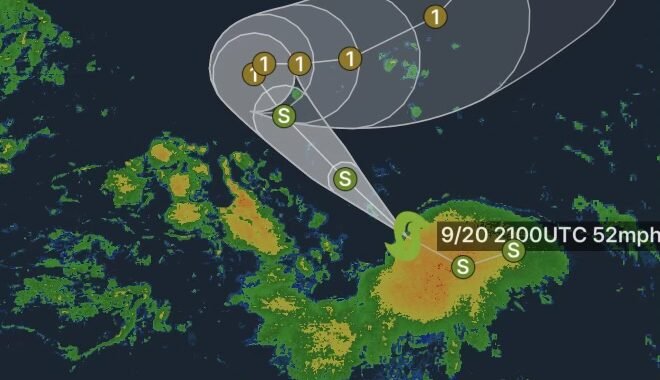
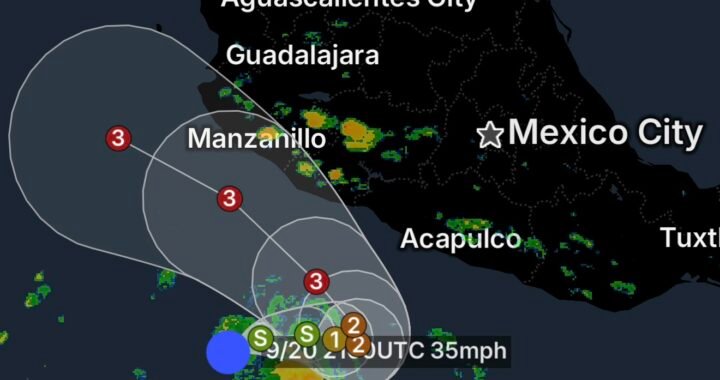
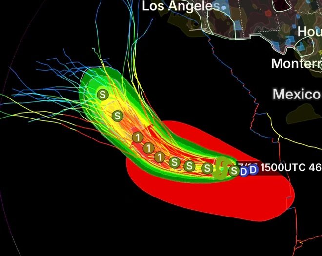
Tropical Storm Elida has continued to gradually strengthen over the open waters of the eastern Pacific Ocean while remaining well away from land. According to the National Hurricane Center (NHC), there are currently no coastal watches or warnings in effect, and no hazards are expected to impact land areas. Forecast models indicate Elida will continue moving west to northwest over open ocean, where environmental conditions remain favorable for additional strengthening.
Elida Continues to Intensify
As of the latest advisory, Tropical Storm Elida is producing sustained winds near 45 mph (75 km/h) and is forecast to strengthen steadily over the next couple of days. Warm sea surface temperatures, abundant tropical moisture, and relatively low wind shear are creating favorable conditions for the storm to organize further. The National Hurricane Center forecasts that Elida could become a hurricane later this week while remaining far from populated coastlines.
No Current Threat to Land
The good news is that Elida is expected to remain over the open eastern Pacific Ocean.
At this time:
- No coastal watches or warnings are in effect.
- No hazardous weather is expected across Mexico, Baja California, or the United States.
- No storm surge, flooding, or tropical storm impacts are forecast for land.
- Elida is projected to stay over open water throughout the current forecast period.
While the storm poses no immediate danger to communities, interests across the eastern Pacific, including commercial shipping and recreational boating, should continue monitoring official forecasts as conditions over the ocean will become increasingly hazardous near the storm’s center.
Why Elida Is Strengthening
Several atmospheric factors are helping Elida organize:
- Very warm ocean waters providing abundant energy.
- Low vertical wind shear allowing thunderstorms to remain organized.
- Moist tropical air supporting continued thunderstorm development.
- Favorable upper-level atmospheric conditions promoting strengthening.
Although these ingredients support additional intensification, Elida’s forecast track keeps it over open waters where it is expected to remain away from populated areas.
The Importance of Monitoring Tropical Systems
Even when tropical cyclones remain over open water, meteorologists closely monitor every system. Forecast tracks and storm intensity can change over time, making regular updates from the National Hurricane Center essential for mariners and coastal interests.
Fortunately, forecast confidence remains high that Elida will stay away from land through the next several days.
Stay Weather Aware
Although Tropical Storm Elida currently poses no threat to land, hurricane season remains active across the eastern Pacific. Conditions can evolve quickly, and new tropical systems may develop in the coming weeks.
Radar Watch HQ will continue providing the latest tropical weather updates, forecast discussions, and hurricane tracking throughout the 2026 hurricane season.