Tropical Storm Iselle Remains the Focus as More Disturbances Develop Across the Eastern Pacific
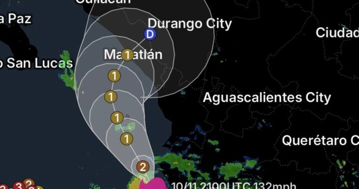
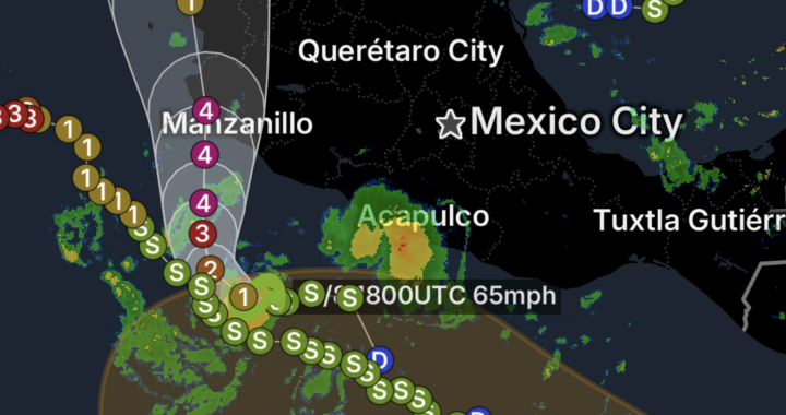
The Eastern and Central Pacific remain active as Tropical Storm Iselle continues to be monitored alongside several areas of disturbed weather that could develop over the coming days. According to the National Hurricane Center, Iselle is being tracked while additional low-pressure systems are showing signs of possible tropical development across the eastern Pacific. (National Hurricane Center)
While none of the developing disturbances currently represents an immediate threat to the continental United States, conditions across the tropical Pacific could become increasingly active as the week progresses.
Tropical Storm Iselle
Tropical Storm Iselle is currently the primary organized tropical system in the region. Forecasters are closely watching its structure, movement and interaction with nearby disturbances.
One of the more interesting features of the current pattern is the potential for a nearby area of low pressure to briefly organize before being absorbed into Iselle. This interaction could alter the appearance or structure of the surrounding tropical activity.
For residents and mariners across the region, the most important factors to watch are changes in Iselle’s intensity, forward movement and the development of additional thunderstorms around its circulation.
A Disorganized Area South-Southwest of Baja California
Short-Lived Tropical Depression Possible
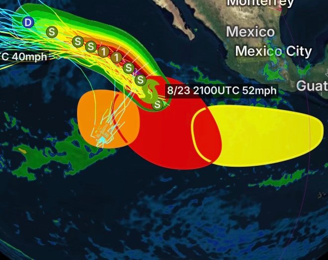
Well south-southwest of the southern tip of the Baja California Peninsula, a broad area of low pressure continues to produce disorganized showers and thunderstorms.
Although the circulation is not currently well organized, environmental conditions may become supportive enough for the system to briefly strengthen.
Forecasters indicate that a short-lived tropical depression could develop during the next couple of days before the system is absorbed by Tropical Storm Iselle.
This scenario demonstrates why tropical forecasting can change quickly. A disturbance does not necessarily need to become a long-lasting named storm to influence the surrounding tropical environment.
Another Low Could Develop Southwest of Mexico
Development Possible Later This Week
A second area of low pressure is expected to develop well southwest of the southern tip of the Baja California Peninsula during the middle portion of this week.
Some slow development is expected afterward. As the system moves generally west-northwestward, conditions could become increasingly favorable for organization.
A tropical depression is considered likely to form later this week or over the weekend.
Because this system is expected to remain well offshore, the immediate land threat appears limited. Nevertheless, its development will be important to monitor because tropical systems can change direction or intensity as environmental conditions evolve.
Another Area May Form Offshore of Southern Mexico
Late-Week Development Potential
A third area of interest is located farther south and could develop well offshore of Central America late this week.
Environmental conditions appear favorable for gradual development over the weekend as the system moves generally westward to west-northwestward at approximately 10–15 mph.
Like the other disturbances, this system is expected to remain well offshore of southern Mexico initially. However, increasing organization could result in another tropical depression developing.
The combination of multiple disturbances developing within the same broad region makes the Eastern Pacific especially important to watch during the upcoming week.
Why Are So Many Areas Developing?
Tropical development depends on several environmental ingredients working together.
Warm ocean temperatures provide energy for thunderstorms, while sufficient atmospheric moisture allows convection to persist. At the same time, lower levels of wind shear can help thunderstorms remain organized around a developing circulation.
When several of these ingredients overlap, an area of thunderstorms can gradually develop a more defined low-pressure center.
However, development is never guaranteed. Dry air, stronger wind shear, cooler water, interaction with another tropical system or unfavorable atmospheric conditions can stop a disturbance from organizing.
What to Watch This Week
The Eastern Pacific tropical pattern could become increasingly active as the week continues.
The primary features to monitor are:
- Tropical Storm Iselle and its future intensity and movement.
- The broad low south-southwest of Baja California that could briefly become a tropical depression.
- A new low expected to develop southwest of the southern tip of Baja California.
- A possible third disturbance developing offshore of Central America.
- Potential interactions between nearby tropical systems.
- Changes in forecast track, organization and intensity.
Because several systems are developing within the same general region, forecasts may change as new satellite observations and computer-model guidance become available.
No Immediate Land Threat Highlighted
At this time, the developing systems described above are expected to remain well offshore. That means the greatest immediate concerns are likely to involve marine conditions, heavy thunderstorms, squalls, rough seas and locally strong winds near the disturbances.
Residents along the Pacific coast of Mexico and Baja California should nevertheless continue monitoring official forecasts, particularly if any system begins moving closer to land or becomes significantly stronger than currently anticipated.
Radar Watch HQ Final Thoughts
The Eastern and Central Pacific are entering another active stretch, with Tropical Storm Iselle and multiple areas of potential tropical development being monitored.
The next several days will be important. One disturbance could briefly become a tropical depression before interacting with Iselle, while additional systems may organize later in the week.
For now, the key message is monitor the trend rather than focus on a single forecast point. Tropical systems can strengthen, weaken or change direction as environmental conditions evolve.
Radar Watch HQ will continue following Tropical Storm Iselle and the developing Pacific disturbances as new information becomes available.
Stay weather-aware, monitor official forecasts, and check back with Radar Watch HQ for continuing tropical weather coverage.